Erie Basin 2 Reservoir Report
Nearby: Poly Met Hrf Dam Erie Basin 1
Last Updated: February 21, 2026
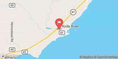
Erie Basin 2, also known as Cell 2w, is a privately owned tailings dam located in Hoyt Lakes, Minnesota.
Summary
Completed in 1978, this earth dam stands at a height of 250 feet and stretches across a length of 20,500 feet. With a storage capacity of 25,035 acre-feet and a drainage area of 2.3 square miles, Erie Basin 2 plays a crucial role in managing tailings from mining operations in the area.
Managed by the Minnesota Department of Natural Resources, Erie Basin 2 is regulated, inspected, and enforced to ensure its safety and functionality. The dam has a significant hazard potential but has been assessed as satisfactory in condition. Regular inspections have been conducted, with the last one taking place in October 2018. The dam's emergency action plan status, risk assessment, and inundation maps prepared are additional factors that contribute to its overall management and safety protocols.
As a key structure in the region, Erie Basin 2 serves an essential purpose in storing tailings and protecting the environment from potential hazards. Its strategic location along the Embarrass River-TR and its adherence to state regulatory guidelines underscore its importance in water resource management and climate resilience efforts in St. Louis County, Minnesota.
°F
°F
mph
Wind
%
Humidity
15-Day Weather Outlook
Year Completed |
1978 |
Dam Length |
20500 |
Dam Height |
250 |
River Or Stream |
EMBARRASS RIVER-TR |
Primary Dam Type |
Earth |
Drainage Area |
2.3 |
Nid Storage |
25035 |
Structural Height |
250 |
Hazard Potential |
Significant |
Foundations |
Unlisted/Unknown |
Nid Height |
250 |
Seasonal Comparison
5-Day Hourly Forecast Detail
Nearby Streamflow Levels
Dam Data Reference
Condition Assessment
SatisfactoryNo existing or potential dam safety deficiencies are recognized. Acceptable performance is expected under all loading conditions (static, hydrologic, seismic) in accordance with the minimum applicable state or federal regulatory criteria or tolerable risk guidelines.
Fair
No existing dam safety deficiencies are recognized for normal operating conditions. Rare or extreme hydrologic and/or seismic events may result in a dam safety deficiency. Risk may be in the range to take further action. Note: Rare or extreme event is defined by the regulatory agency based on their minimum
Poor A dam safety deficiency is recognized for normal operating conditions which may realistically occur. Remedial action is necessary. POOR may also be used when uncertainties exist as to critical analysis parameters which identify a potential dam safety deficiency. Investigations and studies are necessary.
Unsatisfactory
A dam safety deficiency is recognized that requires immediate or emergency remedial action for problem resolution.
Not Rated
The dam has not been inspected, is not under state or federal jurisdiction, or has been inspected but, for whatever reason, has not been rated.
Not Available
Dams for which the condition assessment is restricted to approved government users.
Hazard Potential Classification
HighDams assigned the high hazard potential classification are those where failure or mis-operation will probably cause loss of human life.
Significant
Dams assigned the significant hazard potential classification are those dams where failure or mis-operation results in no probable loss of human life but can cause economic loss, environment damage, disruption of lifeline facilities, or impact other concerns. Significant hazard potential classification dams are often located in predominantly rural or agricultural areas but could be in areas with population and significant infrastructure.
Low
Dams assigned the low hazard potential classification are those where failure or mis-operation results in no probable loss of human life and low economic and/or environmental losses. Losses are principally limited to the owner's property.
Undetermined
Dams for which a downstream hazard potential has not been designated or is not provided.
Not Available
Dams for which the downstream hazard potential is restricted to approved government users.
Area Campgrounds
| Location | Reservations | Toilets |
|---|---|---|
 Heritage City Park
|
||
 Fisherman's Point CityCampground
|
||
 Fishermans Point City Campground
|
||
 Vermilion Trail
|
||
 Vermilion Trail Park Campground
|


 Erie Basin 2