Fortier Twp 36 Reservoir Report
Nearby: Fortier Twp 24 Canby R-6
Last Updated: January 11, 2026
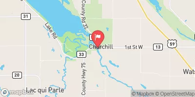
Fortier Twp 36 is a privately owned dam located in Yellow Medicine, Minnesota, along the Lac Qui Parle River.
°F
°F
mph
Wind
%
Humidity
Summary
This rockfill dam stands at a height of 30 feet and serves the primary purpose of flood risk reduction in the area. With a storage capacity of 107 acre-feet, the dam helps to control water flow and mitigate potential flooding events, covering a surface area of 6 acres with a drainage area of 3 square miles.
Managed by the Minnesota Department of Natural Resources, this dam is regulated, inspected, and enforced to ensure its structural integrity and operational efficiency. Despite being categorized with a low hazard potential, the condition assessment of Fortier Twp 36 is currently labeled as "Not Rated," with the last inspection conducted in May 2019. While the Emergency Action Plan (EAP) status and risk assessment details are unspecified, the dam's presence signifies a crucial infrastructure for water resource management and climate resilience efforts in the region.
As part of the flood risk reduction strategy, Fortier Twp 36 plays a vital role in safeguarding the surrounding communities from potential inundation events. With its location in S36 T114N R46W, this dam contributes to the overall water management system along the Lac Qui Parle River, highlighting the importance of maintaining and monitoring such critical infrastructure to protect both property and lives in times of heightened water levels and weather-related challenges.
Dam Height |
30 |
River Or Stream |
LAC QUI PARLE RIVER-TR |
Primary Dam Type |
Rockfill |
Surface Area |
6 |
Drainage Area |
3 |
Nid Storage |
107 |
Hazard Potential |
Low |
Foundations |
Unlisted/Unknown |
Nid Height |
30 |
Seasonal Comparison
Weather Forecast
Nearby Streamflow Levels
Dam Data Reference
Condition Assessment
SatisfactoryNo existing or potential dam safety deficiencies are recognized. Acceptable performance is expected under all loading conditions (static, hydrologic, seismic) in accordance with the minimum applicable state or federal regulatory criteria or tolerable risk guidelines.
Fair
No existing dam safety deficiencies are recognized for normal operating conditions. Rare or extreme hydrologic and/or seismic events may result in a dam safety deficiency. Risk may be in the range to take further action. Note: Rare or extreme event is defined by the regulatory agency based on their minimum
Poor A dam safety deficiency is recognized for normal operating conditions which may realistically occur. Remedial action is necessary. POOR may also be used when uncertainties exist as to critical analysis parameters which identify a potential dam safety deficiency. Investigations and studies are necessary.
Unsatisfactory
A dam safety deficiency is recognized that requires immediate or emergency remedial action for problem resolution.
Not Rated
The dam has not been inspected, is not under state or federal jurisdiction, or has been inspected but, for whatever reason, has not been rated.
Not Available
Dams for which the condition assessment is restricted to approved government users.
Hazard Potential Classification
HighDams assigned the high hazard potential classification are those where failure or mis-operation will probably cause loss of human life.
Significant
Dams assigned the significant hazard potential classification are those dams where failure or mis-operation results in no probable loss of human life but can cause economic loss, environment damage, disruption of lifeline facilities, or impact other concerns. Significant hazard potential classification dams are often located in predominantly rural or agricultural areas but could be in areas with population and significant infrastructure.
Low
Dams assigned the low hazard potential classification are those where failure or mis-operation results in no probable loss of human life and low economic and/or environmental losses. Losses are principally limited to the owner's property.
Undetermined
Dams for which a downstream hazard potential has not been designated or is not provided.
Not Available
Dams for which the downstream hazard potential is restricted to approved government users.

 Fortier Twp 36