
Upper Deer Creek-Lake Hendricks Watershed (Udclh) 1-C Reservoir Report
Nearby: Tetonka Ridge Gibbons No. 4
Last Updated: April 1, 2026
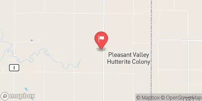
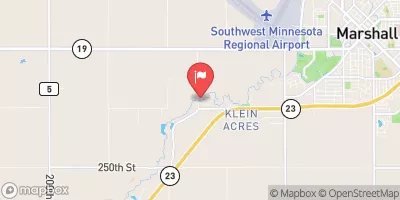
The Upper Deer Creek-Lake Hendricks Watershed (Udclh) 1-C is a dam located in South Dakota, specifically in Brookings County.
Summary
Constructed in 1970 by the USDA NRCS, this Earth dam stands at a height of 29 feet and has a length of 500 feet, providing a storage capacity of 3,583 acre-feet. The dam regulates the Upper Deer Creek, with a drainage area of 17 square miles and a maximum discharge of 2,751 cubic feet per second.
Managed by the DENR, the Udclh 1-C dam is classified as having a low hazard potential and a moderate risk level. While its condition assessment is currently not rated, the dam is under state regulation and inspection, ensuring its safety and functionality. With a primary purpose not specified, the dam serves as a crucial infrastructure for water resource management and climate resilience in the region, contributing to flood control, water supply, and environmental protection along the Upper Deer Creek.
As an essential structure in the Upper Deer Creek-Lake Hendricks Watershed, the Udclh 1-C dam plays a vital role in managing water resources and mitigating the impacts of extreme weather events in the area. With its regulated operation and state oversight, the dam stands as a key asset in safeguarding the local community against flooding and ensuring the sustainable use of water for agricultural, municipal, and ecological purposes. For water resource and climate enthusiasts, understanding the significance of the Udclh 1-C dam sheds light on the interconnectedness of infrastructure, environment, and resilience in the face of changing climatic conditions.
°F
°F
mph
Wind
%
Humidity
15-Day Weather Outlook
Year Completed |
1970 |
Dam Length |
500 |
Dam Height |
29 |
River Or Stream |
UPPER DEER CREEK |
Primary Dam Type |
Earth |
Hydraulic Height |
29 |
Drainage Area |
17 |
Nid Storage |
3583 |
Outlet Gates |
None |
Hazard Potential |
Low |
Nid Height |
29 |
Seasonal Comparison
5-Day Hourly Forecast Detail
Nearby Streamflow Levels
Dam Data Reference
Condition Assessment
SatisfactoryNo existing or potential dam safety deficiencies are recognized. Acceptable performance is expected under all loading conditions (static, hydrologic, seismic) in accordance with the minimum applicable state or federal regulatory criteria or tolerable risk guidelines.
Fair
No existing dam safety deficiencies are recognized for normal operating conditions. Rare or extreme hydrologic and/or seismic events may result in a dam safety deficiency. Risk may be in the range to take further action. Note: Rare or extreme event is defined by the regulatory agency based on their minimum
Poor A dam safety deficiency is recognized for normal operating conditions which may realistically occur. Remedial action is necessary. POOR may also be used when uncertainties exist as to critical analysis parameters which identify a potential dam safety deficiency. Investigations and studies are necessary.
Unsatisfactory
A dam safety deficiency is recognized that requires immediate or emergency remedial action for problem resolution.
Not Rated
The dam has not been inspected, is not under state or federal jurisdiction, or has been inspected but, for whatever reason, has not been rated.
Not Available
Dams for which the condition assessment is restricted to approved government users.
Hazard Potential Classification
HighDams assigned the high hazard potential classification are those where failure or mis-operation will probably cause loss of human life.
Significant
Dams assigned the significant hazard potential classification are those dams where failure or mis-operation results in no probable loss of human life but can cause economic loss, environment damage, disruption of lifeline facilities, or impact other concerns. Significant hazard potential classification dams are often located in predominantly rural or agricultural areas but could be in areas with population and significant infrastructure.
Low
Dams assigned the low hazard potential classification are those where failure or mis-operation results in no probable loss of human life and low economic and/or environmental losses. Losses are principally limited to the owner's property.
Undetermined
Dams for which a downstream hazard potential has not been designated or is not provided.
Not Available
Dams for which the downstream hazard potential is restricted to approved government users.
 Upper Deer Creek-Lake Hendricks Watershed (Udclh) 1-C
 Brookings County