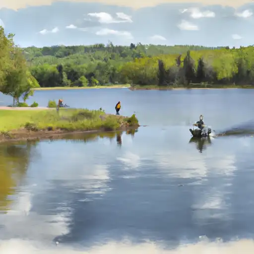
Upper Red Lake At Waskish reservoir
As of July 16, 2026, Upper Red Lake At Waskish is holding 74 ft of water — 99% of normal storage for this date. Storage data refreshed throughout the day.

Upper Red Lake At Waskish
Upper Red Lake is the largest freshwater lake in Minnesota and is located near Waskish. The lake was formed during the last glacial period and has a total surface area of 288 square miles. It is fed by several rivers and streams, including the Tamarac River and the Blackduck River. The lake is known for its excellent fishing, especially for walleye, and is also popular for recreational activities such as boating and ice fishing.
The hydrology of Upper Red Lake is influenced by its large catchment area and the surrounding topography. The lake has a shallow basin that is prone to fluctuating water levels, which can be affected by precipitation, evaporation, and human activities such as damming and dredging.
Snowmelt and precipitation are the primary sources of surface flow to Upper Red Lake. The lake also receives water from groundwater seepage and runoff from agricultural lands in the surrounding area. However, agricultural activities have been limited due to the potential for runoff contamination and negative impacts on water quality.
Overall, Upper Red Lake is a valuable natural resource for the local community and provides important habitat for fish and wildlife. However, ongoing efforts are needed to monitor and manage the lake's hydrology and water quality to ensure its continued health and productivity.
Daily levels at Upper Red Lake At Waskish
Storage volume, pool elevation, and total release plotted from the operating agency's daily observations.
Gage height, ft
ft · code 00065
Precipitation, total, in
in · code 00045
Plan around the weather
Same NOAA / yr.no feed Snoflo's iOS app uses. Watch the precipitation column on the meteogram -- rain on the basin upstream typically lifts inflow 24-72 hours later.
Next 5 days, hour by hour
Temperature line with weather symbols on top, snow + rain accumulation as columns, humidity as a dotted line.
5-day forecast table
Every 3 hours, broken out across temperature, snow, rain, humidity, and wind. Each cell is colour-coded relative to the column min/max.
| Time | Condition | Temp (°F) | Snow (in) | Rain (in) | Humidity (%) | Wind (mps) | Wind dir |
|---|---|---|---|---|---|---|---|
| Loading detailed forecast… | |||||||
15-day temperature & precipitation
Daily temperatures, snow, and rain projected over the next two weeks.
Nearby streamflow gauges
USGS streamgauges around Upper Red Lake At Waskish -- inflows here typically show up in storage 24-72 hours later.
| Streamgauge | Discharge | View |
|---|---|---|
| Rapid River Near Baudette | 35 cfs | → |
| Big Fork River At Big Falls | 98 cfs | → |
| Red Lake River Near Red Lake | 418 cfs | → |
| Little Fork River At Littlefork | 114 cfs | → |
| Mississippi River Near Bemidji | 177 cfs | → |


About Upper Red Lake At Waskish
Where does the data for Upper Red Lake At Waskish come from?
Daily storage, pool elevation, and release rates are sourced from USGS, USBR, and USACE monitoring stations. Weather forecast comes from NOAA / yr.no -- the same feed Snoflo's iOS app uses.
How often is the report updated?
Storage observations are updated daily by the operating agency. The 15-day weather forecast refreshes throughout the day. Snoflo caches and renders the most recent observation -- check the "as of" timestamp on the storage card.
What does the Hazard hazard rating mean?
The Corps of Engineers' hazard potential classification grades probable consequences if the dam fails: High = probable loss of human life; Significant = no probable loss of human life but possible economic loss / environmental damage; Low = no probable loss of human life, only minor economic / environmental losses. See the Dam Data Reference card below for the full definitions.
What's "% of normal"?
The current storage value compared to the historical average storage on this calendar day. 100% = right on average; values above 100% mean above-normal storage (wet year); values below mean below-normal (dry year or drought).
Can I get alerts when storage crosses a threshold?
Yes -- alerts are managed in the Snoflo iOS app. Favorite this reservoir, set a threshold, and you'll get a push the moment conditions cross.