


Lower Power Reservoir Report
Last Updated: April 30, 2026
Nearby: Little Falls I-94 Rest Area
°F
°F
mph
Wind
%
Humidity
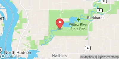
Lower Power, also known as Saint Croix, is a gravity dam located on the Willow River in Hudson, Wisconsin.
Summary
Completed in 1866, the dam serves primarily for recreational purposes, offering a surface area of 270 acres and a maximum discharge capacity of 15,900 cubic feet per second. With a height of 22 feet and a hydraulic height of 14 feet, Lower Power provides a tranquil reservoir with a normal storage capacity of 1,388 acre-feet.
Despite its age, Lower Power has a low hazard potential and has been deemed to be in satisfactory condition as of the last assessment in 2016. The dam is regulated by the Wisconsin Department of Natural Resources and undergoes regular inspections every 10 years. Its controlled spillway ensures proper water management, while the risk assessment ranks the dam as having a very high risk level. The surrounding area is known for its scenic beauty and recreational opportunities, making Lower Power a vital resource for both the local community and visitors alike.
Overall, Lower Power stands as a historic landmark in St. Croix, Wisconsin, offering a picturesque setting for outdoor activities and water recreation. With its rich history dating back to the 19th century and continued operation for over a century, the dam serves as a testament to the importance of water resource management and the preservation of natural landscapes. As climate change poses new challenges to water infrastructure, the maintenance and regulation of dams like Lower Power become increasingly crucial in ensuring the safety and sustainability of our water resources for future generations.
Regional Streamflow Levels


15-Day Long Term Forecast
Years Modified |
1934 - Other, 1998 - Other |
Year Completed |
1866 |
Dam Length |
400 |
Dam Height |
22 |
River Or Stream |
Willow River |
Primary Dam Type |
Gravity |
Surface Area |
270 |
Hydraulic Height |
14 |
Drainage Area |
175 |
Nid Storage |
3000 |
Structural Height |
22 |
Hazard Potential |
Low |
Nid Height |
22 |
Seasonal Comparison
5-Day Hourly Forecast Detail
Dam Data Reference
Condition Assessment
SatisfactoryNo existing or potential dam safety deficiencies are recognized. Acceptable performance is expected under all loading conditions (static, hydrologic, seismic) in accordance with the minimum applicable state or federal regulatory criteria or tolerable risk guidelines.
Fair
No existing dam safety deficiencies are recognized for normal operating conditions. Rare or extreme hydrologic and/or seismic events may result in a dam safety deficiency. Risk may be in the range to take further action. Note: Rare or extreme event is defined by the regulatory agency based on their minimum
Poor A dam safety deficiency is recognized for normal operating conditions which may realistically occur. Remedial action is necessary. POOR may also be used when uncertainties exist as to critical analysis parameters which identify a potential dam safety deficiency. Investigations and studies are necessary.
Unsatisfactory
A dam safety deficiency is recognized that requires immediate or emergency remedial action for problem resolution.
Not Rated
The dam has not been inspected, is not under state or federal jurisdiction, or has been inspected but, for whatever reason, has not been rated.
Not Available
Dams for which the condition assessment is restricted to approved government users.
Hazard Potential Classification
HighDams assigned the high hazard potential classification are those where failure or mis-operation will probably cause loss of human life.
Significant
Dams assigned the significant hazard potential classification are those dams where failure or mis-operation results in no probable loss of human life but can cause economic loss, environment damage, disruption of lifeline facilities, or impact other concerns. Significant hazard potential classification dams are often located in predominantly rural or agricultural areas but could be in areas with population and significant infrastructure.
Low
Dams assigned the low hazard potential classification are those where failure or mis-operation results in no probable loss of human life and low economic and/or environmental losses. Losses are principally limited to the owner's property.
Undetermined
Dams for which a downstream hazard potential has not been designated or is not provided.
Not Available
Dams for which the downstream hazard potential is restricted to approved government users.
 Willow River State Park
 Willow River State Park Campground
 Lake Elmo County Park Preserve
 Afton State Park Back Country Campground
 Afton State Park River Side
 Afton State Park
 Lake Mallalieu -- Access