


Palmer Mine Dam Reservoir Report
Last Updated: May 3, 2026
Nearby: Howell Mine Dam Gudaitis Lake Dam
°F
°F
mph
Wind
%
Humidity
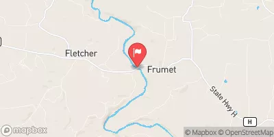
Palmer Mine Dam, located in Shirley, Missouri, is a privately owned earth dam constructed in 1961 for recreational purposes along TR Hazel Creek.
Summary
Standing at a height of 76 feet with a length of 2400 feet, the dam holds a storage capacity of 1460 acre-feet and covers a surface area of 112 acres. Despite its satisfactory condition assessment in 2007, the dam's hazard potential is considered high, prompting regular inspections every 3 years to ensure safety.
With a spillway width of 25 feet and a maximum discharge rate of 2739 cubic feet per second, Palmer Mine Dam poses a moderate risk level (3) in terms of potential hazards. The dam is regulated by the Dam and Reservoir Safety Program in Missouri and falls under state jurisdiction for permitting, inspection, and enforcement. Although the dam has no associated structures or outlet gates, it serves as a crucial recreational and tailings containment structure in the region, highlighting the importance of maintaining its structural integrity and safety measures for water resource and climate enthusiasts in the area.
Regional Streamflow Levels
 Big River At Irondale
|
315cfs |
 East Fork Black River Nr Lesterville
|
32cfs |
 Big River Below Desloge
|
367cfs |
 Meramec River Near Sullivan
|
1770cfs |
 Big River Near Richwoods
|
882cfs |
 East Fork Black River At Lesterville
|
44cfs |
15-Day Long Term Forecast
Year Completed |
1961 |
Dam Length |
2400 |
Dam Height |
76 |
River Or Stream |
TR HAZEL CREEK |
Primary Dam Type |
Earth |
Surface Area |
112 |
Drainage Area |
1025 |
Nid Storage |
1460 |
Structural Height |
76 |
Outlet Gates |
None |
Hazard Potential |
High |
Foundations |
Unlisted/Unknown |
Nid Height |
76 |
Seasonal Comparison
5-Day Hourly Forecast Detail
Dam Data Reference
Condition Assessment
SatisfactoryNo existing or potential dam safety deficiencies are recognized. Acceptable performance is expected under all loading conditions (static, hydrologic, seismic) in accordance with the minimum applicable state or federal regulatory criteria or tolerable risk guidelines.
Fair
No existing dam safety deficiencies are recognized for normal operating conditions. Rare or extreme hydrologic and/or seismic events may result in a dam safety deficiency. Risk may be in the range to take further action. Note: Rare or extreme event is defined by the regulatory agency based on their minimum
Poor A dam safety deficiency is recognized for normal operating conditions which may realistically occur. Remedial action is necessary. POOR may also be used when uncertainties exist as to critical analysis parameters which identify a potential dam safety deficiency. Investigations and studies are necessary.
Unsatisfactory
A dam safety deficiency is recognized that requires immediate or emergency remedial action for problem resolution.
Not Rated
The dam has not been inspected, is not under state or federal jurisdiction, or has been inspected but, for whatever reason, has not been rated.
Not Available
Dams for which the condition assessment is restricted to approved government users.
Hazard Potential Classification
HighDams assigned the high hazard potential classification are those where failure or mis-operation will probably cause loss of human life.
Significant
Dams assigned the significant hazard potential classification are those dams where failure or mis-operation results in no probable loss of human life but can cause economic loss, environment damage, disruption of lifeline facilities, or impact other concerns. Significant hazard potential classification dams are often located in predominantly rural or agricultural areas but could be in areas with population and significant infrastructure.
Low
Dams assigned the low hazard potential classification are those where failure or mis-operation results in no probable loss of human life and low economic and/or environmental losses. Losses are principally limited to the owner's property.
Undetermined
Dams for which a downstream hazard potential has not been designated or is not provided.
Not Available
Dams for which the downstream hazard potential is restricted to approved government users.
Area Campgrounds
| Location | Reservations | Toilets |
|---|---|---|
 Hazel Creek Campground
|
||
 Hazel Creek
|
||
 Council Bluff - Wild Boar Ridge
|
||
 Council Bluff Recreation Area
|
||
 Berryman Campground
|
||
 Panther Branch
|
 Clearwater Lake Near Piedmont
 Council Bluff Lake Trail Washington County
River Runs
-
 State Highway 49 Bridge Near Dillard, Missouri To Forest Boundary In Sections 13/24, T38N, R3W
-
 Forest Boundary At North Section Line Of Sec 4, T33N, R5E To Forest Boundary At South Section Line Of Sec 35, T32N, R5E
-
 Confluence With Alley Spring (Branch) To Confluence With Current River (Does Not Include River Segment In Gap Between Parkland Units)
-
 Markam Spring Recreation Area To Nf Boundary
 Parole Lake
 Timberline Lake
 Huzzah Ponds
 Crane Lake Recreation Area