


Corydon Lake Reservoir Report
Last Updated: April 23, 2026
Nearby: Allen- Ewing Dam Blackford Dam
°F
°F
mph
Wind
%
Humidity
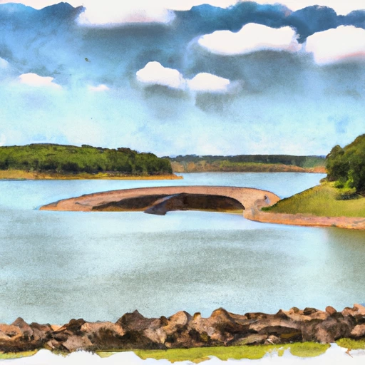
Corydon Lake is a man-made body of water in south-central Iowa near the town of Corydon.
Summary
The lake was created in the 1970s as a flood control measure and for recreational purposes. The lake has a surface area of 121 acres and a maximum depth of 25 feet. It is fed by rainfall and runoff from surrounding agricultural land. The lake has a spillway that helps regulate the water level and prevent flooding downstream. The lake is used for fishing, boating, and other water sports, and is stocked with fish species including bass, crappie, and catfish. The surrounding area is also popular for hunting and camping. The lake is managed by the Iowa Department of Natural Resources.
Regional Streamflow Levels
 South Fork Chariton River Near Promise City
|
143cfs |
 Chariton River Near Chariton
|
73cfs |
 Chariton River Near Rathbun
|
1060cfs |
 Thompson River At Davis City
|
325cfs |
 Chariton River Near Moulton
|
1270cfs |
 White Breast Creek Near Dallas
|
87cfs |
15-Day Long Term Forecast
Reservoir Details
| 24hr Change | None% |
| Percent of Normal | None% |
| Minimum |
0.01
1993-03-18 |
| Maximum |
118.0
1993-03-31 |
| Average | |
| Dam_Height | 26 |
| Drainage_Area | 2.7 |
| Year_Completed | 1974 |
| Nid_Storage | 870 |
| Foundations | Soil |
| Surface_Area | 66.9 |
| River_Or_Stream | TR-WEST JACKSON CREEK |
| Dam_Length | 750 |
| Hazard_Potential | Significant |
| Primary_Dam_Type | Earth |
| Nid_Height | 26 |
Seasonal Comparison
Streamflow, Ft³/S Levels
5-Day Hourly Forecast Detail
Dam Data Reference
Condition Assessment
SatisfactoryNo existing or potential dam safety deficiencies are recognized. Acceptable performance is expected under all loading conditions (static, hydrologic, seismic) in accordance with the minimum applicable state or federal regulatory criteria or tolerable risk guidelines.
Fair
No existing dam safety deficiencies are recognized for normal operating conditions. Rare or extreme hydrologic and/or seismic events may result in a dam safety deficiency. Risk may be in the range to take further action. Note: Rare or extreme event is defined by the regulatory agency based on their minimum
Poor A dam safety deficiency is recognized for normal operating conditions which may realistically occur. Remedial action is necessary. POOR may also be used when uncertainties exist as to critical analysis parameters which identify a potential dam safety deficiency. Investigations and studies are necessary.
Unsatisfactory
A dam safety deficiency is recognized that requires immediate or emergency remedial action for problem resolution.
Not Rated
The dam has not been inspected, is not under state or federal jurisdiction, or has been inspected but, for whatever reason, has not been rated.
Not Available
Dams for which the condition assessment is restricted to approved government users.
Hazard Potential Classification
HighDams assigned the high hazard potential classification are those where failure or mis-operation will probably cause loss of human life.
Significant
Dams assigned the significant hazard potential classification are those dams where failure or mis-operation results in no probable loss of human life but can cause economic loss, environment damage, disruption of lifeline facilities, or impact other concerns. Significant hazard potential classification dams are often located in predominantly rural or agricultural areas but could be in areas with population and significant infrastructure.
Low
Dams assigned the low hazard potential classification are those where failure or mis-operation results in no probable loss of human life and low economic and/or environmental losses. Losses are principally limited to the owner's property.
Undetermined
Dams for which a downstream hazard potential has not been designated or is not provided.
Not Available
Dams for which the downstream hazard potential is restricted to approved government users.
 Corydon Lake