Lake Taneycomo At Ozark Beach Dam Reservoir Report
Nearby: Cross Creek Dam Silver Creek Lake Dam
Last Updated: February 23, 2026
Lake Taneycomo is a man-made reservoir created by the construction of Ozark Beach Dam in Missouri.
Summary
The lake spans about 22 miles and is known for its clear and cold waters, making it a popular spot for trout fishing. The lake was created by the White River Basin development project in 1913 to control flooding and provide hydroelectric power. The lake is fed by several surface flow providers and snowpack, including the James River and Table Rock Lake. The lake also serves as a source of water for agricultural irrigation and recreational activities such as boating, kayaking, and camping. Overall, Lake Taneycomo is an important resource for both the local community and visitors alike.
°F
°F
mph
Wind
%
Humidity
15-Day Weather Outlook
Reservoir Details
| Lake Or Reservoir Water Surface Elevation Above Navd 1988, Ft 24hr Change | 0.05% |
| Percent of Normal | 100% |
| Minimum |
696.31 ft
2011-11-07 |
| Maximum |
709.0 ft
2015-12-29 |
| Average | 701 ft |
| Dam_Height | 54 |
| Drainage_Area | 4500 |
| Year_Completed | 1913 |
| Nid_Storage | 38200 |
| River_Or_Stream | White River |
| Foundations | Rock |
| Surface_Area | 2200 |
| Hazard_Potential | High |
| Dam_Length | 1270 |
| Primary_Dam_Type | Buttress |
| Nid_Height | 54 |
Seasonal Comparison
Precipitation, Total, In Levels
Lake Or Reservoir Water Surface Elevation Above Navd 1988, Ft Levels
5-Day Hourly Forecast Detail
Nearby Streamflow Levels
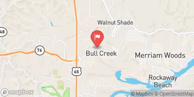
 Bull Creek Near Walnut Shade
|
24cfs |
 Beaver Creek At Bradleyville
|
52cfs |
 Yocum Creek Near Oak Grove
|
11cfs |
 James River At Galena
|
245cfs |
 Finley Creek Below Riverdale
|
71cfs |
 James River Near Boaz
|
123cfs |
Dam Data Reference
Condition Assessment
SatisfactoryNo existing or potential dam safety deficiencies are recognized. Acceptable performance is expected under all loading conditions (static, hydrologic, seismic) in accordance with the minimum applicable state or federal regulatory criteria or tolerable risk guidelines.
Fair
No existing dam safety deficiencies are recognized for normal operating conditions. Rare or extreme hydrologic and/or seismic events may result in a dam safety deficiency. Risk may be in the range to take further action. Note: Rare or extreme event is defined by the regulatory agency based on their minimum
Poor A dam safety deficiency is recognized for normal operating conditions which may realistically occur. Remedial action is necessary. POOR may also be used when uncertainties exist as to critical analysis parameters which identify a potential dam safety deficiency. Investigations and studies are necessary.
Unsatisfactory
A dam safety deficiency is recognized that requires immediate or emergency remedial action for problem resolution.
Not Rated
The dam has not been inspected, is not under state or federal jurisdiction, or has been inspected but, for whatever reason, has not been rated.
Not Available
Dams for which the condition assessment is restricted to approved government users.
Hazard Potential Classification
HighDams assigned the high hazard potential classification are those where failure or mis-operation will probably cause loss of human life.
Significant
Dams assigned the significant hazard potential classification are those dams where failure or mis-operation results in no probable loss of human life but can cause economic loss, environment damage, disruption of lifeline facilities, or impact other concerns. Significant hazard potential classification dams are often located in predominantly rural or agricultural areas but could be in areas with population and significant infrastructure.
Low
Dams assigned the low hazard potential classification are those where failure or mis-operation results in no probable loss of human life and low economic and/or environmental losses. Losses are principally limited to the owner's property.
Undetermined
Dams for which a downstream hazard potential has not been designated or is not provided.
Not Available
Dams for which the downstream hazard potential is restricted to approved government users.
Area Campgrounds
| Location | Reservations | Toilets |
|---|---|---|
 River Run
|
||
 Shadow Rock Park
|
||
 Branson City Campground
|
||
 Drury-Mincy Conservation Area - MDC
|
||
 T1 & T2
|
||
 Branson Musicland Kampground
|

 Ozark Beach
 Lake Taneycomo At Ozark Beach Dam
 Lake Taneycomo At School Of The Ozarks
 South Boardwalk Branson