Ozark Beach Dam

Ozark Beach
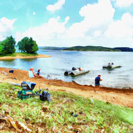
Ozark Beach, located in Forsyth, Missouri, is a hydroelectric dam on the White River with a rich history dating back to its completion in 1913. With a dam height of 54 feet and a length of 1270 feet, it serves multiple purposes including hydroelectric power generation and recreation, making it a valuable resource in the area. The dam has a storage capacity of 38,200 acre-feet and a surface area of 2200 acres, providing essential water resources for the region.
Managed by the Federal Energy Regulatory Commission, Ozark Beach is a significant structure with a controlled spillway and a high hazard potential due to its age and condition assessment. The dam's risk assessment indicates a very high risk level, emphasizing the importance of regular inspections and maintenance to ensure its safety and functionality. Despite its age, Ozark Beach continues to play a vital role in water resource management and hydroelectric power generation, contributing to the resilience of the surrounding community in Taney County.
As a key feature in the Little Rock District of the US Army Corps of Engineers, Ozark Beach represents a blend of historical significance and modern utility. With a primary purpose of hydroelectric power generation, the dam stands as a testament to the ingenuity and engineering prowess of its time. Its location on the scenic White River adds to its appeal for recreation, attracting visitors and enthusiasts of water resources and climate to witness its grandeur and contribution to the local ecosystem.
Plan around the weather
Same NOAA / yr.no feed Snoflo's iOS app uses. Watch the precipitation column on the meteogram -- rain on the basin upstream typically lifts inflow 24-72 hours later.
Next 5 days, hour by hour
Temperature line with weather symbols on top, snow + rain accumulation as columns, humidity as a dotted line.
5-day forecast table
Every 3 hours, broken out across temperature, snow, rain, humidity, and wind. Each cell is colour-coded relative to the column min/max.
| Time | Condition | Temp (°F) | Snow (in) | Rain (in) | Humidity (%) | Wind (mps) | Wind dir |
|---|---|---|---|---|---|---|---|
| Loading detailed forecast… | |||||||
15-day temperature & precipitation
Daily temperatures, snow, and rain projected over the next two weeks.
Nearby streamflow gauges
USGS streamgauges around Ozark Beach -- inflows here typically show up in storage 24-72 hours later.
| Streamgauge | Discharge | View |
|---|---|---|
| Bull Creek Near Walnut Shade | 69 cfs | → |
| Beaver Creek At Bradleyville | 103 cfs | → |
| Yocum Creek Near Oak Grove | 31 cfs | → |
| James River At Galena | 636 cfs | → |
| Finley Creek Below Riverdale | 138 cfs | → |
| James River Near Boaz | 621 cfs | → |


About Ozark Beach
Where does the data for Ozark Beach come from?
Structural and regulatory data come from the U.S. Army Corps of Engineers' National Inventory of Dams (NID). Weather forecast comes from NOAA / yr.no -- the same feed Snoflo's iOS app uses.
How often is the report updated?
NID structural data refreshes annually as the Corps publishes updated assessments. The weather forecast refreshes throughout the day.
What does the High hazard rating mean?
The Corps of Engineers' hazard potential classification grades probable consequences if the dam fails: High = probable loss of human life; Significant = no probable loss of human life but possible economic loss / environmental damage; Low = no probable loss of human life, only minor economic / environmental losses. See the Dam Data Reference card below for the full definitions.
What's "% of normal"?
The current storage value compared to the historical average storage on this calendar day. 100% = right on average; values above 100% mean above-normal storage (wet year); values below mean below-normal (dry year or drought).
Can I get alerts when storage crosses a threshold?
Yes -- alerts are managed in the Snoflo iOS app. Favorite this dam, set a threshold, and you'll get a push the moment conditions cross.
Dam data reference
Condition Assessment
- Satisfactory
- No existing or potential dam safety deficiencies are recognized. Acceptable performance is expected under all loading conditions (static, hydrologic, seismic) in accordance with the minimum applicable state or federal regulatory criteria or tolerable risk guidelines.
- Fair
- No existing dam safety deficiencies are recognized for normal operating conditions. Rare or extreme hydrologic and/or seismic events may result in a dam safety deficiency. Risk may be in the range to take further action.
- Poor
- A dam safety deficiency is recognized for normal operating conditions which may realistically occur. Remedial action is necessary. POOR may also be used when uncertainties exist as to critical analysis parameters which identify a potential dam safety deficiency.
- Unsatisfactory
- A dam safety deficiency is recognized that requires immediate or emergency remedial action for problem resolution.
- Not Rated
- The dam has not been inspected, is not under state or federal jurisdiction, or has been inspected but, for whatever reason, has not been rated.
Hazard Potential Classification
- High
- Dams assigned the high hazard potential classification are those where failure or mis-operation will probably cause loss of human life.
- Significant
- Dams assigned the significant hazard potential classification are those dams where failure or mis-operation results in no probable loss of human life but can cause economic loss, environmental damage, disruption of lifeline facilities, or impact other concerns. Significant hazard potential classification dams are often located in predominantly rural or agricultural areas but could be in areas with population and significant infrastructure.
- Low
- Dams assigned the low hazard potential classification are those where failure or mis-operation results in no probable loss of human life and low economic and/or environmental losses. Losses are principally limited to the owner's property.
- Undetermined
- Dams for which a downstream hazard potential has not been designated or is not provided.