


Wray Watershed District #5 Reservoir Report
Last Updated: April 25, 2026
°F
°F
mph
Wind
%
Humidity
Wray Watershed District #5, located in Yuma, Colorado, is a local government-owned entity designed by the USDA NRCS to manage flood risk along the N.
Summary
Fork Republican River. This earth dam, completed in 1958, stands at 31 feet high and spans 344 feet in length, providing a storage capacity of 43 acre-feet. With a significant hazard potential and a moderate risk assessment rating, the dam is inspected every 3 years to ensure its structural integrity and satisfactory condition.
Despite its uncontrolled spillway type and a maximum discharge capacity of 1417 cubic feet per second, Wray Watershed District #5 has effectively reduced flood risks in the region. This dam plays a crucial role in protecting the surrounding area from potential inundation, with a normal storage capacity of 27 acre-feet and a surface area of 3 acres. While it meets regulatory requirements for state permitting, inspection, and enforcement, the dam's emergency action plan (EAP) and risk management measures may need further refinement to align with guidelines and ensure effective response in case of emergencies.
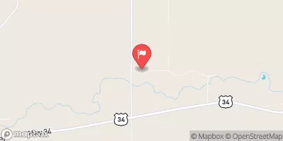
Overall, Wray Watershed District #5 serves as a vital flood risk reduction infrastructure in Colorado, managed by the Natural Resources Conservation Service. With its strategic location in S12, T.01N, R.44W, 6TH PM, and oversight by the state regulatory agency DWR, this dam continues to safeguard the community of Wray and beyond. As water resource and climate enthusiasts, it is essential to monitor the ongoing maintenance and risk assessments of this critical water management structure to ensure its continued effectiveness in mitigating potential flood events.
Regional Streamflow Levels
15-Day Long Term Forecast
Year Completed |
1958 |
Dam Length |
344 |
Dam Height |
27 |
River Or Stream |
N. FORK REPUBLICAN RIVER-TR |
Primary Dam Type |
Earth |
Surface Area |
3 |
Hydraulic Height |
26 |
Nid Storage |
43 |
Structural Height |
31 |
Hazard Potential |
Significant |
Nid Height |
31 |
Seasonal Comparison
5-Day Hourly Forecast Detail
Dam Data Reference
Condition Assessment
SatisfactoryNo existing or potential dam safety deficiencies are recognized. Acceptable performance is expected under all loading conditions (static, hydrologic, seismic) in accordance with the minimum applicable state or federal regulatory criteria or tolerable risk guidelines.
Fair
No existing dam safety deficiencies are recognized for normal operating conditions. Rare or extreme hydrologic and/or seismic events may result in a dam safety deficiency. Risk may be in the range to take further action. Note: Rare or extreme event is defined by the regulatory agency based on their minimum
Poor A dam safety deficiency is recognized for normal operating conditions which may realistically occur. Remedial action is necessary. POOR may also be used when uncertainties exist as to critical analysis parameters which identify a potential dam safety deficiency. Investigations and studies are necessary.
Unsatisfactory
A dam safety deficiency is recognized that requires immediate or emergency remedial action for problem resolution.
Not Rated
The dam has not been inspected, is not under state or federal jurisdiction, or has been inspected but, for whatever reason, has not been rated.
Not Available
Dams for which the condition assessment is restricted to approved government users.
Hazard Potential Classification
HighDams assigned the high hazard potential classification are those where failure or mis-operation will probably cause loss of human life.
Significant
Dams assigned the significant hazard potential classification are those dams where failure or mis-operation results in no probable loss of human life but can cause economic loss, environment damage, disruption of lifeline facilities, or impact other concerns. Significant hazard potential classification dams are often located in predominantly rural or agricultural areas but could be in areas with population and significant infrastructure.
Low
Dams assigned the low hazard potential classification are those where failure or mis-operation results in no probable loss of human life and low economic and/or environmental losses. Losses are principally limited to the owner's property.
Undetermined
Dams for which a downstream hazard potential has not been designated or is not provided.
Not Available
Dams for which the downstream hazard potential is restricted to approved government users.