


Floodwater Ret Dam Ss-5 Reservoir Report
Last Updated: May 3, 2026
°F
°F
mph
Wind
%
Humidity
Floodwater Ret Dam Ss-5 is a crucial structure in Sedgwick, Colorado, designed by USDA NRCS to mitigate flood risks along the South Platte-TR river.
Summary
Completed in 1985, this earth dam stands at a height of 33 feet, with a hydraulic height of 31 feet and a structural height of 36 feet. It spans 2000 feet in length, providing a storage capacity of 875 acre-feet and a normal storage volume of 561 acre-feet over a surface area of 53 acres.
Owned and regulated by the local government, Floodwater Ret Dam Ss-5 boasts an uncontrolled spillway with a width of 102 feet, capable of handling a maximum discharge of 2364 cubic feet per second. Despite its low hazard potential, the dam's satisfactory condition as assessed in 2015 underscores its effectiveness in flood risk reduction. With State oversight and regular inspections, this dam serves as a testament to successful collaboration between government agencies and communities in safeguarding against potential natural disasters.
For water resource and climate enthusiasts, Floodwater Ret Dam Ss-5 stands as a prime example of engineering excellence and strategic planning in managing water resources. Its location in the heart of Sedgwick, Colorado, reflects the commitment to protecting local communities from the devastating impact of floods. With a moderate risk assessment and a history of successful risk management measures, this dam serves as a beacon of resilience in the face of environmental challenges.
Regional Streamflow Levels
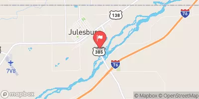 S. Platte R. At Julesburg
|
-999cfs |
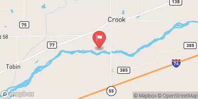 South Platte River Near Crook
|
13cfs |
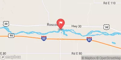 South Platte River At Roscoe Nebr
|
41cfs |
15-Day Long Term Forecast
Year Completed |
1985 |
Dam Length |
2000 |
Dam Height |
33 |
River Or Stream |
SOUTH PLATTE-TR |
Primary Dam Type |
Earth |
Surface Area |
53 |
Hydraulic Height |
31 |
Drainage Area |
3 |
Nid Storage |
875 |
Structural Height |
36 |
Outlet Gates |
Uncontrolled - 0 |
Hazard Potential |
Low |
Foundations |
Soil |
Nid Height |
36 |
Seasonal Comparison
5-Day Hourly Forecast Detail
Dam Data Reference
Condition Assessment
SatisfactoryNo existing or potential dam safety deficiencies are recognized. Acceptable performance is expected under all loading conditions (static, hydrologic, seismic) in accordance with the minimum applicable state or federal regulatory criteria or tolerable risk guidelines.
Fair
No existing dam safety deficiencies are recognized for normal operating conditions. Rare or extreme hydrologic and/or seismic events may result in a dam safety deficiency. Risk may be in the range to take further action. Note: Rare or extreme event is defined by the regulatory agency based on their minimum
Poor A dam safety deficiency is recognized for normal operating conditions which may realistically occur. Remedial action is necessary. POOR may also be used when uncertainties exist as to critical analysis parameters which identify a potential dam safety deficiency. Investigations and studies are necessary.
Unsatisfactory
A dam safety deficiency is recognized that requires immediate or emergency remedial action for problem resolution.
Not Rated
The dam has not been inspected, is not under state or federal jurisdiction, or has been inspected but, for whatever reason, has not been rated.
Not Available
Dams for which the condition assessment is restricted to approved government users.
Hazard Potential Classification
HighDams assigned the high hazard potential classification are those where failure or mis-operation will probably cause loss of human life.
Significant
Dams assigned the significant hazard potential classification are those dams where failure or mis-operation results in no probable loss of human life but can cause economic loss, environment damage, disruption of lifeline facilities, or impact other concerns. Significant hazard potential classification dams are often located in predominantly rural or agricultural areas but could be in areas with population and significant infrastructure.
Low
Dams assigned the low hazard potential classification are those where failure or mis-operation results in no probable loss of human life and low economic and/or environmental losses. Losses are principally limited to the owner's property.
Undetermined
Dams for which a downstream hazard potential has not been designated or is not provided.
Not Available
Dams for which the downstream hazard potential is restricted to approved government users.
 Jumbo Reservoir (Julesburg)
 Jumbo Annex (Red Lion SWA)
 Lodgepole Creek
 Tamarack Ranch Pond
 DePoorter Lake