Bellwood 5-G Reservoir Report
Nearby: Bellwood 5-J Bellwood 5-K
Last Updated: February 23, 2026
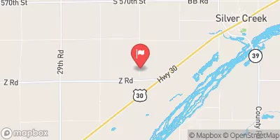
Bellwood 5-G is a local government-owned earth dam in Butler, Nebraska, designed by the USDA NRCS to primarily reduce flood risks in the area.
Summary
Completed in 1965, this dam stands at 43 feet tall, with a hydraulic height of 31 feet and a length of 542 feet. It has a storage capacity of 529 acre-feet and serves a drainage area of 1.5 square miles, with a maximum discharge of 1060 cubic feet per second.
Located in the vicinity of TR-DEER CREEK in Nebraska, Bellwood 5-G is regulated by the NE DNR and undergoes regular inspections to ensure its structural integrity. With a low hazard potential and a satisfactory condition assessment as of 2016, the dam has not been significantly modified since its completion. Despite its low hazard potential, the dam plays a crucial role in mitigating flood risks in the region.
For water resource and climate enthusiasts, Bellwood 5-G serves as a noteworthy example of local government-led flood risk reduction infrastructure. Its design by the USDA NRCS, state-regulated status, and satisfactory condition assessment highlight the importance of proactive dam management to safeguard communities and ecosystems from potential water-related hazards. As climate change continues to impact water resources, the role of structures like Bellwood 5-G in managing flood risks becomes increasingly significant for sustainable water management in the region.
°F
°F
mph
Wind
%
Humidity
15-Day Weather Outlook
Year Completed |
1965 |
Dam Length |
542 |
Dam Height |
31 |
River Or Stream |
TR-DEER CREEK |
Primary Dam Type |
Earth |
Surface Area |
10 |
Hydraulic Height |
31 |
Drainage Area |
1.5 |
Nid Storage |
529 |
Structural Height |
43 |
Hazard Potential |
Low |
Foundations |
Soil |
Nid Height |
43 |
Seasonal Comparison
5-Day Hourly Forecast Detail
Nearby Streamflow Levels
 Clear Cr 1.75mi W Of Polk Co Line
|
12cfs |
 Shell Creek Near Columbus
|
104cfs |
 Platte River Near Duncan
|
2260cfs |
 Prairie Creek Nr Silver Creek Nebr
|
38cfs |
 Platte River At North Bend
|
4150cfs |
 Silver Cr
|
3cfs |
Dam Data Reference
Condition Assessment
SatisfactoryNo existing or potential dam safety deficiencies are recognized. Acceptable performance is expected under all loading conditions (static, hydrologic, seismic) in accordance with the minimum applicable state or federal regulatory criteria or tolerable risk guidelines.
Fair
No existing dam safety deficiencies are recognized for normal operating conditions. Rare or extreme hydrologic and/or seismic events may result in a dam safety deficiency. Risk may be in the range to take further action. Note: Rare or extreme event is defined by the regulatory agency based on their minimum
Poor A dam safety deficiency is recognized for normal operating conditions which may realistically occur. Remedial action is necessary. POOR may also be used when uncertainties exist as to critical analysis parameters which identify a potential dam safety deficiency. Investigations and studies are necessary.
Unsatisfactory
A dam safety deficiency is recognized that requires immediate or emergency remedial action for problem resolution.
Not Rated
The dam has not been inspected, is not under state or federal jurisdiction, or has been inspected but, for whatever reason, has not been rated.
Not Available
Dams for which the condition assessment is restricted to approved government users.
Hazard Potential Classification
HighDams assigned the high hazard potential classification are those where failure or mis-operation will probably cause loss of human life.
Significant
Dams assigned the significant hazard potential classification are those dams where failure or mis-operation results in no probable loss of human life but can cause economic loss, environment damage, disruption of lifeline facilities, or impact other concerns. Significant hazard potential classification dams are often located in predominantly rural or agricultural areas but could be in areas with population and significant infrastructure.
Low
Dams assigned the low hazard potential classification are those where failure or mis-operation results in no probable loss of human life and low economic and/or environmental losses. Losses are principally limited to the owner's property.
Undetermined
Dams for which a downstream hazard potential has not been designated or is not provided.
Not Available
Dams for which the downstream hazard potential is restricted to approved government users.

 Bellwood 5-G