Bellwood 5-K Reservoir Report
Nearby: Bellwood 5-J Bellwood 5-G
Last Updated: February 23, 2026
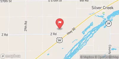
Bellwood 5-K is a local government-owned earth dam located in Butler County, Nebraska, designed by the USDA NRCS in 1974 for flood risk reduction along Deer Creek.
Summary
With a height of 29 feet and a length of 590 feet, the dam has a storage capacity of 455 acre-feet and serves as a vital water resource infrastructure in the area. The dam's low hazard potential and satisfactory condition assessment make it a key player in ensuring the safety and resilience of the surrounding community in the face of potential climate-related challenges.
Managed by the NE DNR, Bellwood 5-K is subject to state regulations, inspections, and enforcement to uphold its structural integrity and operational efficiency. The dam's primary purpose is flood risk reduction, with a normal storage capacity of 36 acre-feet and a maximum discharge capability of 3053 cubic feet per second. Despite its age, the dam continues to play a crucial role in mitigating flood risks and safeguarding the local environment and water resources.
As part of the Kansas City District, Bellwood 5-K is a testament to the collaborative efforts between federal and local agencies in managing water resources and climate-related challenges. Its strategic location and design highlight the importance of sustainable infrastructure that can adapt to changing climate conditions. With a focus on risk reduction and community safety, Bellwood 5-K stands as a model for effective water resource management in the face of climate uncertainties.
°F
°F
mph
Wind
%
Humidity
15-Day Weather Outlook
Year Completed |
1974 |
Dam Length |
590 |
Dam Height |
29 |
River Or Stream |
DEER CREEK |
Primary Dam Type |
Earth |
Surface Area |
10 |
Hydraulic Height |
28 |
Drainage Area |
1.1 |
Nid Storage |
455 |
Structural Height |
30 |
Hazard Potential |
Low |
Foundations |
Soil |
Nid Height |
30 |
Seasonal Comparison
5-Day Hourly Forecast Detail
Nearby Streamflow Levels
 Clear Cr 1.75mi W Of Polk Co Line
|
12cfs |
 Shell Creek Near Columbus
|
104cfs |
 Platte River Near Duncan
|
2260cfs |
 Platte River At North Bend
|
4150cfs |
 Prairie Creek Nr Silver Creek Nebr
|
38cfs |
 Silver Cr
|
3cfs |
Dam Data Reference
Condition Assessment
SatisfactoryNo existing or potential dam safety deficiencies are recognized. Acceptable performance is expected under all loading conditions (static, hydrologic, seismic) in accordance with the minimum applicable state or federal regulatory criteria or tolerable risk guidelines.
Fair
No existing dam safety deficiencies are recognized for normal operating conditions. Rare or extreme hydrologic and/or seismic events may result in a dam safety deficiency. Risk may be in the range to take further action. Note: Rare or extreme event is defined by the regulatory agency based on their minimum
Poor A dam safety deficiency is recognized for normal operating conditions which may realistically occur. Remedial action is necessary. POOR may also be used when uncertainties exist as to critical analysis parameters which identify a potential dam safety deficiency. Investigations and studies are necessary.
Unsatisfactory
A dam safety deficiency is recognized that requires immediate or emergency remedial action for problem resolution.
Not Rated
The dam has not been inspected, is not under state or federal jurisdiction, or has been inspected but, for whatever reason, has not been rated.
Not Available
Dams for which the condition assessment is restricted to approved government users.
Hazard Potential Classification
HighDams assigned the high hazard potential classification are those where failure or mis-operation will probably cause loss of human life.
Significant
Dams assigned the significant hazard potential classification are those dams where failure or mis-operation results in no probable loss of human life but can cause economic loss, environment damage, disruption of lifeline facilities, or impact other concerns. Significant hazard potential classification dams are often located in predominantly rural or agricultural areas but could be in areas with population and significant infrastructure.
Low
Dams assigned the low hazard potential classification are those where failure or mis-operation results in no probable loss of human life and low economic and/or environmental losses. Losses are principally limited to the owner's property.
Undetermined
Dams for which a downstream hazard potential has not been designated or is not provided.
Not Available
Dams for which the downstream hazard potential is restricted to approved government users.

 Bellwood 5-K