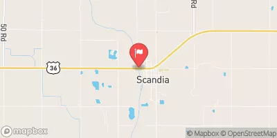
Higer Dam Reservoir Report
Nearby: Bill Hill Dam Grummert Dam
Last Updated: February 22, 2026
Higer Dam, located in Nuckolls, Nebraska, is a privately owned structure designed by USDA NRCS and regulated by the Nebraska Department of Natural Resources.
Summary
Completed in 1969, this Earth-type dam stands at 26 feet tall and stretches for 783 feet along Oak Creek. With a storage capacity of 422 acre-feet and a maximum discharge of 113 cubic feet per second, Higer Dam serves purposes of flood risk reduction and other water resource management activities.
Despite its low hazard potential and satisfactory condition assessment, Higer Dam undergoes regular inspections every five years to ensure its structural integrity and safety. The dam has a drainage area of 1.4 square miles and a normal storage capacity of 76 acre-feet, contributing to the management of surface water resources in the area. The presence of the dam also creates a surface area of 16 acres, supporting ecosystem diversity and providing recreational opportunities for the community.
Owned by a private entity, Higer Dam plays a vital role in water resource management in the region, with the support of the Natural Resources Conservation Service in its design and construction. The dam's location in Superior, Nebraska, highlights its importance for flood control and water supply purposes, safeguarding the surrounding areas from potential risks and ensuring a sustainable water management system for the future.
°F
°F
mph
Wind
%
Humidity
15-Day Weather Outlook
Year Completed |
1969 |
Dam Length |
783 |
Dam Height |
26 |
River Or Stream |
OAK CREEK |
Primary Dam Type |
Earth |
Surface Area |
16 |
Hydraulic Height |
26 |
Drainage Area |
1.4 |
Nid Storage |
422 |
Structural Height |
28 |
Hazard Potential |
Low |
Foundations |
Soil |
Nid Height |
28 |
Seasonal Comparison
5-Day Hourly Forecast Detail
Nearby Streamflow Levels
Dam Data Reference
Condition Assessment
SatisfactoryNo existing or potential dam safety deficiencies are recognized. Acceptable performance is expected under all loading conditions (static, hydrologic, seismic) in accordance with the minimum applicable state or federal regulatory criteria or tolerable risk guidelines.
Fair
No existing dam safety deficiencies are recognized for normal operating conditions. Rare or extreme hydrologic and/or seismic events may result in a dam safety deficiency. Risk may be in the range to take further action. Note: Rare or extreme event is defined by the regulatory agency based on their minimum
Poor A dam safety deficiency is recognized for normal operating conditions which may realistically occur. Remedial action is necessary. POOR may also be used when uncertainties exist as to critical analysis parameters which identify a potential dam safety deficiency. Investigations and studies are necessary.
Unsatisfactory
A dam safety deficiency is recognized that requires immediate or emergency remedial action for problem resolution.
Not Rated
The dam has not been inspected, is not under state or federal jurisdiction, or has been inspected but, for whatever reason, has not been rated.
Not Available
Dams for which the condition assessment is restricted to approved government users.
Hazard Potential Classification
HighDams assigned the high hazard potential classification are those where failure or mis-operation will probably cause loss of human life.
Significant
Dams assigned the significant hazard potential classification are those dams where failure or mis-operation results in no probable loss of human life but can cause economic loss, environment damage, disruption of lifeline facilities, or impact other concerns. Significant hazard potential classification dams are often located in predominantly rural or agricultural areas but could be in areas with population and significant infrastructure.
Low
Dams assigned the low hazard potential classification are those where failure or mis-operation results in no probable loss of human life and low economic and/or environmental losses. Losses are principally limited to the owner's property.
Undetermined
Dams for which a downstream hazard potential has not been designated or is not provided.
Not Available
Dams for which the downstream hazard potential is restricted to approved government users.


 Higer Dam