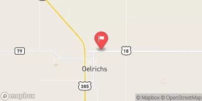
Isham Dam Reservoir Report
Nearby: Chasek Dam Lundy Dam
Last Updated: February 5, 2026
Isham Dam, located in Sheridan, Nebraska, is a privately owned structure designed by the USDA NRCS with a primary purpose of irrigation.
°F
°F
mph
Wind
%
Humidity
15-Day Weather Outlook
Summary
Completed in 1953, this earth dam stands at 26 feet high with a hydraulic height of 24 feet and a length of 502 feet. It has a storage capacity of 619.4 acre-feet and serves an area with a drainage area of 11.17 square miles.
Despite its low hazard potential, Isham Dam's condition assessment is rated as poor as of October 2017. The dam is inspected every 5 years, with the last inspection conducted in 2017. It is regulated by the Nebraska Department of Natural Resources and has state permitting, inspection, and enforcement in place. The dam's location along TR-BEAVER CREEK makes it a crucial resource for irrigation in the region.
For water resource and climate enthusiasts, Isham Dam presents an interesting case study in the management and maintenance of vital water infrastructure. With its historical significance and ongoing challenges in maintenance, the dam serves as a reminder of the importance of sustainable water management practices in the face of changing climate conditions. Its association with the USDA NRCS and state regulatory agencies underscores the collaborative efforts required to ensure the safety and efficiency of water resources in Nebraska.
Year Completed |
1953 |
Dam Length |
502 |
Dam Height |
26 |
River Or Stream |
TR-BEAVER CREEK |
Primary Dam Type |
Earth |
Surface Area |
42 |
Hydraulic Height |
24 |
Drainage Area |
11.17 |
Nid Storage |
619.4 |
Structural Height |
26 |
Hazard Potential |
Low |
Foundations |
Soil |
Nid Height |
26 |
Seasonal Comparison
Hourly Weather Forecast
Nearby Streamflow Levels
Dam Data Reference
Condition Assessment
SatisfactoryNo existing or potential dam safety deficiencies are recognized. Acceptable performance is expected under all loading conditions (static, hydrologic, seismic) in accordance with the minimum applicable state or federal regulatory criteria or tolerable risk guidelines.
Fair
No existing dam safety deficiencies are recognized for normal operating conditions. Rare or extreme hydrologic and/or seismic events may result in a dam safety deficiency. Risk may be in the range to take further action. Note: Rare or extreme event is defined by the regulatory agency based on their minimum
Poor A dam safety deficiency is recognized for normal operating conditions which may realistically occur. Remedial action is necessary. POOR may also be used when uncertainties exist as to critical analysis parameters which identify a potential dam safety deficiency. Investigations and studies are necessary.
Unsatisfactory
A dam safety deficiency is recognized that requires immediate or emergency remedial action for problem resolution.
Not Rated
The dam has not been inspected, is not under state or federal jurisdiction, or has been inspected but, for whatever reason, has not been rated.
Not Available
Dams for which the condition assessment is restricted to approved government users.
Hazard Potential Classification
HighDams assigned the high hazard potential classification are those where failure or mis-operation will probably cause loss of human life.
Significant
Dams assigned the significant hazard potential classification are those dams where failure or mis-operation results in no probable loss of human life but can cause economic loss, environment damage, disruption of lifeline facilities, or impact other concerns. Significant hazard potential classification dams are often located in predominantly rural or agricultural areas but could be in areas with population and significant infrastructure.
Low
Dams assigned the low hazard potential classification are those where failure or mis-operation results in no probable loss of human life and low economic and/or environmental losses. Losses are principally limited to the owner's property.
Undetermined
Dams for which a downstream hazard potential has not been designated or is not provided.
Not Available
Dams for which the downstream hazard potential is restricted to approved government users.


 Isham Dam