Don Littrel Dam Reservoir Report
Nearby: Jones Dam 821 Morris Dam
Last Updated: February 5, 2026
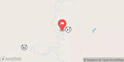
Nestled in the heart of Dawes, Nebraska, the Don Littrel Dam stands as a testament to water resource management and climate resilience.
°F
°F
mph
Wind
%
Humidity
15-Day Weather Outlook
Summary
Completed in 1987 by the USDA NRCS, this private dam serves as a vital flood risk reduction structure along the TR-White River. With a height of 17 feet and a capacity of 131 acre-feet, it plays a crucial role in protecting the surrounding area from potential hazards.
Managed by the Nebraska Department of Natural Resources, the Don Littrel Dam has undergone regular inspections to ensure its structural integrity. With a low hazard potential and a satisfactory condition assessment, this earth dam continues to be a reliable asset for the community. Its primary purpose extends beyond flood control, encompassing a variety of water management functions essential for the region's sustainability.
As climate change intensifies, the Don Littrel Dam stands as a beacon of resilience in the face of environmental challenges. With its stone core and soil foundation, this structure represents a harmonious blend of nature and engineering. From its strategic location to its modest surface area and drainage capabilities, the dam exemplifies the intersection of human ingenuity and ecological stewardship in safeguarding water resources for future generations.
Year Completed |
1987 |
Dam Length |
545 |
Dam Height |
17 |
River Or Stream |
TR-WHITE RIVER |
Primary Dam Type |
Earth |
Surface Area |
12 |
Hydraulic Height |
14 |
Drainage Area |
4 |
Nid Storage |
131 |
Structural Height |
24 |
Hazard Potential |
Low |
Foundations |
Soil |
Nid Height |
24 |
Seasonal Comparison
Hourly Weather Forecast
Nearby Streamflow Levels
Dam Data Reference
Condition Assessment
SatisfactoryNo existing or potential dam safety deficiencies are recognized. Acceptable performance is expected under all loading conditions (static, hydrologic, seismic) in accordance with the minimum applicable state or federal regulatory criteria or tolerable risk guidelines.
Fair
No existing dam safety deficiencies are recognized for normal operating conditions. Rare or extreme hydrologic and/or seismic events may result in a dam safety deficiency. Risk may be in the range to take further action. Note: Rare or extreme event is defined by the regulatory agency based on their minimum
Poor A dam safety deficiency is recognized for normal operating conditions which may realistically occur. Remedial action is necessary. POOR may also be used when uncertainties exist as to critical analysis parameters which identify a potential dam safety deficiency. Investigations and studies are necessary.
Unsatisfactory
A dam safety deficiency is recognized that requires immediate or emergency remedial action for problem resolution.
Not Rated
The dam has not been inspected, is not under state or federal jurisdiction, or has been inspected but, for whatever reason, has not been rated.
Not Available
Dams for which the condition assessment is restricted to approved government users.
Hazard Potential Classification
HighDams assigned the high hazard potential classification are those where failure or mis-operation will probably cause loss of human life.
Significant
Dams assigned the significant hazard potential classification are those dams where failure or mis-operation results in no probable loss of human life but can cause economic loss, environment damage, disruption of lifeline facilities, or impact other concerns. Significant hazard potential classification dams are often located in predominantly rural or agricultural areas but could be in areas with population and significant infrastructure.
Low
Dams assigned the low hazard potential classification are those where failure or mis-operation results in no probable loss of human life and low economic and/or environmental losses. Losses are principally limited to the owner's property.
Undetermined
Dams for which a downstream hazard potential has not been designated or is not provided.
Not Available
Dams for which the downstream hazard potential is restricted to approved government users.


 Don Littrel Dam