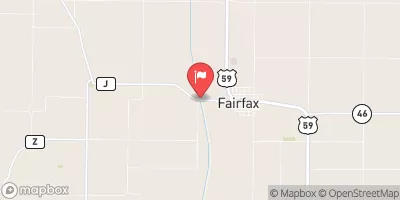
Gauchat Group Dam Reservoir Report
Last Updated: February 23, 2026
Gauchat Group Dam, located in Nemaha, Nebraska, serves as a critical flood risk reduction structure along the TR-Little Nemaha River.
Summary
Completed in 1979, this earth dam stands at 23 feet high with a hydraulic height of 22 feet, providing essential protection to the surrounding area. With a storage capacity of 68 acre-feet and a normal storage level of 26 acre-feet, the dam plays a crucial role in mitigating potential flood damage in the region.
Owned and regulated by the local government with oversight from the Nebraska Department of Natural Resources, Gauchat Group Dam is classified as having a low hazard potential and is in satisfactory condition as of the last inspection in May 2016. With a drainage area of 0.4 square miles and a maximum discharge capacity of 172 cubic feet per second, the dam's importance in managing water flow and reducing flood risks cannot be overstated. Its strategic location in AUBURN, Nebraska, highlights its significance in protecting the community and surrounding areas from potential water-related disasters.
As water resource and climate enthusiasts, understanding the vital role that structures like Gauchat Group Dam play in safeguarding communities and ecosystems is crucial. With its history of effective flood risk reduction and ongoing state-regulated inspections and enforcement, this dam stands as a testament to the importance of proactive water management in the face of changing climate conditions. Despite its unassuming hazard potential, Gauchat Group Dam serves as a key line of defense against flood events in Nemaha County, Nebraska, showcasing the intersection of infrastructure, environmental protection, and community resilience in water resource management.
°F
°F
mph
Wind
%
Humidity
15-Day Weather Outlook
Year Completed |
1979 |
Dam Length |
757 |
Dam Height |
23 |
River Or Stream |
TR-LITTLE NEMAHA RIVER |
Primary Dam Type |
Earth |
Surface Area |
6 |
Hydraulic Height |
22 |
Drainage Area |
0.4 |
Nid Storage |
68 |
Structural Height |
26 |
Hazard Potential |
Low |
Foundations |
Soil |
Nid Height |
26 |
Seasonal Comparison
5-Day Hourly Forecast Detail
Nearby Streamflow Levels
Dam Data Reference
Condition Assessment
SatisfactoryNo existing or potential dam safety deficiencies are recognized. Acceptable performance is expected under all loading conditions (static, hydrologic, seismic) in accordance with the minimum applicable state or federal regulatory criteria or tolerable risk guidelines.
Fair
No existing dam safety deficiencies are recognized for normal operating conditions. Rare or extreme hydrologic and/or seismic events may result in a dam safety deficiency. Risk may be in the range to take further action. Note: Rare or extreme event is defined by the regulatory agency based on their minimum
Poor A dam safety deficiency is recognized for normal operating conditions which may realistically occur. Remedial action is necessary. POOR may also be used when uncertainties exist as to critical analysis parameters which identify a potential dam safety deficiency. Investigations and studies are necessary.
Unsatisfactory
A dam safety deficiency is recognized that requires immediate or emergency remedial action for problem resolution.
Not Rated
The dam has not been inspected, is not under state or federal jurisdiction, or has been inspected but, for whatever reason, has not been rated.
Not Available
Dams for which the condition assessment is restricted to approved government users.
Hazard Potential Classification
HighDams assigned the high hazard potential classification are those where failure or mis-operation will probably cause loss of human life.
Significant
Dams assigned the significant hazard potential classification are those dams where failure or mis-operation results in no probable loss of human life but can cause economic loss, environment damage, disruption of lifeline facilities, or impact other concerns. Significant hazard potential classification dams are often located in predominantly rural or agricultural areas but could be in areas with population and significant infrastructure.
Low
Dams assigned the low hazard potential classification are those where failure or mis-operation results in no probable loss of human life and low economic and/or environmental losses. Losses are principally limited to the owner's property.
Undetermined
Dams for which a downstream hazard potential has not been designated or is not provided.
Not Available
Dams for which the downstream hazard potential is restricted to approved government users.


 Gauchat Group Dam