Coryell Smith Dam Reservoir Report
Last Updated: February 3, 2026
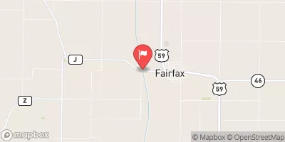
Coryell Smith Dam, located in Auburn, Nebraska, is a local government-owned structure designed by USDA NRCS to manage flood risk along the TR-Little Nemaha River.
°F
°F
mph
Wind
%
Humidity
15-Day Weather Outlook
Summary
Completed in 2000, this earth dam stands at a height of 32 feet with a hydraulic height of 29 feet, providing essential flood risk reduction for the surrounding area. With a normal storage capacity of 18 acre-feet and a maximum storage of 96 acre-feet, this dam plays a crucial role in protecting the region from potential water-related disasters.
Managed by the NE DNR, Coryell Smith Dam underwent its last inspection in March 2017 and was found to be in satisfactory condition with a low hazard potential. The dam's spillway type, spillway width, and other specific design details are not listed, but its primary purpose of flood risk reduction remains clear. With a drainage area of 0.5 square miles and a maximum discharge of 72 cubic feet per second, this dam serves as a vital resource for water resource and climate enthusiasts interested in understanding the infrastructure that helps protect communities from the impacts of extreme weather events.
As a part of the Kansas City District within the USACE, Coryell Smith Dam stands as an example of effective water infrastructure designed to mitigate flood risks in Nemaha County, Nebraska. Its stone core, soil foundation, and 497-foot length contribute to its structural integrity, while its location at NWS3T5R13E ensures that it plays a key role in managing water flow along the TR-Little Nemaha River. With a history of successful operation and regular inspections, this dam serves as a model for sustainable water resource management in the region.
Year Completed |
2000 |
Dam Length |
497 |
Dam Height |
32 |
River Or Stream |
TR-LITTLE NEMAHA RIVER |
Primary Dam Type |
Earth |
Surface Area |
3 |
Hydraulic Height |
29 |
Drainage Area |
0.5 |
Nid Storage |
96 |
Structural Height |
36 |
Hazard Potential |
Low |
Foundations |
Soil |
Nid Height |
36 |
Seasonal Comparison
Hourly Weather Forecast
Nearby Streamflow Levels
Dam Data Reference
Condition Assessment
SatisfactoryNo existing or potential dam safety deficiencies are recognized. Acceptable performance is expected under all loading conditions (static, hydrologic, seismic) in accordance with the minimum applicable state or federal regulatory criteria or tolerable risk guidelines.
Fair
No existing dam safety deficiencies are recognized for normal operating conditions. Rare or extreme hydrologic and/or seismic events may result in a dam safety deficiency. Risk may be in the range to take further action. Note: Rare or extreme event is defined by the regulatory agency based on their minimum
Poor A dam safety deficiency is recognized for normal operating conditions which may realistically occur. Remedial action is necessary. POOR may also be used when uncertainties exist as to critical analysis parameters which identify a potential dam safety deficiency. Investigations and studies are necessary.
Unsatisfactory
A dam safety deficiency is recognized that requires immediate or emergency remedial action for problem resolution.
Not Rated
The dam has not been inspected, is not under state or federal jurisdiction, or has been inspected but, for whatever reason, has not been rated.
Not Available
Dams for which the condition assessment is restricted to approved government users.
Hazard Potential Classification
HighDams assigned the high hazard potential classification are those where failure or mis-operation will probably cause loss of human life.
Significant
Dams assigned the significant hazard potential classification are those dams where failure or mis-operation results in no probable loss of human life but can cause economic loss, environment damage, disruption of lifeline facilities, or impact other concerns. Significant hazard potential classification dams are often located in predominantly rural or agricultural areas but could be in areas with population and significant infrastructure.
Low
Dams assigned the low hazard potential classification are those where failure or mis-operation results in no probable loss of human life and low economic and/or environmental losses. Losses are principally limited to the owner's property.
Undetermined
Dams for which a downstream hazard potential has not been designated or is not provided.
Not Available
Dams for which the downstream hazard potential is restricted to approved government users.


 Coryell Smith Dam