Blackwood Creek 51-A Reservoir Report
Last Updated: February 21, 2026
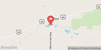
Blackwood Creek 51-A is a locally owned earth dam located in Hayes, Nebraska, designed by the USDA NRCS with a primary purpose of flood risk reduction.
Summary
Completed in 1985, this dam stands at 39 feet high with a hydraulic height of 37 feet and a structural height of 62 feet. It has a storage capacity of 726 acre-feet, a normal storage of 69 acre-feet, and covers a surface area of 12 acres.
Managed by the Nebraska Department of Natural Resources, Blackwood Creek 51-A is inspected every five years and has been deemed to have a low hazard potential with a satisfactory condition assessment as of May 2020. The dam has a drainage area of 5 square miles and a maximum discharge of 2,224 cubic feet per second, serving as a crucial infrastructure for flood control in the region. Despite its age, the dam continues to play a vital role in protecting the surrounding area from potential water-related disasters.
Located in the Omaha District, Blackwood Creek 51-A is a testament to effective water resource management and climate resilience efforts in Nebraska. With its strategic design and regular inspections, this dam serves as a crucial asset in mitigating flood risks and safeguarding the community against water-related emergencies. As water resource and climate enthusiasts, the data surrounding Blackwood Creek 51-A underscores the importance of proactive infrastructure planning and maintenance to enhance water security in the face of changing climate patterns.
°F
°F
mph
Wind
%
Humidity
15-Day Weather Outlook
Year Completed |
1985 |
Dam Length |
469 |
Dam Height |
39 |
River Or Stream |
TR-BLACKWOOD CREEK |
Primary Dam Type |
Earth |
Surface Area |
12 |
Hydraulic Height |
37 |
Drainage Area |
5 |
Nid Storage |
726 |
Structural Height |
62 |
Hazard Potential |
Low |
Foundations |
Soil |
Nid Height |
62 |
Seasonal Comparison
5-Day Hourly Forecast Detail
Nearby Streamflow Levels
Dam Data Reference
Condition Assessment
SatisfactoryNo existing or potential dam safety deficiencies are recognized. Acceptable performance is expected under all loading conditions (static, hydrologic, seismic) in accordance with the minimum applicable state or federal regulatory criteria or tolerable risk guidelines.
Fair
No existing dam safety deficiencies are recognized for normal operating conditions. Rare or extreme hydrologic and/or seismic events may result in a dam safety deficiency. Risk may be in the range to take further action. Note: Rare or extreme event is defined by the regulatory agency based on their minimum
Poor A dam safety deficiency is recognized for normal operating conditions which may realistically occur. Remedial action is necessary. POOR may also be used when uncertainties exist as to critical analysis parameters which identify a potential dam safety deficiency. Investigations and studies are necessary.
Unsatisfactory
A dam safety deficiency is recognized that requires immediate or emergency remedial action for problem resolution.
Not Rated
The dam has not been inspected, is not under state or federal jurisdiction, or has been inspected but, for whatever reason, has not been rated.
Not Available
Dams for which the condition assessment is restricted to approved government users.
Hazard Potential Classification
HighDams assigned the high hazard potential classification are those where failure or mis-operation will probably cause loss of human life.
Significant
Dams assigned the significant hazard potential classification are those dams where failure or mis-operation results in no probable loss of human life but can cause economic loss, environment damage, disruption of lifeline facilities, or impact other concerns. Significant hazard potential classification dams are often located in predominantly rural or agricultural areas but could be in areas with population and significant infrastructure.
Low
Dams assigned the low hazard potential classification are those where failure or mis-operation results in no probable loss of human life and low economic and/or environmental losses. Losses are principally limited to the owner's property.
Undetermined
Dams for which a downstream hazard potential has not been designated or is not provided.
Not Available
Dams for which the downstream hazard potential is restricted to approved government users.


 Blackwood Creek 51-A