Blackwood Creek 12-A Reservoir Report
Last Updated: February 21, 2026
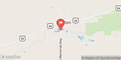
Blackwood Creek 12-A is a local government-owned dam located in McCook, Nebraska, designed by the USDA NRCS with oversight from the Nebraska Department of Natural Resources.
Summary
Built in 1988, this earth dam stands at a height of 68 feet and serves the primary purpose of flood risk reduction along the TR-Blackwood Creek. With a storage capacity of 11,205 acre-feet and a drainage area of 63 square miles, the dam plays a crucial role in managing water resources in the region.
The dam's structural integrity is regularly inspected, with the last assessment in May 2020 deeming it satisfactory and posing a low hazard potential. With a flood risk reduction focus, Blackwood Creek 12-A ensures the safety of nearby communities and infrastructure from potential inundation events. Managed by local authorities and designed by the Natural Resources Conservation Service, this dam exemplifies the importance of effective water resource management and climate resilience in the face of changing environmental conditions.
As part of the Omaha District's infrastructure, Blackwood Creek 12-A contributes to the overall water management strategy in the area, with a focus on maintaining satisfactory conditions and low hazard potential. With a history of effective flood risk reduction and a storage capacity of 11,205 acre-feet, this dam plays a vital role in protecting the surrounding community and supporting sustainable water resource management practices in Nebraska.
°F
°F
mph
Wind
%
Humidity
15-Day Weather Outlook
Year Completed |
1988 |
Dam Length |
1080 |
Dam Height |
68 |
River Or Stream |
TR-BLACKWOOD CREEK |
Primary Dam Type |
Earth |
Surface Area |
17 |
Hydraulic Height |
63 |
Drainage Area |
63 |
Nid Storage |
11205 |
Structural Height |
71 |
Hazard Potential |
Low |
Foundations |
Soil |
Nid Height |
71 |
Seasonal Comparison
5-Day Hourly Forecast Detail
Nearby Streamflow Levels
Dam Data Reference
Condition Assessment
SatisfactoryNo existing or potential dam safety deficiencies are recognized. Acceptable performance is expected under all loading conditions (static, hydrologic, seismic) in accordance with the minimum applicable state or federal regulatory criteria or tolerable risk guidelines.
Fair
No existing dam safety deficiencies are recognized for normal operating conditions. Rare or extreme hydrologic and/or seismic events may result in a dam safety deficiency. Risk may be in the range to take further action. Note: Rare or extreme event is defined by the regulatory agency based on their minimum
Poor A dam safety deficiency is recognized for normal operating conditions which may realistically occur. Remedial action is necessary. POOR may also be used when uncertainties exist as to critical analysis parameters which identify a potential dam safety deficiency. Investigations and studies are necessary.
Unsatisfactory
A dam safety deficiency is recognized that requires immediate or emergency remedial action for problem resolution.
Not Rated
The dam has not been inspected, is not under state or federal jurisdiction, or has been inspected but, for whatever reason, has not been rated.
Not Available
Dams for which the condition assessment is restricted to approved government users.
Hazard Potential Classification
HighDams assigned the high hazard potential classification are those where failure or mis-operation will probably cause loss of human life.
Significant
Dams assigned the significant hazard potential classification are those dams where failure or mis-operation results in no probable loss of human life but can cause economic loss, environment damage, disruption of lifeline facilities, or impact other concerns. Significant hazard potential classification dams are often located in predominantly rural or agricultural areas but could be in areas with population and significant infrastructure.
Low
Dams assigned the low hazard potential classification are those where failure or mis-operation results in no probable loss of human life and low economic and/or environmental losses. Losses are principally limited to the owner's property.
Undetermined
Dams for which a downstream hazard potential has not been designated or is not provided.
Not Available
Dams for which the downstream hazard potential is restricted to approved government users.


 Blackwood Creek 12-A