
Duis Dam Reservoir Report
Nearby: Andrews Dam Bryan Dam
Last Updated: December 6, 2025
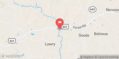
Duis Dam, located in Bedford, Virginia, is a state-regulated structure owned by an unspecified entity.
°F
°F
mph
Wind
%
Humidity
Summary
This earth dam stands at a height of 29 feet and has a storage capacity of 43.73 acre-feet, with a normal storage level of 22.6 acre-feet. The dam's purpose and primary dam type are not specified, but it is known to be state-jurisdictioned, inspected, regulated, and enforced by the Department of Conservation and Recreation in Virginia.
Despite its undetermined hazard potential and not being rated for condition assessment, Duis Dam plays a crucial role in water resource management in the region. Its strategic location and hydraulic height of 29 feet make it a key component in flood control and water supply management. Climate and water resource enthusiasts will be fascinated by the dam's significance in the local ecosystem and its impact on the surrounding environment.
As a part of the Norfolk District within Congressional District 05, Virginia, Duis Dam serves as a vital infrastructure for the community. With its emergency action plan status and risk management measures not specified, there is a need for further assessment and preparedness to ensure the dam's safety and functionality in the face of potential climate challenges. For those interested in water resource management and climate resilience, Duis Dam presents an intriguing case study in the intersection of infrastructure, regulation, and environmental stewardship.
Dam Height |
29 |
Surface Area |
2.57 |
Hydraulic Height |
29 |
Nid Storage |
43.73 |
Structural Height |
29 |
Hazard Potential |
Undetermined |
Nid Height |
29 |
Seasonal Comparison
Weather Forecast
Nearby Streamflow Levels
 Big Otter River Near Bedford
|
53cfs |
 Big Otter River Near Evington
|
101cfs |
 Goose Creek Near Huddleston
|
58cfs |
 James River At Holcomb Rock
|
1010cfs |
 Roanoke River At Altavista
|
618cfs |
 James River At Buchanan
|
657cfs |
Dam Data Reference
Condition Assessment
SatisfactoryNo existing or potential dam safety deficiencies are recognized. Acceptable performance is expected under all loading conditions (static, hydrologic, seismic) in accordance with the minimum applicable state or federal regulatory criteria or tolerable risk guidelines.
Fair
No existing dam safety deficiencies are recognized for normal operating conditions. Rare or extreme hydrologic and/or seismic events may result in a dam safety deficiency. Risk may be in the range to take further action. Note: Rare or extreme event is defined by the regulatory agency based on their minimum
Poor A dam safety deficiency is recognized for normal operating conditions which may realistically occur. Remedial action is necessary. POOR may also be used when uncertainties exist as to critical analysis parameters which identify a potential dam safety deficiency. Investigations and studies are necessary.
Unsatisfactory
A dam safety deficiency is recognized that requires immediate or emergency remedial action for problem resolution.
Not Rated
The dam has not been inspected, is not under state or federal jurisdiction, or has been inspected but, for whatever reason, has not been rated.
Not Available
Dams for which the condition assessment is restricted to approved government users.
Hazard Potential Classification
HighDams assigned the high hazard potential classification are those where failure or mis-operation will probably cause loss of human life.
Significant
Dams assigned the significant hazard potential classification are those dams where failure or mis-operation results in no probable loss of human life but can cause economic loss, environment damage, disruption of lifeline facilities, or impact other concerns. Significant hazard potential classification dams are often located in predominantly rural or agricultural areas but could be in areas with population and significant infrastructure.
Low
Dams assigned the low hazard potential classification are those where failure or mis-operation results in no probable loss of human life and low economic and/or environmental losses. Losses are principally limited to the owner's property.
Undetermined
Dams for which a downstream hazard potential has not been designated or is not provided.
Not Available
Dams for which the downstream hazard potential is restricted to approved government users.
 Duis Dam
 Forest Recreation Park
 Timbrook Park
 Blue Ridge Parkway