Santa Rosa Reservoir Reservoir Report
Nearby: Railroad Dam No.1 Railroad Dam No.2
Last Updated: January 12, 2026
Santa Rosa Reservoir is a man-made lake located on the Pecos River in eastern New Mexico.
°F
°F
mph
Wind
%
Humidity
Summary
Built in the 1980s, the reservoir was created for flood control, irrigation, and recreational purposes. It has a capacity of 117,000 acre-feet of water and a surface area of 3,800 acres. The reservoir receives water from the Pecos River, which is fed by several tributaries and snowpack in the Sangre de Cristo Mountains. The reservoir provides water for irrigation to surrounding agricultural land, as well as for recreational activities like fishing and boating. The Pecos River also serves as a source of hydroelectric power. The reservoir is managed by the United States Army Corps of Engineers and is an important part of the water supply infrastructure in the region.
Reservoir Details
| Storage 24hr Change | 0.04% |
| Percent of Normal | 149% |
| Minimum |
120.0 acre-ft
1981-07-30 |
| Maximum |
120,481.0 acre-ft
1987-05-08 |
| Average | 50,492 acre-ft |
Seasonal Comparison
Storage Levels
Storage Levels
Pool Elevation Levels
Total Release Levels
Inflow Levels
Weather Forecast
Nearby Streamflow Levels
Dam Data Reference
Condition Assessment
SatisfactoryNo existing or potential dam safety deficiencies are recognized. Acceptable performance is expected under all loading conditions (static, hydrologic, seismic) in accordance with the minimum applicable state or federal regulatory criteria or tolerable risk guidelines.
Fair
No existing dam safety deficiencies are recognized for normal operating conditions. Rare or extreme hydrologic and/or seismic events may result in a dam safety deficiency. Risk may be in the range to take further action. Note: Rare or extreme event is defined by the regulatory agency based on their minimum
Poor A dam safety deficiency is recognized for normal operating conditions which may realistically occur. Remedial action is necessary. POOR may also be used when uncertainties exist as to critical analysis parameters which identify a potential dam safety deficiency. Investigations and studies are necessary.
Unsatisfactory
A dam safety deficiency is recognized that requires immediate or emergency remedial action for problem resolution.
Not Rated
The dam has not been inspected, is not under state or federal jurisdiction, or has been inspected but, for whatever reason, has not been rated.
Not Available
Dams for which the condition assessment is restricted to approved government users.
Hazard Potential Classification
HighDams assigned the high hazard potential classification are those where failure or mis-operation will probably cause loss of human life.
Significant
Dams assigned the significant hazard potential classification are those dams where failure or mis-operation results in no probable loss of human life but can cause economic loss, environment damage, disruption of lifeline facilities, or impact other concerns. Significant hazard potential classification dams are often located in predominantly rural or agricultural areas but could be in areas with population and significant infrastructure.
Low
Dams assigned the low hazard potential classification are those where failure or mis-operation results in no probable loss of human life and low economic and/or environmental losses. Losses are principally limited to the owner's property.
Undetermined
Dams for which a downstream hazard potential has not been designated or is not provided.
Not Available
Dams for which the downstream hazard potential is restricted to approved government users.

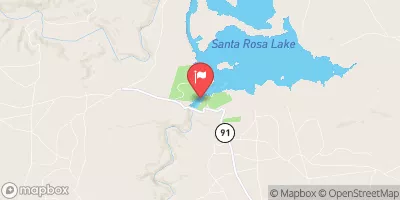


 Santa Rosa Dam
 Santa Rosa Reservoir