


Bulls Bridge Mountainside Spillway Reservoir Report
Last Updated: April 29, 2026
°F
°F
mph
Wind
%
Humidity
Bulls Bridge Mountainside Spillway in Gaylordsville, Connecticut, is a significant hydroelectric structure completed in 1902, owned by a public utility.
Summary
It is associated with four other structures and located along the Housatonic River in Litchfield County. The spillway has a gravity dam type, standing at 20 feet in height and 200 feet in length, with a storage capacity of 400 acre-feet and a drainage area of 784 square miles.
Managed by the Federal Energy Regulatory Commission, the spillway serves multiple purposes, including hydroelectric power generation and recreation. With a spillway type classified as uncontrolled and a significant hazard potential, it has a maximum discharge capability of 150 cubic feet per second. Despite its age, the condition assessment of Bulls Bridge Mountainside Spillway is currently not available, highlighting the importance of ongoing monitoring and risk management measures to ensure its continued safe operation.
Ensuring the integrity and safety of Bulls Bridge Mountainside Spillway remains a priority, given its historical significance and importance in the region's water resource management. As a vital component in the area's hydroelectric infrastructure, the spillway's risk assessment categorizes it as moderate, emphasizing the need for regular inspections and emergency preparedness measures. With its picturesque location and critical role in power generation, Bulls Bridge Mountainside Spillway stands as a testament to the intersection of water resource management and climate resilience in Connecticut's landscape.
Regional Streamflow Levels
15-Day Long Term Forecast
Year Completed |
1902 |
Dam Length |
200 |
Dam Height |
20 |
River Or Stream |
Housatonic River |
Primary Dam Type |
Gravity |
Surface Area |
120 |
Drainage Area |
784 |
Nid Storage |
400 |
Hazard Potential |
Significant |
Nid Height |
20 |
Seasonal Comparison
5-Day Hourly Forecast Detail
Dam Data Reference
Condition Assessment
SatisfactoryNo existing or potential dam safety deficiencies are recognized. Acceptable performance is expected under all loading conditions (static, hydrologic, seismic) in accordance with the minimum applicable state or federal regulatory criteria or tolerable risk guidelines.
Fair
No existing dam safety deficiencies are recognized for normal operating conditions. Rare or extreme hydrologic and/or seismic events may result in a dam safety deficiency. Risk may be in the range to take further action. Note: Rare or extreme event is defined by the regulatory agency based on their minimum
Poor A dam safety deficiency is recognized for normal operating conditions which may realistically occur. Remedial action is necessary. POOR may also be used when uncertainties exist as to critical analysis parameters which identify a potential dam safety deficiency. Investigations and studies are necessary.
Unsatisfactory
A dam safety deficiency is recognized that requires immediate or emergency remedial action for problem resolution.
Not Rated
The dam has not been inspected, is not under state or federal jurisdiction, or has been inspected but, for whatever reason, has not been rated.
Not Available
Dams for which the condition assessment is restricted to approved government users.
Hazard Potential Classification
HighDams assigned the high hazard potential classification are those where failure or mis-operation will probably cause loss of human life.
Significant
Dams assigned the significant hazard potential classification are those dams where failure or mis-operation results in no probable loss of human life but can cause economic loss, environment damage, disruption of lifeline facilities, or impact other concerns. Significant hazard potential classification dams are often located in predominantly rural or agricultural areas but could be in areas with population and significant infrastructure.
Low
Dams assigned the low hazard potential classification are those where failure or mis-operation results in no probable loss of human life and low economic and/or environmental losses. Losses are principally limited to the owner's property.
Undetermined
Dams for which a downstream hazard potential has not been designated or is not provided.
Not Available
Dams for which the downstream hazard potential is restricted to approved government users.
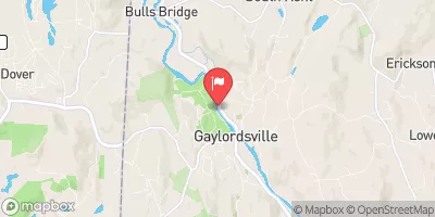
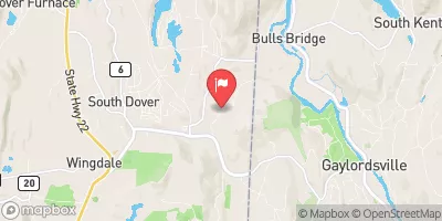
Area Campgrounds
| Location | Reservations | Toilets |
|---|---|---|
 Schaghticoke Mountain Camping Area
|
||
 Lake Waramaug State Park
|
||
 Macedonia Brook State Park
|
||
 SR4
SR4
|
||
 SR3
SR3
|
||
 SR2
SR2
|
 South Kent Road Kent
 Kent Bridge To Boardman Bridge
 Pond Downstream Of Shepaug Reservoir Dam, Marked By Service Road Bridge To Ends In Backwaters Of Lake Lillinonah, Near Roxbury Falls