Jamestown Reservoir Report
Nearby: Jamestown Ice House Dam Pipestem Dam
Last Updated: December 13, 2025
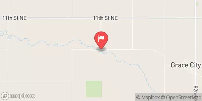
Jamestown, located in North Dakota along the James River, is a federally owned dam managed by the Bureau of Reclamation.
°F
°F
mph
Wind
%
Humidity
Summary
Completed in 1954, this earth dam stands at 110 feet tall and serves primarily for flood risk reduction and irrigation purposes. With a storage capacity of 379,636 acre-feet and a surface area of 17,427 acres, Jamestown plays a crucial role in managing water resources in the region.
The dam has a high hazard potential and is regulated by the North Dakota State Water Commission, with regular inspections conducted by the Bureau of Reclamation. While the condition assessment is currently not available, emergency action plans have been prepared and revised periodically. The dam features an uncontrolled spillway and two slide gates for water release. Overall, Jamestown represents a significant infrastructure project that safeguards the community from flooding events and supports agricultural activities through irrigation.
The dam's location within Stutsman County, North Dakota, and its design by the Bureau of Reclamation highlight the collaboration between federal agencies and local authorities in ensuring water resource management and climate resilience. With a moderate risk assessment rating, Jamestown underscores the importance of ongoing monitoring and maintenance to mitigate potential hazards and ensure the longevity of this critical water infrastructure.
Year Completed |
1954 |
Dam Length |
1418 |
Dam Height |
81 |
River Or Stream |
JAMES RIVER |
Primary Dam Type |
Earth |
Surface Area |
17427 |
Hydraulic Height |
74 |
Drainage Area |
1670 |
Nid Storage |
379636 |
Structural Height |
110 |
Outlet Gates |
Slide (sluice gate) - 2 |
Hazard Potential |
High |
Foundations |
Soil |
Nid Height |
110 |
Seasonal Comparison
Weather Forecast
Nearby Streamflow Levels
Dam Data Reference
Condition Assessment
SatisfactoryNo existing or potential dam safety deficiencies are recognized. Acceptable performance is expected under all loading conditions (static, hydrologic, seismic) in accordance with the minimum applicable state or federal regulatory criteria or tolerable risk guidelines.
Fair
No existing dam safety deficiencies are recognized for normal operating conditions. Rare or extreme hydrologic and/or seismic events may result in a dam safety deficiency. Risk may be in the range to take further action. Note: Rare or extreme event is defined by the regulatory agency based on their minimum
Poor A dam safety deficiency is recognized for normal operating conditions which may realistically occur. Remedial action is necessary. POOR may also be used when uncertainties exist as to critical analysis parameters which identify a potential dam safety deficiency. Investigations and studies are necessary.
Unsatisfactory
A dam safety deficiency is recognized that requires immediate or emergency remedial action for problem resolution.
Not Rated
The dam has not been inspected, is not under state or federal jurisdiction, or has been inspected but, for whatever reason, has not been rated.
Not Available
Dams for which the condition assessment is restricted to approved government users.
Hazard Potential Classification
HighDams assigned the high hazard potential classification are those where failure or mis-operation will probably cause loss of human life.
Significant
Dams assigned the significant hazard potential classification are those dams where failure or mis-operation results in no probable loss of human life but can cause economic loss, environment damage, disruption of lifeline facilities, or impact other concerns. Significant hazard potential classification dams are often located in predominantly rural or agricultural areas but could be in areas with population and significant infrastructure.
Low
Dams assigned the low hazard potential classification are those where failure or mis-operation results in no probable loss of human life and low economic and/or environmental losses. Losses are principally limited to the owner's property.
Undetermined
Dams for which a downstream hazard potential has not been designated or is not provided.
Not Available
Dams for which the downstream hazard potential is restricted to approved government users.


 Lakeside Campground - Jamestown Lake
 Parkhurst - Pipestem Lake
 Pelican Point Landing - Jamestown Lake
 Smokeys Campsite and Landing
 Shady Cove Co Park
 Spiritwood Lake/Sandy Beach
 Jamestown