Larson Dam; Michael Reservoir Report
Last Updated: February 9, 2026
Larson Dam, also known as Wetland #1, is a private earth dam located in Sioux County, North Dakota.
Summary
Designed by USFWS and completed in 2001, this dam serves multiple purposes including fire protection, stock, and small fish pond maintenance. With a height of 19.5 feet and a length of 550 feet, Larson Dam has a storage capacity of 205.1 acre-feet and a drainage area of 9.63 square miles.
Situated on Cedar Creek-Tr, Larson Dam is regulated by the North Dakota State Water Commission and is subject to state permitting, inspection, and enforcement. With a spillway width of 90 feet and a low hazard potential, this dam has not been rated for its condition assessment. Despite its moderate risk level, Larson Dam does not have an Emergency Action Plan in place, and its risk management measures are currently unspecified. Overall, Larson Dam serves as a key infrastructure for water resource management in the region.
For water resource and climate enthusiasts, Larson Dam represents an important piece of infrastructure that plays a crucial role in fire protection, livestock maintenance, and small fish pond operations in North Dakota. As a privately owned dam with state regulation and oversight, Larson Dam serves as a testament to the collaboration between private entities and government agencies in managing water resources. With its low hazard potential and moderate risk level, Larson Dam highlights the importance of proper risk assessment and management in ensuring the safety and sustainability of water infrastructure projects.
°F
°F
mph
Wind
%
Humidity
15-Day Weather Outlook
Year Completed |
2001 |
Dam Length |
550 |
Dam Height |
19.5 |
River Or Stream |
CEDAR CREEK-TR |
Primary Dam Type |
Earth |
Surface Area |
20 |
Drainage Area |
9.63 |
Nid Storage |
205.1 |
Hazard Potential |
Low |
Foundations |
Soil |
Nid Height |
20 |
Seasonal Comparison
5-Day Hourly Forecast Detail
Nearby Streamflow Levels
Dam Data Reference
Condition Assessment
SatisfactoryNo existing or potential dam safety deficiencies are recognized. Acceptable performance is expected under all loading conditions (static, hydrologic, seismic) in accordance with the minimum applicable state or federal regulatory criteria or tolerable risk guidelines.
Fair
No existing dam safety deficiencies are recognized for normal operating conditions. Rare or extreme hydrologic and/or seismic events may result in a dam safety deficiency. Risk may be in the range to take further action. Note: Rare or extreme event is defined by the regulatory agency based on their minimum
Poor A dam safety deficiency is recognized for normal operating conditions which may realistically occur. Remedial action is necessary. POOR may also be used when uncertainties exist as to critical analysis parameters which identify a potential dam safety deficiency. Investigations and studies are necessary.
Unsatisfactory
A dam safety deficiency is recognized that requires immediate or emergency remedial action for problem resolution.
Not Rated
The dam has not been inspected, is not under state or federal jurisdiction, or has been inspected but, for whatever reason, has not been rated.
Not Available
Dams for which the condition assessment is restricted to approved government users.
Hazard Potential Classification
HighDams assigned the high hazard potential classification are those where failure or mis-operation will probably cause loss of human life.
Significant
Dams assigned the significant hazard potential classification are those dams where failure or mis-operation results in no probable loss of human life but can cause economic loss, environment damage, disruption of lifeline facilities, or impact other concerns. Significant hazard potential classification dams are often located in predominantly rural or agricultural areas but could be in areas with population and significant infrastructure.
Low
Dams assigned the low hazard potential classification are those where failure or mis-operation results in no probable loss of human life and low economic and/or environmental losses. Losses are principally limited to the owner's property.
Undetermined
Dams for which a downstream hazard potential has not been designated or is not provided.
Not Available
Dams for which the downstream hazard potential is restricted to approved government users.

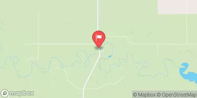

 Larson Dam; Michael