Atoka County Lake Dam

Atoka County Lake
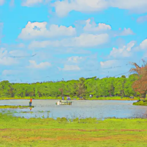
Atoka County Lake, also known as Fugate Lake, is a state-owned reservoir located in Murray County, Oklahoma. Managed by the Oklahoma Water Resources Board (OWRB), this picturesque lake was completed in 1965 and primarily serves as a recreational spot for water resource and climate enthusiasts. With a dam height of 46 feet and a surface area of 61 acres, Atoka County Lake offers ample opportunities for fishing, boating, and enjoying the surrounding natural beauty.
Situated near Potapo Creek in the city of Fugate, Atoka County Lake boasts a maximum storage capacity of 1522 acre-feet and a normal storage level of 1390 acre-feet. The dam, constructed with earth and stone materials, features a controlled spillway with a width of 4 feet. Despite being classified as having a very high hazard potential, the dam is in satisfactory condition and has not been modified in recent years. In the event of an emergency, the risk management measures for Atoka County Lake are currently undetermined, highlighting the importance of ongoing monitoring and maintenance efforts.
With its scenic location and recreational opportunities, Atoka County Lake is a popular destination for outdoor enthusiasts in Oklahoma. Whether visitors are looking to relax by the water's edge or explore the surrounding area, this state-regulated reservoir offers a tranquil escape and a chance to connect with nature. As the OWRB continues to oversee the maintenance and inspection of the dam, Atoka County Lake remains a valuable resource for both locals and tourists seeking a peaceful retreat in the heart of Oklahoma.
Plan around the weather
Same NOAA / yr.no feed Snoflo's iOS app uses. Watch the precipitation column on the meteogram -- rain on the basin upstream typically lifts inflow 24-72 hours later.
Next 5 days, hour by hour
Temperature line with weather symbols on top, snow + rain accumulation as columns, humidity as a dotted line.
5-day forecast table
Every 3 hours, broken out across temperature, snow, rain, humidity, and wind. Each cell is colour-coded relative to the column min/max.
| Time | Condition | Temp (°F) | Snow (in) | Rain (in) | Humidity (%) | Wind (mps) | Wind dir |
|---|---|---|---|---|---|---|---|
| Loading detailed forecast… | |||||||
15-day temperature & precipitation
Daily temperatures, snow, and rain projected over the next two weeks.
Nearby streamflow gauges
USGS streamgauges around Atoka County Lake -- inflows here typically show up in storage 24-72 hours later.
| Streamgauge | Discharge | View |
|---|---|---|
| Rock Creek At Sulphur | 9 cfs | → |
| Pennington Creek Near Reagan | 19 cfs | → |
| Washita River Near Dickson | 188 cfs | → |
| Blue River Near Connerville | 75 cfs | → |
| Washita River Near Pauls Valley | 166 cfs | → |
| Little River Near Sasakwa | 0 cfs | → |


About Atoka County Lake
Where does the data for Atoka County Lake come from?
Structural and regulatory data come from the U.S. Army Corps of Engineers' National Inventory of Dams (NID). Weather forecast comes from NOAA / yr.no -- the same feed Snoflo's iOS app uses.
How often is the report updated?
NID structural data refreshes annually as the Corps publishes updated assessments. The weather forecast refreshes throughout the day.
What does the Undetermined hazard rating mean?
The Corps of Engineers' hazard potential classification grades probable consequences if the dam fails: High = probable loss of human life; Significant = no probable loss of human life but possible economic loss / environmental damage; Low = no probable loss of human life, only minor economic / environmental losses. See the Dam Data Reference card below for the full definitions.
What's "% of normal"?
The current storage value compared to the historical average storage on this calendar day. 100% = right on average; values above 100% mean above-normal storage (wet year); values below mean below-normal (dry year or drought).
Can I get alerts when storage crosses a threshold?
Yes -- alerts are managed in the Snoflo iOS app. Favorite this dam, set a threshold, and you'll get a push the moment conditions cross.
Dam data reference
Condition Assessment
- Satisfactory
- No existing or potential dam safety deficiencies are recognized. Acceptable performance is expected under all loading conditions (static, hydrologic, seismic) in accordance with the minimum applicable state or federal regulatory criteria or tolerable risk guidelines.
- Fair
- No existing dam safety deficiencies are recognized for normal operating conditions. Rare or extreme hydrologic and/or seismic events may result in a dam safety deficiency. Risk may be in the range to take further action.
- Poor
- A dam safety deficiency is recognized for normal operating conditions which may realistically occur. Remedial action is necessary. POOR may also be used when uncertainties exist as to critical analysis parameters which identify a potential dam safety deficiency.
- Unsatisfactory
- A dam safety deficiency is recognized that requires immediate or emergency remedial action for problem resolution.
- Not Rated
- The dam has not been inspected, is not under state or federal jurisdiction, or has been inspected but, for whatever reason, has not been rated.
Hazard Potential Classification
- High
- Dams assigned the high hazard potential classification are those where failure or mis-operation will probably cause loss of human life.
- Significant
- Dams assigned the significant hazard potential classification are those dams where failure or mis-operation results in no probable loss of human life but can cause economic loss, environmental damage, disruption of lifeline facilities, or impact other concerns. Significant hazard potential classification dams are often located in predominantly rural or agricultural areas but could be in areas with population and significant infrastructure.
- Low
- Dams assigned the low hazard potential classification are those where failure or mis-operation results in no probable loss of human life and low economic and/or environmental losses. Losses are principally limited to the owner's property.
- Undetermined
- Dams for which a downstream hazard potential has not been designated or is not provided.