
Scs-Upper Black Bear Creek Site-09 Reservoir Report
Last Updated: January 11, 2026
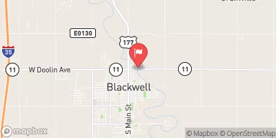
Located in Morrison, Oklahoma, the SCS-Upper Black Bear Creek Site-09 is a state-regulated dam designed by USDA NRCS in 1993 for flood risk reduction purposes.
°F
°F
mph
Wind
%
Humidity
Summary
The earth dam stands at a height of 31 feet and spans 850 feet along Black Bear Creek, offering a storage capacity of 1343 acre-feet and a normal storage of 100 acre-feet. With a drainage area of 3.75 square miles, the dam can handle a maximum discharge of 299 cubic feet per second, ensuring controlled flow through its spillway in times of heavy rainfall.
Despite its low hazard potential, the dam at SCS-Upper Black Bear Creek Site-09 is rated as having a very high risk due to its location and potential impact on downstream areas. Inspected in 1999 with an inspection frequency of 5 years, the dam's condition assessment remains unrated. While lacking specific risk management measures or emergency action plans, this structure serves as a crucial asset in mitigating flood risks in the region, under the jurisdiction of the OWRB and with state permitting, inspection, and enforcement mechanisms in place to ensure its safety and functionality for the surrounding community.
Year Completed |
1993 |
Dam Length |
850 |
Dam Height |
31 |
River Or Stream |
BLACK BEAR CREEK |
Primary Dam Type |
Earth |
Surface Area |
33 |
Hydraulic Height |
31 |
Drainage Area |
3.75 |
Nid Storage |
1343 |
Structural Height |
31 |
Outlet Gates |
Valve - 1 |
Hazard Potential |
Low |
Foundations |
Soil |
Nid Height |
31 |
Seasonal Comparison
Weather Forecast
Nearby Streamflow Levels
 Black Bear Creek At Pawnee
|
19cfs |
 Salt Fork Arkansas River At Tonkawa
|
352cfs |
 Arkansas River At Ralston
|
1750cfs |
 Cimarron River Near Ripley
|
592cfs |
 Chikaskia River Near Blackwell
|
243cfs |
 Skeleton Creek Near Lovell
|
41cfs |
Dam Data Reference
Condition Assessment
SatisfactoryNo existing or potential dam safety deficiencies are recognized. Acceptable performance is expected under all loading conditions (static, hydrologic, seismic) in accordance with the minimum applicable state or federal regulatory criteria or tolerable risk guidelines.
Fair
No existing dam safety deficiencies are recognized for normal operating conditions. Rare or extreme hydrologic and/or seismic events may result in a dam safety deficiency. Risk may be in the range to take further action. Note: Rare or extreme event is defined by the regulatory agency based on their minimum
Poor A dam safety deficiency is recognized for normal operating conditions which may realistically occur. Remedial action is necessary. POOR may also be used when uncertainties exist as to critical analysis parameters which identify a potential dam safety deficiency. Investigations and studies are necessary.
Unsatisfactory
A dam safety deficiency is recognized that requires immediate or emergency remedial action for problem resolution.
Not Rated
The dam has not been inspected, is not under state or federal jurisdiction, or has been inspected but, for whatever reason, has not been rated.
Not Available
Dams for which the condition assessment is restricted to approved government users.
Hazard Potential Classification
HighDams assigned the high hazard potential classification are those where failure or mis-operation will probably cause loss of human life.
Significant
Dams assigned the significant hazard potential classification are those dams where failure or mis-operation results in no probable loss of human life but can cause economic loss, environment damage, disruption of lifeline facilities, or impact other concerns. Significant hazard potential classification dams are often located in predominantly rural or agricultural areas but could be in areas with population and significant infrastructure.
Low
Dams assigned the low hazard potential classification are those where failure or mis-operation results in no probable loss of human life and low economic and/or environmental losses. Losses are principally limited to the owner's property.
Undetermined
Dams for which a downstream hazard potential has not been designated or is not provided.
Not Available
Dams for which the downstream hazard potential is restricted to approved government users.
 Scs-Upper Black Bear Creek Site-09