
Summary
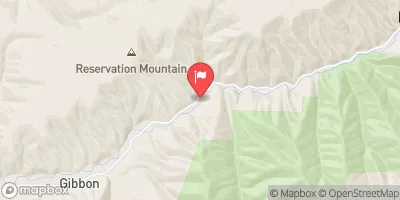
Built in 1926, this earth dam stands at 165 feet high and spans 2700 feet, with a storage capacity of 83,260 acre-feet. The dam is situated on McKay Creek and serves to protect the surrounding area from potential flooding events, making it a crucial component of the region's water resource management system.
Over the years, Mckay Dam has undergone several modifications, including foundation, seismic, and structural upgrades in 1998, as well as additional foundation work in 2015. With a high hazard potential, the dam's safety and maintenance are closely monitored by the Bureau of Reclamation, which conducts inspections and oversees its operations. Despite its age, the dam continues to play a significant role in safeguarding the community against flood risks and supporting agricultural irrigation in the region.
With its rich history and ongoing commitment to flood risk reduction, Mckay Dam stands as a testament to the importance of effective water resource management in Oregon. As climate change continues to pose challenges to the region, this critical infrastructure will play a key role in ensuring the safety and sustainability of the surrounding areas for years to come.
Years Modified |
1998 - Foundation, 1998 - Seismic, 1998 - Structural, 2015 - Foundation |
Year Completed |
1926 |
Dam Length |
2700 |
Dam Height |
165 |
River Or Stream |
MCKAY CREEK |
Primary Dam Type |
Earth |
Surface Area |
1200 |
Hydraulic Height |
158 |
Drainage Area |
186 |
Nid Storage |
83260 |
Structural Height |
165 |
Hazard Potential |
High |
Nid Height |
165 |
Seasonal Comparison
Weather Forecast
Nearby Streamflow Levels


Dam Data Reference
Condition Assessment
SatisfactoryNo existing or potential dam safety deficiencies are recognized. Acceptable performance is expected under all loading conditions (static, hydrologic, seismic) in accordance with the minimum applicable state or federal regulatory criteria or tolerable risk guidelines.
Fair
No existing dam safety deficiencies are recognized for normal operating conditions. Rare or extreme hydrologic and/or seismic events may result in a dam safety deficiency. Risk may be in the range to take further action. Note: Rare or extreme event is defined by the regulatory agency based on their minimum
Poor A dam safety deficiency is recognized for normal operating conditions which may realistically occur. Remedial action is necessary. POOR may also be used when uncertainties exist as to critical analysis parameters which identify a potential dam safety deficiency. Investigations and studies are necessary.
Unsatisfactory
A dam safety deficiency is recognized that requires immediate or emergency remedial action for problem resolution.
Not Rated
The dam has not been inspected, is not under state or federal jurisdiction, or has been inspected but, for whatever reason, has not been rated.
Not Available
Dams for which the condition assessment is restricted to approved government users.
Hazard Potential Classification
HighDams assigned the high hazard potential classification are those where failure or mis-operation will probably cause loss of human life.
Significant
Dams assigned the significant hazard potential classification are those dams where failure or mis-operation results in no probable loss of human life but can cause economic loss, environment damage, disruption of lifeline facilities, or impact other concerns. Significant hazard potential classification dams are often located in predominantly rural or agricultural areas but could be in areas with population and significant infrastructure.
Low
Dams assigned the low hazard potential classification are those where failure or mis-operation results in no probable loss of human life and low economic and/or environmental losses. Losses are principally limited to the owner's property.
Undetermined
Dams for which a downstream hazard potential has not been designated or is not provided.
Not Available
Dams for which the downstream hazard potential is restricted to approved government users.
Area Campgrounds
| Location | Reservations | Toilets |
|---|---|---|
 High Divide Camp
|
||
 Marshall Camp
|
||
 Confluence Camp
|
||
 Elk Camp
|
||
 Rendevous Camp 1
|
||
 Douglas Camp
|
 Mckay
Mckay