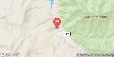
Hills Creek Lake Near Oakridge Reservoir Report
Nearby: Oakridge Mill Log Pond
Last Updated: February 22, 2026
Hills Creek Lake, located near Oakridge, Oregon, was created in 1961 by the construction of a dam on the Middle Fork Willamette River.
Summary
The lake serves as a significant source of hydroelectric power to the area. The hydrology of the lake is fed by surface flow from the Willamette River and snowpack from the surrounding mountains. During the summer months, the lake is used for recreational activities such as boating, swimming, and camping. The lake is also used as a water source for irrigation in the surrounding agricultural areas. The lake is home to a variety of fish species, including rainbow trout and kokanee salmon. Hills Creek Lake provides a beautiful setting for outdoor enthusiasts to enjoy the natural beauty of the region.
°F
°F
mph
Wind
%
Humidity
15-Day Weather Outlook
Reservoir Details
| Lake Or Reservoir Water Surface Elevation Above Ngvd 1929, Ft 24hr Change | -0.02% |
| Percent of Normal | 99% |
| Minimum |
1,425.11 ft
2023-03-13 |
| Maximum |
1,541.26 ft
2014-05-12 |
| Average | 1,470 ft |
| Dam_Height | 328 |
| Hydraulic_Height | 317 |
| Drainage_Area | 389 |
| Year_Completed | 1962 |
| Nid_Storage | 356000 |
| Structural_Height | 341 |
| River_Or_Stream | MIDDLE FORK WILLAMETTE RIVER |
| Foundations | Rock, Soil |
| Surface_Area | 2735 |
| Hazard_Potential | High |
| Outlet_Gates | Slide (sluice gate) - 3, Tainter (radial) - 2 |
| Dam_Length | 2235 |
| Primary_Dam_Type | Earth |
| Nid_Height | 341 |
Seasonal Comparison
Lake Or Reservoir Water Surface Elevation Above Ngvd 1929, Ft Levels
5-Day Hourly Forecast Detail
Nearby Streamflow Levels
Dam Data Reference
Condition Assessment
SatisfactoryNo existing or potential dam safety deficiencies are recognized. Acceptable performance is expected under all loading conditions (static, hydrologic, seismic) in accordance with the minimum applicable state or federal regulatory criteria or tolerable risk guidelines.
Fair
No existing dam safety deficiencies are recognized for normal operating conditions. Rare or extreme hydrologic and/or seismic events may result in a dam safety deficiency. Risk may be in the range to take further action. Note: Rare or extreme event is defined by the regulatory agency based on their minimum
Poor A dam safety deficiency is recognized for normal operating conditions which may realistically occur. Remedial action is necessary. POOR may also be used when uncertainties exist as to critical analysis parameters which identify a potential dam safety deficiency. Investigations and studies are necessary.
Unsatisfactory
A dam safety deficiency is recognized that requires immediate or emergency remedial action for problem resolution.
Not Rated
The dam has not been inspected, is not under state or federal jurisdiction, or has been inspected but, for whatever reason, has not been rated.
Not Available
Dams for which the condition assessment is restricted to approved government users.
Hazard Potential Classification
HighDams assigned the high hazard potential classification are those where failure or mis-operation will probably cause loss of human life.
Significant
Dams assigned the significant hazard potential classification are those dams where failure or mis-operation results in no probable loss of human life but can cause economic loss, environment damage, disruption of lifeline facilities, or impact other concerns. Significant hazard potential classification dams are often located in predominantly rural or agricultural areas but could be in areas with population and significant infrastructure.
Low
Dams assigned the low hazard potential classification are those where failure or mis-operation results in no probable loss of human life and low economic and/or environmental losses. Losses are principally limited to the owner's property.
Undetermined
Dams for which a downstream hazard potential has not been designated or is not provided.
Not Available
Dams for which the downstream hazard potential is restricted to approved government users.


 Packard Creek Campground
 Packard Creek Group Campsite
 Packard Creek
 Salmon Creek Falls Campground
 Blue Pool Campground (Middle Fork Ranger District)
 Sand Prairie Campground
 Hills Creek Dam
 Hills Creek Lake Near Oakridge
 Forest Road 2100-019 Lane County
 Confluence With Echo Creek To Hills Creek Reservoir