Jubilee Lake Dam

Jubilee Lake
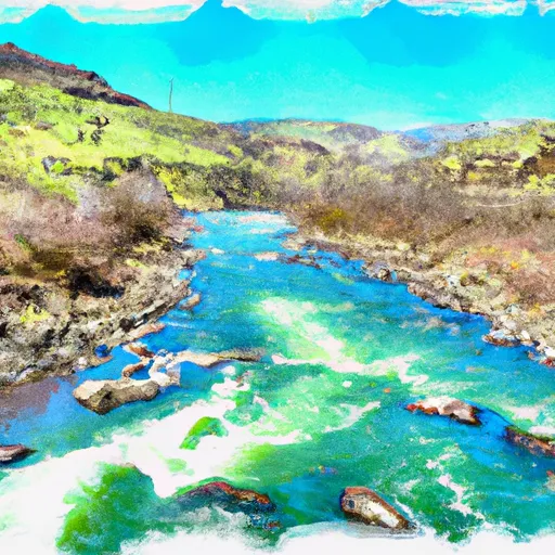
Nestled in the picturesque Union county of Oregon, Jubilee Lake, also known as Jubilee Meadows Reservoir, is a state-owned recreational oasis. Managed by the Oregon Department of Fish and Wildlife, this Earth dam was completed in 1967 and stands at a height of 50 feet, offering a maximum storage capacity of 1579 acre-feet. The lake covers an area of 98 acres and is fed by the serene waters of Mottet Creek.
Despite its tranquil appearance, Jubilee Lake has been flagged with a high hazard potential and poor condition assessment, underscoring the need for regular inspections and maintenance. The last inspection in August 2021 highlighted the urgency for improvement to ensure the safety and resilience of this beloved water resource. With its stunning natural surroundings and recreational opportunities, Jubilee Lake serves as a haven for outdoor enthusiasts seeking solace in the heart of Oregon's wilderness.
As climate change continues to impact water resources, the management and upkeep of Jubilee Lake become even more crucial. With state regulation and jurisdiction in place, including permitting, inspection, and enforcement, efforts are being made to safeguard this reservoir for future generations. As water and climate enthusiasts, it is imperative to stay informed and engaged in the preservation of Jubilee Lake and other vital water bodies that contribute to the ecological balance and recreational enjoyment of our environment.
Plan around the weather
Same NOAA / yr.no feed Snoflo's iOS app uses. Watch the precipitation column on the meteogram -- rain on the basin upstream typically lifts inflow 24-72 hours later.
Next 5 days, hour by hour
Temperature line with weather symbols on top, snow + rain accumulation as columns, humidity as a dotted line.
5-day forecast table
Every 3 hours, broken out across temperature, snow, rain, humidity, and wind. Each cell is colour-coded relative to the column min/max.
| Time | Condition | Temp (°F) | Snow (in) | Rain (in) | Humidity (%) | Wind (mps) | Wind dir |
|---|---|---|---|---|---|---|---|
| Loading detailed forecast… | |||||||
15-day temperature & precipitation
Daily temperatures, snow, and rain projected over the next two weeks.
Nearby streamflow gauges
USGS streamgauges around Jubilee Lake -- inflows here typically show up in storage 24-72 hours later.
| Streamgauge | Discharge | View |
|---|---|---|
| Mill Creek Near Walla Walla | 32 cfs | → |
| Minam River Near Minam | 148 cfs | → |
| Umatilla River Above Meacham Creek | 35 cfs | → |
| Meacham Creek At Gibbon | 12 cfs | → |
| Mill Creek At Five Mile Rd Br Nr Walla Walla | 634 cfs | → |
| Mill Creek At Walla Walla | 7 cfs | → |


About Jubilee Lake
Where does the data for Jubilee Lake come from?
Structural and regulatory data come from the U.S. Army Corps of Engineers' National Inventory of Dams (NID). Weather forecast comes from NOAA / yr.no -- the same feed Snoflo's iOS app uses.
How often is the report updated?
NID structural data refreshes annually as the Corps publishes updated assessments. The weather forecast refreshes throughout the day.
What does the High hazard rating mean?
The Corps of Engineers' hazard potential classification grades probable consequences if the dam fails: High = probable loss of human life; Significant = no probable loss of human life but possible economic loss / environmental damage; Low = no probable loss of human life, only minor economic / environmental losses. See the Dam Data Reference card below for the full definitions.
What's "% of normal"?
The current storage value compared to the historical average storage on this calendar day. 100% = right on average; values above 100% mean above-normal storage (wet year); values below mean below-normal (dry year or drought).
Can I get alerts when storage crosses a threshold?
Yes -- alerts are managed in the Snoflo iOS app. Favorite this dam, set a threshold, and you'll get a push the moment conditions cross.
Dam data reference
Condition Assessment
- Satisfactory
- No existing or potential dam safety deficiencies are recognized. Acceptable performance is expected under all loading conditions (static, hydrologic, seismic) in accordance with the minimum applicable state or federal regulatory criteria or tolerable risk guidelines.
- Fair
- No existing dam safety deficiencies are recognized for normal operating conditions. Rare or extreme hydrologic and/or seismic events may result in a dam safety deficiency. Risk may be in the range to take further action.
- Poor
- A dam safety deficiency is recognized for normal operating conditions which may realistically occur. Remedial action is necessary. POOR may also be used when uncertainties exist as to critical analysis parameters which identify a potential dam safety deficiency.
- Unsatisfactory
- A dam safety deficiency is recognized that requires immediate or emergency remedial action for problem resolution.
- Not Rated
- The dam has not been inspected, is not under state or federal jurisdiction, or has been inspected but, for whatever reason, has not been rated.
Hazard Potential Classification
- High
- Dams assigned the high hazard potential classification are those where failure or mis-operation will probably cause loss of human life.
- Significant
- Dams assigned the significant hazard potential classification are those dams where failure or mis-operation results in no probable loss of human life but can cause economic loss, environmental damage, disruption of lifeline facilities, or impact other concerns. Significant hazard potential classification dams are often located in predominantly rural or agricultural areas but could be in areas with population and significant infrastructure.
- Low
- Dams assigned the low hazard potential classification are those where failure or mis-operation results in no probable loss of human life and low economic and/or environmental losses. Losses are principally limited to the owner's property.
- Undetermined
- Dams for which a downstream hazard potential has not been designated or is not provided.