Olalla Reservoir Report
Last Updated: December 13, 2025
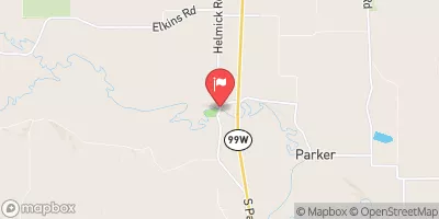
Olalla, located in Lincoln, Oregon, is a privately-owned dam on the West Olalla Creek, with a primary purpose classified as 'Other'.
°F
°F
mph
Wind
%
Humidity
Summary
Constructed in 1968 by CH2M HILL, this Earth-type dam stands at a height of 83 feet and stretches 350 feet in length. With a storage capacity of 4300 acre-feet and a drainage area of 1.36 square miles, Olalla plays a crucial role in water resource management in the region.
Despite its fair condition assessment, Olalla poses a high hazard potential, making it vital for regular inspections and maintenance. The dam's last inspection in August 2020 revealed its current state, indicating the need for ongoing monitoring to ensure public safety and prevent potential risks associated with its operation. The dam's proximity to Toledo and its impact on water resources underscore the importance of effective regulatory oversight and emergency preparedness measures.
With a maximum discharge of 355 cubic feet per second and a normal storage capacity of 3650 acre-feet, Olalla serves as a key infrastructure for water storage and flood control in the area. As climate change continues to impact water resources and extreme weather events become more frequent, the role of dams like Olalla in managing water supply and mitigating risks is increasingly critical. As such, ongoing attention to the dam's maintenance, risk assessment, and emergency response planning is essential to ensure the safety and resilience of the surrounding community in the face of a changing climate.
Year Completed |
1968 |
Dam Length |
350 |
Dam Height |
83 |
River Or Stream |
WEST OLLALLA CREEK |
Primary Dam Type |
Earth |
Surface Area |
64 |
Hydraulic Height |
81 |
Drainage Area |
1.36 |
Nid Storage |
4300 |
Structural Height |
83 |
Hazard Potential |
High |
Nid Height |
83 |
Seasonal Comparison
Weather Forecast
Nearby Streamflow Levels
 Siletz River At Siletz
|
4760cfs |
 Alsea River Near Tidewater
|
2090cfs |
 Marys River Near Philomath
|
1060cfs |
 East Fork Lobster Creek Near Alsea
|
37cfs |
 Willamette River At Corvallis
|
14500cfs |
 Luckiamute River Near Suver
|
3790cfs |
Dam Data Reference
Condition Assessment
SatisfactoryNo existing or potential dam safety deficiencies are recognized. Acceptable performance is expected under all loading conditions (static, hydrologic, seismic) in accordance with the minimum applicable state or federal regulatory criteria or tolerable risk guidelines.
Fair
No existing dam safety deficiencies are recognized for normal operating conditions. Rare or extreme hydrologic and/or seismic events may result in a dam safety deficiency. Risk may be in the range to take further action. Note: Rare or extreme event is defined by the regulatory agency based on their minimum
Poor A dam safety deficiency is recognized for normal operating conditions which may realistically occur. Remedial action is necessary. POOR may also be used when uncertainties exist as to critical analysis parameters which identify a potential dam safety deficiency. Investigations and studies are necessary.
Unsatisfactory
A dam safety deficiency is recognized that requires immediate or emergency remedial action for problem resolution.
Not Rated
The dam has not been inspected, is not under state or federal jurisdiction, or has been inspected but, for whatever reason, has not been rated.
Not Available
Dams for which the condition assessment is restricted to approved government users.
Hazard Potential Classification
HighDams assigned the high hazard potential classification are those where failure or mis-operation will probably cause loss of human life.
Significant
Dams assigned the significant hazard potential classification are those dams where failure or mis-operation results in no probable loss of human life but can cause economic loss, environment damage, disruption of lifeline facilities, or impact other concerns. Significant hazard potential classification dams are often located in predominantly rural or agricultural areas but could be in areas with population and significant infrastructure.
Low
Dams assigned the low hazard potential classification are those where failure or mis-operation results in no probable loss of human life and low economic and/or environmental losses. Losses are principally limited to the owner's property.
Undetermined
Dams for which a downstream hazard potential has not been designated or is not provided.
Not Available
Dams for which the downstream hazard potential is restricted to approved government users.
Area Campgrounds
| Location | Reservations | Toilets |
|---|---|---|
 Beverly Beach State Park
|
||
 Port Of Newport Marina and RV Park
|
||
 South Beach State Park
|
||
 Group Site 2
|
||
 Group Site 1
|
||
 Group Site 3
|

 Olalla
 Hee Hee Illahee