Summary
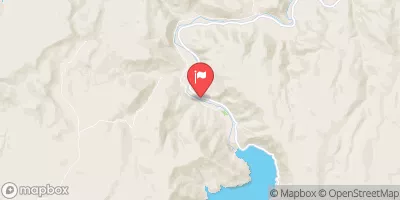
Completed in 1962, this earth dam stands at a height of 121 feet and has a storage capacity of 38,860 acre-feet. The dam spans 3,070 feet in length, creating a reservoir with a surface area of 985 acres and a drainage area of 550 square miles.
With a spillway width of 70 feet and a maximum discharge of 10,000 cubic feet per second, Bully Creek Dam has a high hazard potential and a moderate risk assessment rating. While the condition assessment is currently not available, the dam is inspected annually to ensure its safety and functionality. The dam also serves additional purposes such as fish and wildlife pond, irrigation, and recreation, making it a vital resource for both water management and community enjoyment in the Malheur County region.
Despite not being under state jurisdiction, Bully Creek Dam plays a crucial role in managing water resources in the area. With its strategic location on Bully Creek and its significant storage capacity, the dam serves as a key infrastructure for flood control, irrigation, and recreational activities. Climate and water resource enthusiasts can appreciate the engineering marvel of Bully Creek Dam and its importance in balancing the needs of various stakeholders in the region.
Year Completed |
1962 |
Dam Length |
3070 |
Dam Height |
121 |
River Or Stream |
BULLY CREEK |
Primary Dam Type |
Earth |
Surface Area |
985 |
Hydraulic Height |
99 |
Drainage Area |
550 |
Nid Storage |
38860 |
Structural Height |
121 |
Hazard Potential |
High |
Foundations |
Rock |
Nid Height |
121 |
Seasonal Comparison
Weather Forecast
Nearby Streamflow Levels
 Malheur River Below Nevada Dam Near Vale Or
|
138cfs |
 Snake River At Nyssa Or
|
7230cfs |
 Payette River Nr Payette Id
|
2710cfs |
 Sand Run Gulch Nr Parma Id
|
35cfs |
 Snake River At Weiser Id
|
12300cfs |
 Owyhee River Below Owyhee Dam Or
|
30cfs |
Dam Data Reference
Condition Assessment
SatisfactoryNo existing or potential dam safety deficiencies are recognized. Acceptable performance is expected under all loading conditions (static, hydrologic, seismic) in accordance with the minimum applicable state or federal regulatory criteria or tolerable risk guidelines.
Fair
No existing dam safety deficiencies are recognized for normal operating conditions. Rare or extreme hydrologic and/or seismic events may result in a dam safety deficiency. Risk may be in the range to take further action. Note: Rare or extreme event is defined by the regulatory agency based on their minimum
Poor A dam safety deficiency is recognized for normal operating conditions which may realistically occur. Remedial action is necessary. POOR may also be used when uncertainties exist as to critical analysis parameters which identify a potential dam safety deficiency. Investigations and studies are necessary.
Unsatisfactory
A dam safety deficiency is recognized that requires immediate or emergency remedial action for problem resolution.
Not Rated
The dam has not been inspected, is not under state or federal jurisdiction, or has been inspected but, for whatever reason, has not been rated.
Not Available
Dams for which the condition assessment is restricted to approved government users.
Hazard Potential Classification
HighDams assigned the high hazard potential classification are those where failure or mis-operation will probably cause loss of human life.
Significant
Dams assigned the significant hazard potential classification are those dams where failure or mis-operation results in no probable loss of human life but can cause economic loss, environment damage, disruption of lifeline facilities, or impact other concerns. Significant hazard potential classification dams are often located in predominantly rural or agricultural areas but could be in areas with population and significant infrastructure.
Low
Dams assigned the low hazard potential classification are those where failure or mis-operation results in no probable loss of human life and low economic and/or environmental losses. Losses are principally limited to the owner's property.
Undetermined
Dams for which a downstream hazard potential has not been designated or is not provided.
Not Available
Dams for which the downstream hazard potential is restricted to approved government users.

 Bully Creek