Summary
With a height of 43 feet and a storage capacity of 95 acre-feet, the dam impounds Cherry Creek, covering a surface area of 6.78 acres and serving a drainage area of 14.3 square miles. The dam features a needle outlet gate and has a maximum discharge capacity of 553 cubic feet per second.
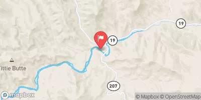
Despite being classified as having low hazard potential, Cherry Creek dam is subject to state regulation, inspection, and enforcement by the Oregon Water Resources Department. The dam has not been rated in terms of condition assessment, and its Emergency Action Plan status is unknown. The dam's last inspection took place in October 2020, with inspections scheduled every 6 years to ensure its structural integrity and safety. The dam is situated in a remote area near the city of Clarno and is under the jurisdiction of the state regulatory agency.
Water resource and climate enthusiasts interested in Cherry Creek can appreciate its role in supporting irrigation activities in the region. The dam's construction and operation contribute to water management efforts, ensuring reliable water supply for agricultural purposes. While the dam presents a low hazard potential, ongoing inspections and regulatory oversight are essential to safeguard the surrounding communities and environment from any potential risks associated with its operation. Overall, Cherry Creek dam represents a vital infrastructure component in the water resource management system of Jefferson County, Oregon.
Year Completed |
1980 |
Dam Length |
370 |
Dam Height |
43 |
River Or Stream |
CHERRY CREEK |
Primary Dam Type |
Earth |
Surface Area |
6.78 |
Hydraulic Height |
38 |
Drainage Area |
14.3 |
Nid Storage |
95 |
Structural Height |
45 |
Outlet Gates |
Needle |
Hazard Potential |
Low |
Nid Height |
45 |
Seasonal Comparison
Weather Forecast
Nearby Streamflow Levels
Dam Data Reference
Condition Assessment
SatisfactoryNo existing or potential dam safety deficiencies are recognized. Acceptable performance is expected under all loading conditions (static, hydrologic, seismic) in accordance with the minimum applicable state or federal regulatory criteria or tolerable risk guidelines.
Fair
No existing dam safety deficiencies are recognized for normal operating conditions. Rare or extreme hydrologic and/or seismic events may result in a dam safety deficiency. Risk may be in the range to take further action. Note: Rare or extreme event is defined by the regulatory agency based on their minimum
Poor A dam safety deficiency is recognized for normal operating conditions which may realistically occur. Remedial action is necessary. POOR may also be used when uncertainties exist as to critical analysis parameters which identify a potential dam safety deficiency. Investigations and studies are necessary.
Unsatisfactory
A dam safety deficiency is recognized that requires immediate or emergency remedial action for problem resolution.
Not Rated
The dam has not been inspected, is not under state or federal jurisdiction, or has been inspected but, for whatever reason, has not been rated.
Not Available
Dams for which the condition assessment is restricted to approved government users.
Hazard Potential Classification
HighDams assigned the high hazard potential classification are those where failure or mis-operation will probably cause loss of human life.
Significant
Dams assigned the significant hazard potential classification are those dams where failure or mis-operation results in no probable loss of human life but can cause economic loss, environment damage, disruption of lifeline facilities, or impact other concerns. Significant hazard potential classification dams are often located in predominantly rural or agricultural areas but could be in areas with population and significant infrastructure.
Low
Dams assigned the low hazard potential classification are those where failure or mis-operation results in no probable loss of human life and low economic and/or environmental losses. Losses are principally limited to the owner's property.
Undetermined
Dams for which a downstream hazard potential has not been designated or is not provided.
Not Available
Dams for which the downstream hazard potential is restricted to approved government users.
Area Campgrounds
| Location | Reservations | Toilets |
|---|---|---|
 J132.05L
|
||
 J132.07R
|
||
 Burnt Ranch BLM Recreation Site
|
||
 J129.60R
|
||
 J135.84L
|
||
 Bingham Springs Campground
|


 Cherry Creek