Norman Stadeli Dam

Norman Stadeli
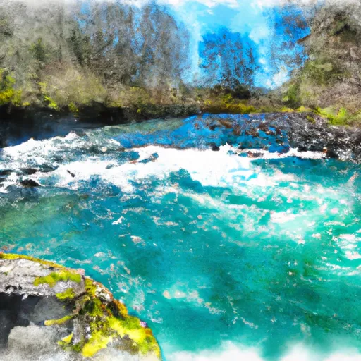
Norman Stadeli is a privately owned irrigation dam located in Silverton, Oregon, along the Tr- Brush Creek. Built in 1969 by the USDA NRCS, this earth dam stands at 23 feet tall and stretches 290 feet in length, providing a storage capacity of 167 acre-feet for irrigation purposes. Despite its low hazard potential, the condition assessment of Norman Stadeli is currently marked as "Not Available," highlighting the need for further evaluation and maintenance to ensure its long-term safety and functionality.
With a maximum discharge of 192 cubic feet per second and a drainage area of 1.13 square miles, Norman Stadeli plays a crucial role in water resource management in the region. As a key structure in the agricultural landscape of Marion County, this dam represents a vital component of the local irrigation infrastructure, enabling efficient water distribution for farms and fields in the area. However, the lack of recent inspection data and a detailed condition assessment raise questions about the dam's resilience and readiness to withstand potential climate-related challenges in the future.
As climate change continues to impact water resources and infrastructure, the importance of maintaining and upgrading dams like Norman Stadeli cannot be overstated. With a focus on sustainability and resilience, it is essential for owners and agencies to prioritize regular inspections, maintenance, and risk assessments to ensure the continued safety and effectiveness of these critical water management structures. By staying proactive and informed, stakeholders can better prepare for the challenges of a changing climate and safeguard the reliability of water resources for both agricultural and environmental needs.
Plan around the weather
Same NOAA / yr.no feed Snoflo's iOS app uses. Watch the precipitation column on the meteogram -- rain on the basin upstream typically lifts inflow 24-72 hours later.
Next 5 days, hour by hour
Temperature line with weather symbols on top, snow + rain accumulation as columns, humidity as a dotted line.
5-day forecast table
Every 3 hours, broken out across temperature, snow, rain, humidity, and wind. Each cell is colour-coded relative to the column min/max.
| Time | Condition | Temp (°F) | Snow (in) | Rain (in) | Humidity (%) | Wind (mps) | Wind dir |
|---|---|---|---|---|---|---|---|
| Loading detailed forecast… | |||||||
15-day temperature & precipitation
Daily temperatures, snow, and rain projected over the next two weeks.
Nearby streamflow gauges
USGS streamgauges around Norman Stadeli -- inflows here typically show up in storage 24-72 hours later.
| Streamgauge | Discharge | View |
|---|---|---|
| Silver Creek At Silverton | 52 cfs | → |
| Abiqua Creek At Silverton | 74 cfs | → |
| Zollner Creek Near Mt Angel | 320 cfs | → |
| Butte Creek At Monitor | 6 cfs | → |
| Pudding River Near Woodburn | 7 cfs | → |
| Willamette River At Salem | 5,840 cfs | → |


About Norman Stadeli
Where does the data for Norman Stadeli come from?
Structural and regulatory data come from the U.S. Army Corps of Engineers' National Inventory of Dams (NID). Weather forecast comes from NOAA / yr.no -- the same feed Snoflo's iOS app uses.
How often is the report updated?
NID structural data refreshes annually as the Corps publishes updated assessments. The weather forecast refreshes throughout the day.
What does the Low hazard rating mean?
The Corps of Engineers' hazard potential classification grades probable consequences if the dam fails: High = probable loss of human life; Significant = no probable loss of human life but possible economic loss / environmental damage; Low = no probable loss of human life, only minor economic / environmental losses. See the Dam Data Reference card below for the full definitions.
What's "% of normal"?
The current storage value compared to the historical average storage on this calendar day. 100% = right on average; values above 100% mean above-normal storage (wet year); values below mean below-normal (dry year or drought).
Can I get alerts when storage crosses a threshold?
Yes -- alerts are managed in the Snoflo iOS app. Favorite this dam, set a threshold, and you'll get a push the moment conditions cross.
Dam data reference
Condition Assessment
- Satisfactory
- No existing or potential dam safety deficiencies are recognized. Acceptable performance is expected under all loading conditions (static, hydrologic, seismic) in accordance with the minimum applicable state or federal regulatory criteria or tolerable risk guidelines.
- Fair
- No existing dam safety deficiencies are recognized for normal operating conditions. Rare or extreme hydrologic and/or seismic events may result in a dam safety deficiency. Risk may be in the range to take further action.
- Poor
- A dam safety deficiency is recognized for normal operating conditions which may realistically occur. Remedial action is necessary. POOR may also be used when uncertainties exist as to critical analysis parameters which identify a potential dam safety deficiency.
- Unsatisfactory
- A dam safety deficiency is recognized that requires immediate or emergency remedial action for problem resolution.
- Not Rated
- The dam has not been inspected, is not under state or federal jurisdiction, or has been inspected but, for whatever reason, has not been rated.
Hazard Potential Classification
- High
- Dams assigned the high hazard potential classification are those where failure or mis-operation will probably cause loss of human life.
- Significant
- Dams assigned the significant hazard potential classification are those dams where failure or mis-operation results in no probable loss of human life but can cause economic loss, environmental damage, disruption of lifeline facilities, or impact other concerns. Significant hazard potential classification dams are often located in predominantly rural or agricultural areas but could be in areas with population and significant infrastructure.
- Low
- Dams assigned the low hazard potential classification are those where failure or mis-operation results in no probable loss of human life and low economic and/or environmental losses. Losses are principally limited to the owner's property.
- Undetermined
- Dams for which a downstream hazard potential has not been designated or is not provided.