


Rocky Gap Dam Reservoir Report
Last Updated: April 25, 2026
Nearby: Lake Gordon Thomas W Koon
°F
°F
mph
Wind
%
Humidity
Rocky Gap Dam, located in Allegany County, Maryland, serves as a vital recreational resource for the local community.
Summary
Built in 1969, this earth dam stands at a height of 98 feet and has a storage capacity of 10,048 acre-feet. The dam holds back the waters of Rocky Gap Run, creating a surface area of 208.5 acres for outdoor activities such as fishing, boating, and picnicking.
Managed by the Maryland Dam Safety Agency, Rocky Gap Dam is subject to regular inspections and enforcement measures to ensure its structural integrity and public safety. Despite being classified as having a high hazard potential, the dam is currently rated as satisfactory in condition assessment. The dam's spillway, outfitted with an uncontrolled design and 65-foot width, can handle a maximum discharge of 17,677 cubic feet per second, reducing flood risks downstream.
While the dam poses a moderate risk level according to assessments, it benefits the community by providing a safe and scenic environment for recreational pursuits. With its rich history, diverse wildlife, and stunning water views, Rocky Gap Dam serves as a testament to the importance of water resource management and climate resilience in sustaining vibrant ecosystems and communities.
Regional Streamflow Levels
 Wills Creek Near Cumberland
|
116cfs |
 North Branch Potomac River Near Cumberland
|
492cfs |
 Wills Creek Below Hyndman
|
64cfs |
 Town Creek Near Oldtown
|
38cfs |
 Potomac River At Paw Paw
|
993cfs |
 Sideling Hill Creek Near Bellegrove
|
20cfs |
15-Day Long Term Forecast
Years Modified |
1988 - Structural |
Year Completed |
1969 |
Dam Length |
800 |
Dam Height |
98 |
River Or Stream |
Rocky Gap Run |
Primary Dam Type |
Earth |
Surface Area |
208.5 |
Drainage Area |
8.8 |
Nid Storage |
10048 |
Outlet Gates |
Slide (sluice gate) - 0 |
Hazard Potential |
High |
Foundations |
Rock, Soil |
Nid Height |
98 |
Seasonal Comparison
5-Day Hourly Forecast Detail
Dam Data Reference
Condition Assessment
SatisfactoryNo existing or potential dam safety deficiencies are recognized. Acceptable performance is expected under all loading conditions (static, hydrologic, seismic) in accordance with the minimum applicable state or federal regulatory criteria or tolerable risk guidelines.
Fair
No existing dam safety deficiencies are recognized for normal operating conditions. Rare or extreme hydrologic and/or seismic events may result in a dam safety deficiency. Risk may be in the range to take further action. Note: Rare or extreme event is defined by the regulatory agency based on their minimum
Poor A dam safety deficiency is recognized for normal operating conditions which may realistically occur. Remedial action is necessary. POOR may also be used when uncertainties exist as to critical analysis parameters which identify a potential dam safety deficiency. Investigations and studies are necessary.
Unsatisfactory
A dam safety deficiency is recognized that requires immediate or emergency remedial action for problem resolution.
Not Rated
The dam has not been inspected, is not under state or federal jurisdiction, or has been inspected but, for whatever reason, has not been rated.
Not Available
Dams for which the condition assessment is restricted to approved government users.
Hazard Potential Classification
HighDams assigned the high hazard potential classification are those where failure or mis-operation will probably cause loss of human life.
Significant
Dams assigned the significant hazard potential classification are those dams where failure or mis-operation results in no probable loss of human life but can cause economic loss, environment damage, disruption of lifeline facilities, or impact other concerns. Significant hazard potential classification dams are often located in predominantly rural or agricultural areas but could be in areas with population and significant infrastructure.
Low
Dams assigned the low hazard potential classification are those where failure or mis-operation results in no probable loss of human life and low economic and/or environmental losses. Losses are principally limited to the owner's property.
Undetermined
Dams for which a downstream hazard potential has not been designated or is not provided.
Not Available
Dams for which the downstream hazard potential is restricted to approved government users.
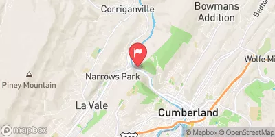
Area Campgrounds
| Location | Reservations | Toilets |
|---|---|---|
 Rocky Gap State Park
|
||
 Evitts Creek Campsite
|
||
 Iron Mountain Campsite
|
||
 Irons Mountain Hiker Biker Campsite
|
||
 Spring Gap
|
||
 Spring Gap Campsite
|
 Evitts Creek
 Evitts Creek Ponds
 Flintstone Creek
 Wills Creek
 Jennings Run