Rainbow (Pa-460) Reservoir Report
Last Updated: February 3, 2026
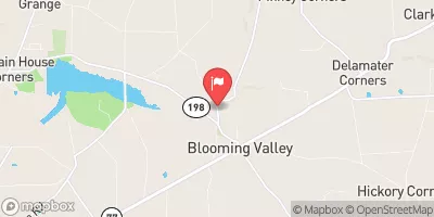
Rainbow (Pa-460), also known as Rainbow Lake, is a local government-owned earth dam located in Meadville City, Crawford County, Pennsylvania.
°F
°F
mph
Wind
%
Humidity
15-Day Weather Outlook
Summary
Built in 1964 by the USDA NRCS, this dam serves as a crucial flood risk reduction structure along the Mill Run river. Standing at a height of 40 feet and a length of 420 feet, Rainbow has a storage capacity of 850 acre-feet, with a normal storage of 30 acre-feet. Its fair condition assessment indicates a high hazard potential, making it an essential asset for protecting the surrounding community from potential flooding events.
Managed by the Pennsylvania Department of Environmental Protection, Rainbow (Pa-460) undergoes regular state inspections and enforcement to ensure its structural integrity and compliance with regulatory standards. With a drainage area of 7.96 square miles and a surface area of 4 acres, this dam plays a vital role in managing water resources and preventing downstream inundation. Despite its high hazard potential, Rainbow's design and construction by the Natural Resources Conservation Service demonstrate a commitment to flood risk reduction and public safety in the region, making it a key component of water resource management efforts in Crawford County.
As a flood risk reduction structure, Rainbow (Pa-460) not only provides crucial protection against potential flooding but also highlights the collaborative efforts of local government and federal agencies in safeguarding communities and water resources. With its historical significance dating back to the 1960s, this earth dam continues to serve as a vital infrastructure for managing water flow along the Mill Run river and protecting the residents of Meadville City. The ongoing state regulation and inspection of Rainbow underscore its importance in ensuring the safety and well-being of the surrounding area, making it a valuable asset for water resource and climate enthusiasts alike.
Year Completed |
1964 |
Dam Length |
420 |
Dam Height |
40 |
River Or Stream |
MILL RUN |
Primary Dam Type |
Earth |
Surface Area |
4 |
Drainage Area |
7.96 |
Nid Storage |
850 |
Hazard Potential |
High |
Foundations |
Unlisted/Unknown |
Nid Height |
40 |
Seasonal Comparison
Hourly Weather Forecast
Nearby Streamflow Levels
 French Creek At Meadville
|
4870cfs |
 Woodcock Creek At Woodcock Creek Dam
|
19cfs |
 Woodcock Creek At Blooming Valley
|
320cfs |
 French Creek At Utica
|
2620cfs |
 Little Shenango River At Greenville
|
93cfs |
 Shenango River At Pymatuning Dam
|
747cfs |
Dam Data Reference
Condition Assessment
SatisfactoryNo existing or potential dam safety deficiencies are recognized. Acceptable performance is expected under all loading conditions (static, hydrologic, seismic) in accordance with the minimum applicable state or federal regulatory criteria or tolerable risk guidelines.
Fair
No existing dam safety deficiencies are recognized for normal operating conditions. Rare or extreme hydrologic and/or seismic events may result in a dam safety deficiency. Risk may be in the range to take further action. Note: Rare or extreme event is defined by the regulatory agency based on their minimum
Poor A dam safety deficiency is recognized for normal operating conditions which may realistically occur. Remedial action is necessary. POOR may also be used when uncertainties exist as to critical analysis parameters which identify a potential dam safety deficiency. Investigations and studies are necessary.
Unsatisfactory
A dam safety deficiency is recognized that requires immediate or emergency remedial action for problem resolution.
Not Rated
The dam has not been inspected, is not under state or federal jurisdiction, or has been inspected but, for whatever reason, has not been rated.
Not Available
Dams for which the condition assessment is restricted to approved government users.
Hazard Potential Classification
HighDams assigned the high hazard potential classification are those where failure or mis-operation will probably cause loss of human life.
Significant
Dams assigned the significant hazard potential classification are those dams where failure or mis-operation results in no probable loss of human life but can cause economic loss, environment damage, disruption of lifeline facilities, or impact other concerns. Significant hazard potential classification dams are often located in predominantly rural or agricultural areas but could be in areas with population and significant infrastructure.
Low
Dams assigned the low hazard potential classification are those where failure or mis-operation results in no probable loss of human life and low economic and/or environmental losses. Losses are principally limited to the owner's property.
Undetermined
Dams for which a downstream hazard potential has not been designated or is not provided.
Not Available
Dams for which the downstream hazard potential is restricted to approved government users.

 Rainbow (Pa-460)
 Bicentennial Park