Saxe Pond Reservoir Report
Nearby: Connell Foster Pond
Last Updated: February 25, 2026
Saxe Pond, located in Wilmot Township, Pennsylvania, is a privately owned recreational water resource regulated by the Pennsylvania Department of Environmental Protection.
Summary
Originally completed in 1929, this earth dam spans 150 feet in length and stands at a height of 17 feet, with a storage capacity of 264 acre-feet and a normal storage level of 154 acre-feet. The pond covers a surface area of 64 acres and is fed by the North Branch Mehoopany Creek, making it a vital part of the local ecosystem.
Despite its high hazard potential, Saxe Pond is currently assessed to be in fair condition, with a moderate risk level of 3 out of 5. The dam's spillway is uncontrolled with a width of 66 feet, and it is inspected annually to ensure its safety and integrity. The surrounding area is at risk of inundation in the event of a breach, highlighting the importance of ongoing risk management measures and emergency preparedness. For water resource and climate enthusiasts, Saxe Pond is not only a picturesque recreational spot but also a key component of water management in Bradford County, Pennsylvania.
°F
°F
mph
Wind
%
Humidity
15-Day Weather Outlook
Year Completed |
1929 |
Dam Length |
150 |
Dam Height |
17 |
River Or Stream |
NORTH BRANCH MEHOOPANY CREEK |
Primary Dam Type |
Earth |
Surface Area |
64 |
Drainage Area |
3.13 |
Nid Storage |
264 |
Hazard Potential |
High |
Foundations |
Unlisted/Unknown |
Nid Height |
17 |
Seasonal Comparison
5-Day Hourly Forecast Detail
Nearby Streamflow Levels
 Towanda Creek Near Monroeton
|
249cfs |
 Susquehanna River At Meshoppen
|
14200cfs |
 Susquehanna River At Towanda
|
11700cfs |
 Towanda Creek Near Franklindale
|
208cfs |
 Muncy Creek Near Sonestown
|
35cfs |
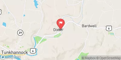 Tunkhannock Creek Near Tunkhannock
|
298cfs |
Dam Data Reference
Condition Assessment
SatisfactoryNo existing or potential dam safety deficiencies are recognized. Acceptable performance is expected under all loading conditions (static, hydrologic, seismic) in accordance with the minimum applicable state or federal regulatory criteria or tolerable risk guidelines.
Fair
No existing dam safety deficiencies are recognized for normal operating conditions. Rare or extreme hydrologic and/or seismic events may result in a dam safety deficiency. Risk may be in the range to take further action. Note: Rare or extreme event is defined by the regulatory agency based on their minimum
Poor A dam safety deficiency is recognized for normal operating conditions which may realistically occur. Remedial action is necessary. POOR may also be used when uncertainties exist as to critical analysis parameters which identify a potential dam safety deficiency. Investigations and studies are necessary.
Unsatisfactory
A dam safety deficiency is recognized that requires immediate or emergency remedial action for problem resolution.
Not Rated
The dam has not been inspected, is not under state or federal jurisdiction, or has been inspected but, for whatever reason, has not been rated.
Not Available
Dams for which the condition assessment is restricted to approved government users.
Hazard Potential Classification
HighDams assigned the high hazard potential classification are those where failure or mis-operation will probably cause loss of human life.
Significant
Dams assigned the significant hazard potential classification are those dams where failure or mis-operation results in no probable loss of human life but can cause economic loss, environment damage, disruption of lifeline facilities, or impact other concerns. Significant hazard potential classification dams are often located in predominantly rural or agricultural areas but could be in areas with population and significant infrastructure.
Low
Dams assigned the low hazard potential classification are those where failure or mis-operation results in no probable loss of human life and low economic and/or environmental losses. Losses are principally limited to the owner's property.
Undetermined
Dams for which a downstream hazard potential has not been designated or is not provided.
Not Available
Dams for which the downstream hazard potential is restricted to approved government users.

 Saxe Pond