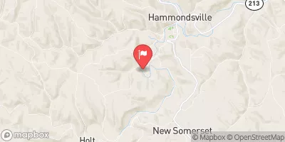
Pa-483 Reservoir Report
Nearby: Pa-482 Harmon Creek (Pa-484)
Last Updated: February 22, 2026
Pa-483, located in Washington, Pennsylvania, is a vital infrastructure designed by the USDA NRCS for flood risk reduction along Ward Run.
Summary
Completed in 1973, this earth dam stands at a height of 74 feet and spans 360 feet, providing a storage capacity of 523 acre-feet for water management. With a satisfactory condition assessment and a high hazard potential, Pa-483 is regulated by the Pennsylvania Department of Environmental Protection and undergoes regular inspections to ensure its structural integrity.
Managed by the local government, Pa-483 plays a crucial role in protecting the surrounding community from potential flooding events. The dam's primary purpose is flood risk reduction, and it has successfully served this function for decades. Its design, incorporating buttress core types and unlisted/unknown foundations, highlights its resilience and effectiveness in managing water flow and storage in the region.
Despite being a non-USACE structure, Pa-483 is a key component of the water resource infrastructure in the area, providing essential flood control measures and contributing to the overall safety and well-being of the residents. As climate change continues to impact weather patterns, structures like Pa-483 play a critical role in mitigating the risks associated with extreme precipitation events and ensuring the sustainable management of water resources for future generations.
°F
°F
mph
Wind
%
Humidity
15-Day Weather Outlook
Years Modified |
2003 - Structural |
Year Completed |
1973 |
Dam Length |
360 |
Dam Height |
74 |
River Or Stream |
WARD RUN |
Primary Dam Type |
Earth |
Surface Area |
4 |
Drainage Area |
1.48 |
Nid Storage |
523 |
Hazard Potential |
High |
Foundations |
Unlisted/Unknown |
Nid Height |
74 |
Seasonal Comparison
5-Day Hourly Forecast Detail
Nearby Streamflow Levels
 Kings Creek At Weirton
|
1cfs |
 Yellow Creek Near Hammondsville Oh
|
384cfs |
 Raccoon Creek At Moffatts Mill
|
384cfs |
 Ohio River At Sewickley
|
102000cfs |
 Short Creek Near Dillonvale Oh
|
133cfs |
 Chartiers Creek At Carnegie
|
392cfs |
Dam Data Reference
Condition Assessment
SatisfactoryNo existing or potential dam safety deficiencies are recognized. Acceptable performance is expected under all loading conditions (static, hydrologic, seismic) in accordance with the minimum applicable state or federal regulatory criteria or tolerable risk guidelines.
Fair
No existing dam safety deficiencies are recognized for normal operating conditions. Rare or extreme hydrologic and/or seismic events may result in a dam safety deficiency. Risk may be in the range to take further action. Note: Rare or extreme event is defined by the regulatory agency based on their minimum
Poor A dam safety deficiency is recognized for normal operating conditions which may realistically occur. Remedial action is necessary. POOR may also be used when uncertainties exist as to critical analysis parameters which identify a potential dam safety deficiency. Investigations and studies are necessary.
Unsatisfactory
A dam safety deficiency is recognized that requires immediate or emergency remedial action for problem resolution.
Not Rated
The dam has not been inspected, is not under state or federal jurisdiction, or has been inspected but, for whatever reason, has not been rated.
Not Available
Dams for which the condition assessment is restricted to approved government users.
Hazard Potential Classification
HighDams assigned the high hazard potential classification are those where failure or mis-operation will probably cause loss of human life.
Significant
Dams assigned the significant hazard potential classification are those dams where failure or mis-operation results in no probable loss of human life but can cause economic loss, environment damage, disruption of lifeline facilities, or impact other concerns. Significant hazard potential classification dams are often located in predominantly rural or agricultural areas but could be in areas with population and significant infrastructure.
Low
Dams assigned the low hazard potential classification are those where failure or mis-operation results in no probable loss of human life and low economic and/or environmental losses. Losses are principally limited to the owner's property.
Undetermined
Dams for which a downstream hazard potential has not been designated or is not provided.
Not Available
Dams for which the downstream hazard potential is restricted to approved government users.
Area Campgrounds
| Location | Reservations | Toilets |
|---|---|---|
 Raccoon Creek State Park
|
||
 Montour Trail - Boggs Trailhead Campsite
|
||
 Tomlinson Run State Park
|

 Pa-483