Cross Creek (Pa-662) Reservoir Report
Nearby: Cross Creek (Pa-661) Cherry Valley
Last Updated: January 11, 2026
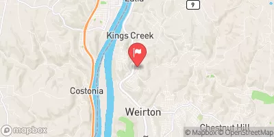
Cross Creek (Pa-662) is a local government-owned earth dam located in Cross Creek Township, Washington County, Pennsylvania.
°F
°F
mph
Wind
%
Humidity
Summary
Constructed in 1983 by the USDA NRCS, this dam stands at a height of 50 feet and has a length of 470 feet, serving primarily for flood risk reduction along the TR South Fork Cross Creek. With a maximum storage capacity of 1420 acre-feet and a drainage area of 3.72 square miles, the dam plays a crucial role in safeguarding the surrounding area from potential flood hazards.
Managed by the Pennsylvania Department of Environmental Protection, Cross Creek (Pa-662) is regulated, inspected, and enforced by state authorities to ensure its structural integrity and functionality. Despite its high hazard potential, the dam is currently assessed as satisfactory and meets the necessary guidelines for emergency action preparedness. The last inspection conducted in November 2020 confirmed the dam's condition and highlighted its vital role in mitigating flood risks in the region. Water resource and climate enthusiasts can appreciate the significance of Cross Creek (Pa-662) as a key infrastructure for flood risk reduction and watershed management in Pennsylvania.
With its strategic location and design, Cross Creek (Pa-662) serves as a critical component in the flood control infrastructure of Washington County, Pennsylvania. Supported by state regulatory agencies and the USDA NRCS, this earth dam not only reduces flood risks but also provides essential storage capacity for the surrounding area. As climate change continues to impact water resources, the importance of structures like Cross Creek (Pa-662) in managing and mitigating potential flooding events becomes increasingly evident, making it a noteworthy site for water resource and climate enthusiasts to study and appreciate.
Year Completed |
1983 |
Dam Length |
470 |
Dam Height |
50 |
River Or Stream |
TR SOUTH FORK CROSS CREEK |
Primary Dam Type |
Earth |
Surface Area |
13 |
Drainage Area |
3.72 |
Nid Storage |
1420 |
Hazard Potential |
High |
Foundations |
Unlisted/Unknown |
Nid Height |
50 |
Seasonal Comparison
Weather Forecast
Nearby Streamflow Levels
 Kings Creek At Weirton
|
44cfs |
 Chartiers Creek At Carnegie
|
176cfs |
 Short Creek Near Dillonvale Oh
|
78cfs |
 Ohio River At Sewickley
|
45000cfs |
 Wheeling Creek At Elm Grove
|
183cfs |
 Raccoon Creek At Moffatts Mill
|
103cfs |
Dam Data Reference
Condition Assessment
SatisfactoryNo existing or potential dam safety deficiencies are recognized. Acceptable performance is expected under all loading conditions (static, hydrologic, seismic) in accordance with the minimum applicable state or federal regulatory criteria or tolerable risk guidelines.
Fair
No existing dam safety deficiencies are recognized for normal operating conditions. Rare or extreme hydrologic and/or seismic events may result in a dam safety deficiency. Risk may be in the range to take further action. Note: Rare or extreme event is defined by the regulatory agency based on their minimum
Poor A dam safety deficiency is recognized for normal operating conditions which may realistically occur. Remedial action is necessary. POOR may also be used when uncertainties exist as to critical analysis parameters which identify a potential dam safety deficiency. Investigations and studies are necessary.
Unsatisfactory
A dam safety deficiency is recognized that requires immediate or emergency remedial action for problem resolution.
Not Rated
The dam has not been inspected, is not under state or federal jurisdiction, or has been inspected but, for whatever reason, has not been rated.
Not Available
Dams for which the condition assessment is restricted to approved government users.
Hazard Potential Classification
HighDams assigned the high hazard potential classification are those where failure or mis-operation will probably cause loss of human life.
Significant
Dams assigned the significant hazard potential classification are those dams where failure or mis-operation results in no probable loss of human life but can cause economic loss, environment damage, disruption of lifeline facilities, or impact other concerns. Significant hazard potential classification dams are often located in predominantly rural or agricultural areas but could be in areas with population and significant infrastructure.
Low
Dams assigned the low hazard potential classification are those where failure or mis-operation results in no probable loss of human life and low economic and/or environmental losses. Losses are principally limited to the owner's property.
Undetermined
Dams for which a downstream hazard potential has not been designated or is not provided.
Not Available
Dams for which the downstream hazard potential is restricted to approved government users.

 Cross Creek (Pa-662)