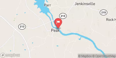
Oswald Pond Dam Reservoir Report
Last Updated: February 24, 2026
Oswald Pond Dam, located in Lexington, South Carolina, was completed in 1940 for the primary purpose of recreation.
Summary
This private earth dam stands at a height of 18 feet and has a length of 675 feet, creating a storage capacity of 58 acre-feet. The dam is situated on the Boggy Branch river and is regulated by the South Carolina Department of Health and Environmental Control (DHEC).
Despite its low hazard potential, Oswald Pond Dam is currently in poor condition as of the last assessment in April 2017. The dam has a history of state regulation, inspection, and enforcement, indicating efforts to ensure its safety and compliance with standards. With a surface area of 8 acres, the dam serves as a recreational spot for locals and visitors, offering opportunities for fishing, boating, and other water-based activities.
As water resource and climate enthusiasts, the details surrounding Oswald Pond Dam provide insight into the complexities of managing and maintaining dam infrastructure. The dam's historical significance, current condition assessment, and regulatory oversight highlight the importance of balancing recreational use with safety and environmental considerations in the face of changing climate patterns and water resource management challenges.
°F
°F
mph
Wind
%
Humidity
15-Day Weather Outlook
Year Completed |
1940 |
Dam Length |
675 |
Dam Height |
18 |
River Or Stream |
BOGGY BRANCH |
Primary Dam Type |
Earth |
Surface Area |
8 |
Nid Storage |
58 |
Hazard Potential |
Low |
Foundations |
Unlisted/Unknown |
Nid Height |
18 |
Seasonal Comparison
5-Day Hourly Forecast Detail
Nearby Streamflow Levels
Dam Data Reference
Condition Assessment
SatisfactoryNo existing or potential dam safety deficiencies are recognized. Acceptable performance is expected under all loading conditions (static, hydrologic, seismic) in accordance with the minimum applicable state or federal regulatory criteria or tolerable risk guidelines.
Fair
No existing dam safety deficiencies are recognized for normal operating conditions. Rare or extreme hydrologic and/or seismic events may result in a dam safety deficiency. Risk may be in the range to take further action. Note: Rare or extreme event is defined by the regulatory agency based on their minimum
Poor A dam safety deficiency is recognized for normal operating conditions which may realistically occur. Remedial action is necessary. POOR may also be used when uncertainties exist as to critical analysis parameters which identify a potential dam safety deficiency. Investigations and studies are necessary.
Unsatisfactory
A dam safety deficiency is recognized that requires immediate or emergency remedial action for problem resolution.
Not Rated
The dam has not been inspected, is not under state or federal jurisdiction, or has been inspected but, for whatever reason, has not been rated.
Not Available
Dams for which the condition assessment is restricted to approved government users.
Hazard Potential Classification
HighDams assigned the high hazard potential classification are those where failure or mis-operation will probably cause loss of human life.
Significant
Dams assigned the significant hazard potential classification are those dams where failure or mis-operation results in no probable loss of human life but can cause economic loss, environment damage, disruption of lifeline facilities, or impact other concerns. Significant hazard potential classification dams are often located in predominantly rural or agricultural areas but could be in areas with population and significant infrastructure.
Low
Dams assigned the low hazard potential classification are those where failure or mis-operation results in no probable loss of human life and low economic and/or environmental losses. Losses are principally limited to the owner's property.
Undetermined
Dams for which a downstream hazard potential has not been designated or is not provided.
Not Available
Dams for which the downstream hazard potential is restricted to approved government users.


 Oswald Pond Dam
 Cabana Way Lexington County