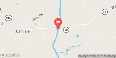
Una Johnson Dam Reservoir Report
Nearby: Una S Johnson Dam Conley Clarke Dam
Last Updated: January 12, 2026
Una Johnson Dam, located in Cherokee, South Carolina, was completed in 1952 and serves as a recreational water resource along the TR-Broad River.
°F
°F
mph
Wind
%
Humidity
Summary
The dam, standing at 42 feet tall and 500 feet long, has a storage capacity of 394 acre-feet and a surface area of 23 acres. Despite being primarily used for recreation, the dam also serves the purpose of flood control and water supply for the surrounding area.
The dam, classified as an earth dam with a buttress core type, is regulated by the South Carolina Department of Health and Environmental Control (DHEC). With a low hazard potential and a poor condition assessment as of September 2017, the dam is inspected every 5 years to ensure its safety and integrity. Although the dam has not undergone any significant modifications in recent years, it remains a crucial structure for the community and a popular destination for outdoor enthusiasts in the region.
As climate change continues to impact water resources, the Una Johnson Dam plays a vital role in managing water flow and providing a recreational outlet for the community. With its historical significance and practical functionality, the dam stands as a testament to the importance of sustainable water management practices in the face of changing environmental conditions.
Year Completed |
1952 |
Dam Length |
500 |
Dam Height |
42 |
River Or Stream |
TR-BROAD RIVER |
Surface Area |
23 |
Nid Storage |
394 |
Hazard Potential |
Low |
Foundations |
Unlisted/Unknown |
Nid Height |
42 |
Seasonal Comparison
Weather Forecast
Nearby Streamflow Levels
 Broad River Below Cherokee Falls
|
1540cfs |
 Broad River Near Gaffney
|
1890cfs |
 Broad River Near Blacksburg
|
1790cfs |
 Broad River Near Carlisle
|
1250cfs |
 Lawsons Fork Creek At Spartanburg Sc
|
122cfs |
 Pacolet River Below Lake Blalock Near Cowpens
|
139cfs |
Dam Data Reference
Condition Assessment
SatisfactoryNo existing or potential dam safety deficiencies are recognized. Acceptable performance is expected under all loading conditions (static, hydrologic, seismic) in accordance with the minimum applicable state or federal regulatory criteria or tolerable risk guidelines.
Fair
No existing dam safety deficiencies are recognized for normal operating conditions. Rare or extreme hydrologic and/or seismic events may result in a dam safety deficiency. Risk may be in the range to take further action. Note: Rare or extreme event is defined by the regulatory agency based on their minimum
Poor A dam safety deficiency is recognized for normal operating conditions which may realistically occur. Remedial action is necessary. POOR may also be used when uncertainties exist as to critical analysis parameters which identify a potential dam safety deficiency. Investigations and studies are necessary.
Unsatisfactory
A dam safety deficiency is recognized that requires immediate or emergency remedial action for problem resolution.
Not Rated
The dam has not been inspected, is not under state or federal jurisdiction, or has been inspected but, for whatever reason, has not been rated.
Not Available
Dams for which the condition assessment is restricted to approved government users.
Hazard Potential Classification
HighDams assigned the high hazard potential classification are those where failure or mis-operation will probably cause loss of human life.
Significant
Dams assigned the significant hazard potential classification are those dams where failure or mis-operation results in no probable loss of human life but can cause economic loss, environment damage, disruption of lifeline facilities, or impact other concerns. Significant hazard potential classification dams are often located in predominantly rural or agricultural areas but could be in areas with population and significant infrastructure.
Low
Dams assigned the low hazard potential classification are those where failure or mis-operation results in no probable loss of human life and low economic and/or environmental losses. Losses are principally limited to the owner's property.
Undetermined
Dams for which a downstream hazard potential has not been designated or is not provided.
Not Available
Dams for which the downstream hazard potential is restricted to approved government users.

 Una Johnson Dam
 Ninetynine Island Reservoir Below Cherokee Falls