York County Dam Reservoir Report
Last Updated: January 10, 2026
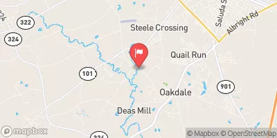
York County Dam, also known as Landfill Dam, is a local government-owned structure located in York, South Carolina.
°F
°F
mph
Wind
%
Humidity
Summary
Built in 1962 by the USDA NRCS, this earth dam stands at a height of 21 feet and a length of 1075 feet, serving primarily as a recreational area along the LANGHAM BRANCH river or stream. Despite its poor condition assessment in 2017, with a low hazard potential, the dam continues to provide a surface area of 10 acres for outdoor activities and leisure.
Managed by the SC DHEC, the dam is state-regulated and permitted, ensuring regular inspections and enforcement to maintain its safety standards. While it features an uncontrolled spillway and outlet gates, its maximum storage capacity of 90 acre-feet and normal storage of 78 acre-feet make it a valuable resource for water management in the region. With a moderate risk assessment rating, the dam poses a manageable level of risk, making it an essential component of the local water infrastructure.
For water resource and climate enthusiasts, York County Dam presents an intriguing case study of a locally managed structure with a mix of recreational and functional purposes. As a product of federal and state collaboration, the dam showcases the importance of regulatory oversight and maintenance in ensuring the safety and sustainability of water resources. Its history, design features, and risk management measures provide valuable insights into the intersection of water infrastructure, environmental protection, and public recreation in the context of changing climate patterns and evolving regulatory frameworks.
Year Completed |
1962 |
Dam Length |
1075 |
Dam Height |
21 |
River Or Stream |
LANGHAM BRANCH |
Primary Dam Type |
Earth |
Surface Area |
10 |
Nid Storage |
90 |
Outlet Gates |
Uncontrolled |
Hazard Potential |
Low |
Foundations |
Unlisted/Unknown |
Nid Height |
21 |
Seasonal Comparison
Weather Forecast
Nearby Streamflow Levels
Dam Data Reference
Condition Assessment
SatisfactoryNo existing or potential dam safety deficiencies are recognized. Acceptable performance is expected under all loading conditions (static, hydrologic, seismic) in accordance with the minimum applicable state or federal regulatory criteria or tolerable risk guidelines.
Fair
No existing dam safety deficiencies are recognized for normal operating conditions. Rare or extreme hydrologic and/or seismic events may result in a dam safety deficiency. Risk may be in the range to take further action. Note: Rare or extreme event is defined by the regulatory agency based on their minimum
Poor A dam safety deficiency is recognized for normal operating conditions which may realistically occur. Remedial action is necessary. POOR may also be used when uncertainties exist as to critical analysis parameters which identify a potential dam safety deficiency. Investigations and studies are necessary.
Unsatisfactory
A dam safety deficiency is recognized that requires immediate or emergency remedial action for problem resolution.
Not Rated
The dam has not been inspected, is not under state or federal jurisdiction, or has been inspected but, for whatever reason, has not been rated.
Not Available
Dams for which the condition assessment is restricted to approved government users.
Hazard Potential Classification
HighDams assigned the high hazard potential classification are those where failure or mis-operation will probably cause loss of human life.
Significant
Dams assigned the significant hazard potential classification are those dams where failure or mis-operation results in no probable loss of human life but can cause economic loss, environment damage, disruption of lifeline facilities, or impact other concerns. Significant hazard potential classification dams are often located in predominantly rural or agricultural areas but could be in areas with population and significant infrastructure.
Low
Dams assigned the low hazard potential classification are those where failure or mis-operation results in no probable loss of human life and low economic and/or environmental losses. Losses are principally limited to the owner's property.
Undetermined
Dams for which a downstream hazard potential has not been designated or is not provided.
Not Available
Dams for which the downstream hazard potential is restricted to approved government users.


 York County Dam