Dubose Pond Dam Reservoir Report
Nearby: Whites Millpond Dam Hill Pond Dam
Last Updated: February 23, 2026
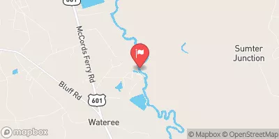
Dubose Pond Dam, located in Sumter, South Carolina, was completed in 1955 and serves as a recreational spot for water and climate enthusiasts alike.
Summary
This private dam, standing at a height of 10 feet and stretching 800 feet in length, holds a storage capacity of 66 acre-feet and covers a surface area of 10 acres. The dam is primarily made of earth with a stone core and rests on a soil foundation, making it an essential structure for both water conservation and leisure activities.
Despite its significant role in providing recreational opportunities, Dubose Pond Dam poses a high hazard potential due to its poor condition assessment. The dam is state-regulated by South Carolina's Department of Health and Environmental Control (DHEC), with regular inspections and enforcement measures in place to ensure public safety. With a designated emergency action plan (EAP) and a history of inspections, the dam continues to be a focal point for water resource management and climate resilience in the region.
As a vital component of the Mulberry Branch waterway, Dubose Pond Dam not only offers recreational benefits but also serves as a critical infrastructure for water storage and management. Its presence highlights the intersection of human development and environmental stewardship, emphasizing the importance of maintaining and monitoring such structures to mitigate risks and ensure sustainable water resource practices in the face of changing climate conditions.
°F
°F
mph
Wind
%
Humidity
15-Day Weather Outlook
Year Completed |
1955 |
Dam Length |
800 |
Dam Height |
10 |
River Or Stream |
MULBERRY BRANCH |
Primary Dam Type |
Earth |
Surface Area |
10 |
Nid Storage |
66 |
Hazard Potential |
High |
Foundations |
Soil |
Nid Height |
10 |
Seasonal Comparison
5-Day Hourly Forecast Detail
Nearby Streamflow Levels
 Wateree R. Bl Eastover
|
2400cfs |
 Lynches River Near Bishopville
|
421cfs |
 Wateree River Nr. Camden
|
2930cfs |
 Black Creek Near Hartsville
|
149cfs |
 Lynches River At Effingham
|
886cfs |
 Black River At Kingstree
|
671cfs |
Dam Data Reference
Condition Assessment
SatisfactoryNo existing or potential dam safety deficiencies are recognized. Acceptable performance is expected under all loading conditions (static, hydrologic, seismic) in accordance with the minimum applicable state or federal regulatory criteria or tolerable risk guidelines.
Fair
No existing dam safety deficiencies are recognized for normal operating conditions. Rare or extreme hydrologic and/or seismic events may result in a dam safety deficiency. Risk may be in the range to take further action. Note: Rare or extreme event is defined by the regulatory agency based on their minimum
Poor A dam safety deficiency is recognized for normal operating conditions which may realistically occur. Remedial action is necessary. POOR may also be used when uncertainties exist as to critical analysis parameters which identify a potential dam safety deficiency. Investigations and studies are necessary.
Unsatisfactory
A dam safety deficiency is recognized that requires immediate or emergency remedial action for problem resolution.
Not Rated
The dam has not been inspected, is not under state or federal jurisdiction, or has been inspected but, for whatever reason, has not been rated.
Not Available
Dams for which the condition assessment is restricted to approved government users.
Hazard Potential Classification
HighDams assigned the high hazard potential classification are those where failure or mis-operation will probably cause loss of human life.
Significant
Dams assigned the significant hazard potential classification are those dams where failure or mis-operation results in no probable loss of human life but can cause economic loss, environment damage, disruption of lifeline facilities, or impact other concerns. Significant hazard potential classification dams are often located in predominantly rural or agricultural areas but could be in areas with population and significant infrastructure.
Low
Dams assigned the low hazard potential classification are those where failure or mis-operation results in no probable loss of human life and low economic and/or environmental losses. Losses are principally limited to the owner's property.
Undetermined
Dams for which a downstream hazard potential has not been designated or is not provided.
Not Available
Dams for which the downstream hazard potential is restricted to approved government users.

 Dubose Pond Dam