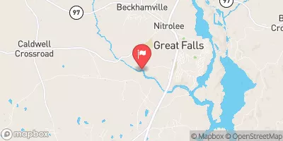
Ralph Smith Pond Dam Reservoir Report
Nearby: Eloise Watson Dam Stokes Pond Dam
Last Updated: February 3, 2026
Ralph Smith Pond Dam, also known as Bente Dam, is a privately owned structure located in Kershaw, South Carolina.
°F
°F
mph
Wind
%
Humidity
15-Day Weather Outlook
Summary
Constructed in 1960, this earth dam stands at a height of 33 feet and spans a length of 380 feet, providing a storage capacity of 25 acre-feet for recreational purposes. Situated on TR-BEAVE DAM CREEK, this dam is regulated by the South Carolina Department of Health and Environmental Control (SC DHEC) and undergoes regular inspections, with the last assessment conducted in March 2017.
Despite its low hazard potential, the dam's condition has been assessed as poor, highlighting potential maintenance issues that need to be addressed to ensure its structural integrity and safety. The dam lacks features such as spillways and outlet gates, raising concerns about its ability to manage water levels effectively. With a surface area of 2 acres and a normal storage capacity of 19 acre-feet, Ralph Smith Pond Dam serves as a recreational resource for the local community, emphasizing the importance of proper maintenance and risk management measures to safeguard its long-term functionality.
In the context of increasing climate variability and water resource management challenges, the state-regulated Ralph Smith Pond Dam serves as a vital infrastructure for recreation and water storage in Kershaw, South Carolina. With the potential for future modifications and improvements, it is crucial for all stakeholders, including the private owner and state regulatory agencies, to collaborate effectively in ensuring the dam's safety, resilience, and sustainable operation. By addressing the identified maintenance issues and implementing risk management measures, Ralph Smith Pond Dam can continue to serve its primary purpose while contributing to the overall water resource management efforts in the region.
Year Completed |
1960 |
Dam Length |
380 |
Dam Height |
33 |
River Or Stream |
TR-BEAVERDAM CREEK |
Primary Dam Type |
Earth |
Surface Area |
2 |
Nid Storage |
25 |
Hazard Potential |
Low |
Foundations |
Unlisted/Unknown |
Nid Height |
33 |
Seasonal Comparison
Hourly Weather Forecast
Nearby Streamflow Levels
 Wateree River Nr. Camden
|
1580cfs |
 Gills Creek At Columbia
|
95cfs |
 Smith Branch At North Main St At Columbia
|
3cfs |
 Rocky Creek At Great Falls
|
16cfs |
 Congaree River At Columbia
|
3750cfs |
 Saluda River Near Columbia
|
933cfs |
Dam Data Reference
Condition Assessment
SatisfactoryNo existing or potential dam safety deficiencies are recognized. Acceptable performance is expected under all loading conditions (static, hydrologic, seismic) in accordance with the minimum applicable state or federal regulatory criteria or tolerable risk guidelines.
Fair
No existing dam safety deficiencies are recognized for normal operating conditions. Rare or extreme hydrologic and/or seismic events may result in a dam safety deficiency. Risk may be in the range to take further action. Note: Rare or extreme event is defined by the regulatory agency based on their minimum
Poor A dam safety deficiency is recognized for normal operating conditions which may realistically occur. Remedial action is necessary. POOR may also be used when uncertainties exist as to critical analysis parameters which identify a potential dam safety deficiency. Investigations and studies are necessary.
Unsatisfactory
A dam safety deficiency is recognized that requires immediate or emergency remedial action for problem resolution.
Not Rated
The dam has not been inspected, is not under state or federal jurisdiction, or has been inspected but, for whatever reason, has not been rated.
Not Available
Dams for which the condition assessment is restricted to approved government users.
Hazard Potential Classification
HighDams assigned the high hazard potential classification are those where failure or mis-operation will probably cause loss of human life.
Significant
Dams assigned the significant hazard potential classification are those dams where failure or mis-operation results in no probable loss of human life but can cause economic loss, environment damage, disruption of lifeline facilities, or impact other concerns. Significant hazard potential classification dams are often located in predominantly rural or agricultural areas but could be in areas with population and significant infrastructure.
Low
Dams assigned the low hazard potential classification are those where failure or mis-operation results in no probable loss of human life and low economic and/or environmental losses. Losses are principally limited to the owner's property.
Undetermined
Dams for which a downstream hazard potential has not been designated or is not provided.
Not Available
Dams for which the downstream hazard potential is restricted to approved government users.

 Ralph Smith Pond Dam
 West DeKalb Street Lugoff