Exp Station Pond Dam Reservoir Report
Last Updated: February 24, 2026
Exp Station Pond Dam in Darlington, South Carolina, stands at a height of 18 feet and has a storage capacity of 90 acre-feet, with a normal storage level of 63 acre-feet.
Summary
The dam, owned by an unspecified entity, has a hazard potential that is currently undetermined and has not been rated for condition assessment. Despite its lacking in official evaluations, the dam's presence is crucial for water resource management in the area.
Located at coordinates 34.295 latitude and -79.73 longitude, Exp Station Pond Dam plays a vital role in regulating water levels and providing essential storage for the surrounding region. With a surface area of 11 acres, the dam serves as a key infrastructure for maintaining water resources in Darlington, South Carolina. While the dam's exact purpose and construction details remain unknown, its significance in water management cannot be understated.
Although lacking in official regulatory oversight and inspection frequency, Exp Station Pond Dam remains a critical component of the local water infrastructure. The dam's emergency action plan status, risk assessment, and management measures are all currently marked as unknown, highlighting the need for further evaluation and assessment to ensure the safety and reliability of this important water resource structure in South Carolina.
°F
°F
mph
Wind
%
Humidity
15-Day Weather Outlook
Dam Height |
18 |
Surface Area |
11 |
Nid Storage |
90 |
Hazard Potential |
Undetermined |
Nid Height |
18 |
Seasonal Comparison
5-Day Hourly Forecast Detail
Nearby Streamflow Levels
 Black Creek Near Quinby
|
400cfs |
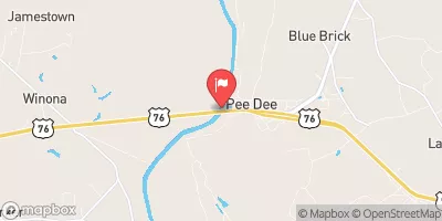
 Pee Dee River At Peedee
|
4840cfs |
 Pee Dee River Below Pee Dee
|
4810cfs |
 Lynches River At Effingham
|
886cfs |
 Pee Dee River Nr Bennettsville
|
4750cfs |
 Black Creek Near Hartsville
|
149cfs |
Dam Data Reference
Condition Assessment
SatisfactoryNo existing or potential dam safety deficiencies are recognized. Acceptable performance is expected under all loading conditions (static, hydrologic, seismic) in accordance with the minimum applicable state or federal regulatory criteria or tolerable risk guidelines.
Fair
No existing dam safety deficiencies are recognized for normal operating conditions. Rare or extreme hydrologic and/or seismic events may result in a dam safety deficiency. Risk may be in the range to take further action. Note: Rare or extreme event is defined by the regulatory agency based on their minimum
Poor A dam safety deficiency is recognized for normal operating conditions which may realistically occur. Remedial action is necessary. POOR may also be used when uncertainties exist as to critical analysis parameters which identify a potential dam safety deficiency. Investigations and studies are necessary.
Unsatisfactory
A dam safety deficiency is recognized that requires immediate or emergency remedial action for problem resolution.
Not Rated
The dam has not been inspected, is not under state or federal jurisdiction, or has been inspected but, for whatever reason, has not been rated.
Not Available
Dams for which the condition assessment is restricted to approved government users.
Hazard Potential Classification
HighDams assigned the high hazard potential classification are those where failure or mis-operation will probably cause loss of human life.
Significant
Dams assigned the significant hazard potential classification are those dams where failure or mis-operation results in no probable loss of human life but can cause economic loss, environment damage, disruption of lifeline facilities, or impact other concerns. Significant hazard potential classification dams are often located in predominantly rural or agricultural areas but could be in areas with population and significant infrastructure.
Low
Dams assigned the low hazard potential classification are those where failure or mis-operation results in no probable loss of human life and low economic and/or environmental losses. Losses are principally limited to the owner's property.
Undetermined
Dams for which a downstream hazard potential has not been designated or is not provided.
Not Available
Dams for which the downstream hazard potential is restricted to approved government users.

 Exp Station Pond Dam