Rucker Reservoir Report
Nearby: Far A Way Young Mill Tailing #2
Last Updated: February 22, 2026
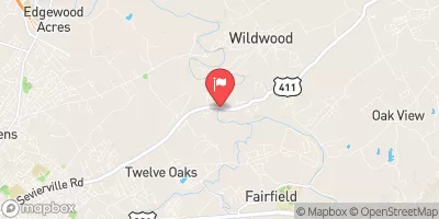
Rucker, located in Jefferson, Tennessee, is a privately owned earth dam completed in 1953 on Tuckahoe Creek.
Summary
With a hydraulic height of 16 feet and a structural height of 22.8 feet, Rucker has a storage capacity of 150 acre-feet and a normal storage level of 77 acre-feet, covering a surface area of 11.5 acres and draining a 0.46 square mile watershed.
Despite being classified as having a low hazard potential, Rucker is considered to have a moderate risk level, with a risk assessment rating of 3 out of 5. The dam is not currently regulated by the state and has not been rated for its condition. The last inspection took place in January 2017, with an inspection frequency of 5 years.
For water resource and climate enthusiasts, Rucker presents an intriguing case study of a privately owned dam in Tennessee with historical significance dating back to the 1950s. Its location on Tuckahoe Creek and its moderate risk level highlight the importance of ongoing monitoring and maintenance to ensure the safety and integrity of the structure. Further research and assessment may provide valuable insights into the intersection of water resource management and climate resilience in the region.
°F
°F
mph
Wind
%
Humidity
15-Day Weather Outlook
Year Completed |
1953 |
Dam Length |
205 |
River Or Stream |
TUCKAHOE CREEK |
Primary Dam Type |
Earth |
Surface Area |
11.5 |
Hydraulic Height |
16 |
Drainage Area |
0.46 |
Nid Storage |
150 |
Structural Height |
22.8 |
Outlet Gates |
None |
Hazard Potential |
Low |
Nid Height |
23 |
Seasonal Comparison
5-Day Hourly Forecast Detail
Nearby Streamflow Levels
 Little Pigeon River At Sevierville
|
680cfs |
 Little River Near Maryville
|
584cfs |
 Pigeon River At Newport
|
1290cfs |
 Bullrun Creek Near Halls Crossroads
|
337cfs |
 French Broad River Near Newport
|
1830cfs |
 Nolichucky River Near Lowland
|
2760cfs |
Dam Data Reference
Condition Assessment
SatisfactoryNo existing or potential dam safety deficiencies are recognized. Acceptable performance is expected under all loading conditions (static, hydrologic, seismic) in accordance with the minimum applicable state or federal regulatory criteria or tolerable risk guidelines.
Fair
No existing dam safety deficiencies are recognized for normal operating conditions. Rare or extreme hydrologic and/or seismic events may result in a dam safety deficiency. Risk may be in the range to take further action. Note: Rare or extreme event is defined by the regulatory agency based on their minimum
Poor A dam safety deficiency is recognized for normal operating conditions which may realistically occur. Remedial action is necessary. POOR may also be used when uncertainties exist as to critical analysis parameters which identify a potential dam safety deficiency. Investigations and studies are necessary.
Unsatisfactory
A dam safety deficiency is recognized that requires immediate or emergency remedial action for problem resolution.
Not Rated
The dam has not been inspected, is not under state or federal jurisdiction, or has been inspected but, for whatever reason, has not been rated.
Not Available
Dams for which the condition assessment is restricted to approved government users.
Hazard Potential Classification
HighDams assigned the high hazard potential classification are those where failure or mis-operation will probably cause loss of human life.
Significant
Dams assigned the significant hazard potential classification are those dams where failure or mis-operation results in no probable loss of human life but can cause economic loss, environment damage, disruption of lifeline facilities, or impact other concerns. Significant hazard potential classification dams are often located in predominantly rural or agricultural areas but could be in areas with population and significant infrastructure.
Low
Dams assigned the low hazard potential classification are those where failure or mis-operation results in no probable loss of human life and low economic and/or environmental losses. Losses are principally limited to the owner's property.
Undetermined
Dams for which a downstream hazard potential has not been designated or is not provided.
Not Available
Dams for which the downstream hazard potential is restricted to approved government users.
Area Campgrounds
| Location | Reservations | Toilets |
|---|---|---|
 Douglas Dam Tailwater
|
||
 Douglas Dam Headwater
|
||
 Sevier County Park - Douglas Reservoir
|
||
 Dandridge Municipal Park - Douglas Reservoir
|
||
 Cherokee Dam
|

 Rucker
 Sevier County