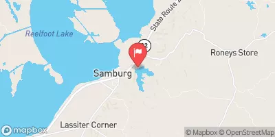
Muzzall Reservoir Report
Nearby: Cypress Creek #1 Little Cypress Creek
Last Updated: January 11, 2026
Muzzall, located in Ruthville, Tennessee, is a privately owned Earth dam that was completed in 1947.
°F
°F
mph
Wind
%
Humidity
Summary
It stands at a hydraulic height of 21.3 feet and a structural height of 22.8 feet, with a length of 495 feet. The dam has a normal storage capacity of 52 acre-feet and a maximum storage of 62 acre-feet, serving the purpose of water resource management for the surrounding area.
The dam, situated on Tribtrouble Creek, has a low hazard potential and is classified as having a moderate risk level. Despite not being state regulated or permitted, it is inspected every five years for safety and structural integrity, with the last inspection conducted in June 2016. Muzzall's spillway type is uncontrolled, and it does not have any outlet gates. With a drainage area of 0.08 square miles, the dam covers a surface area of 6.1 acres, providing essential water storage for the region.
For water resource and climate enthusiasts, Muzzall represents a piece of Tennessee's infrastructure that plays a crucial role in managing water flow and storage. The dam's historical significance, combined with its current operational status and risk assessment, underscores the importance of maintaining and monitoring such structures to ensure the safety and sustainability of water resources in the area. As a privately owned facility, Muzzall serves as a reminder of the diverse landscape of dam ownership and management practices across the state.
Year Completed |
1947 |
Dam Length |
495 |
River Or Stream |
TRIBTROUBLE CREEK |
Primary Dam Type |
Earth |
Surface Area |
6.1 |
Hydraulic Height |
21.3 |
Drainage Area |
0.08 |
Nid Storage |
62 |
Structural Height |
22.8 |
Outlet Gates |
None |
Hazard Potential |
Low |
Nid Height |
23 |
Seasonal Comparison
Weather Forecast
Nearby Streamflow Levels
Dam Data Reference
Condition Assessment
SatisfactoryNo existing or potential dam safety deficiencies are recognized. Acceptable performance is expected under all loading conditions (static, hydrologic, seismic) in accordance with the minimum applicable state or federal regulatory criteria or tolerable risk guidelines.
Fair
No existing dam safety deficiencies are recognized for normal operating conditions. Rare or extreme hydrologic and/or seismic events may result in a dam safety deficiency. Risk may be in the range to take further action. Note: Rare or extreme event is defined by the regulatory agency based on their minimum
Poor A dam safety deficiency is recognized for normal operating conditions which may realistically occur. Remedial action is necessary. POOR may also be used when uncertainties exist as to critical analysis parameters which identify a potential dam safety deficiency. Investigations and studies are necessary.
Unsatisfactory
A dam safety deficiency is recognized that requires immediate or emergency remedial action for problem resolution.
Not Rated
The dam has not been inspected, is not under state or federal jurisdiction, or has been inspected but, for whatever reason, has not been rated.
Not Available
Dams for which the condition assessment is restricted to approved government users.
Hazard Potential Classification
HighDams assigned the high hazard potential classification are those where failure or mis-operation will probably cause loss of human life.
Significant
Dams assigned the significant hazard potential classification are those dams where failure or mis-operation results in no probable loss of human life but can cause economic loss, environment damage, disruption of lifeline facilities, or impact other concerns. Significant hazard potential classification dams are often located in predominantly rural or agricultural areas but could be in areas with population and significant infrastructure.
Low
Dams assigned the low hazard potential classification are those where failure or mis-operation results in no probable loss of human life and low economic and/or environmental losses. Losses are principally limited to the owner's property.
Undetermined
Dams for which a downstream hazard potential has not been designated or is not provided.
Not Available
Dams for which the downstream hazard potential is restricted to approved government users.


 Muzzall