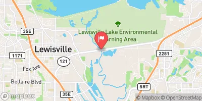
Grapevine Lk Nr Grapevine Reservoir Report
Last Updated: February 9, 2026
Grapevine Lake is located in northern Texas, near the city of Grapevine.
Summary
The lake was created in the 1950s by the US Army Corps of Engineers for flood control and as a source of water for the Dallas-Fort Worth area. The lake is primarily fed by Denton Creek, and its hydrology is managed by the US Army Corps of Engineers. The lake is a popular recreational spot for fishing, boating, and swimming, and it also provides water for agricultural uses in the area. The surface flow of Grapevine Lake is also important for the region's water supply, and the lake's snowpack providers help to regulate the water levels throughout the year. Overall, Grapevine Lake is an important resource for the community and a valuable part of the region's history and hydrology.
°F
°F
mph
Wind
%
Humidity
15-Day Weather Outlook
Reservoir Details
| Lake Or Reservoir Water Surface Elevation Above Ngvd 1929, Ft 24hr Change | -0.01% |
| Percent of Normal | 100% |
| Minimum |
529.63 ft
2023-10-23 |
| Maximum |
555.51 ft
2016-01-11 |
| Average | 537 ft |
| Dam_Height | 137 |
| Hydraulic_Height | 130 |
| Drainage_Area | 688 |
| Year_Completed | 1952 |
| Nid_Storage | 788000 |
| Structural_Height | 137 |
| River_Or_Stream | DENTON CREEK |
| Foundations | Soil |
| Surface_Area | 7380 |
| Hazard_Potential | High |
| Outlet_Gates | Uncontrolled - 0 |
| Dam_Length | 12350 |
| Primary_Dam_Type | Earth |
| Nid_Height | 137 |
Seasonal Comparison
Wind Speed, Mph Levels
Wind Direction, Degrees Clockwise From North Levels
Precipitation, Total, In Levels
Lake Or Reservoir Water Surface Elevation Above Ngvd 1929, Ft Levels
5-Day Hourly Forecast Detail
Nearby Streamflow Levels
 Denton Ck Nr Grapevine
|
60cfs |
 Elm Fk Trinity Rv Nr Carrollton
|
120cfs |
 Elm Fk Trinity Rv Nr Lewisville
|
202cfs |
 Indian Ck At Fm 2281
|
21cfs |
 Elm Fk Trinity Rv At Spur 348
|
130cfs |
 Hickory Ck At Denton
|
15cfs |
Dam Data Reference
Condition Assessment
SatisfactoryNo existing or potential dam safety deficiencies are recognized. Acceptable performance is expected under all loading conditions (static, hydrologic, seismic) in accordance with the minimum applicable state or federal regulatory criteria or tolerable risk guidelines.
Fair
No existing dam safety deficiencies are recognized for normal operating conditions. Rare or extreme hydrologic and/or seismic events may result in a dam safety deficiency. Risk may be in the range to take further action. Note: Rare or extreme event is defined by the regulatory agency based on their minimum
Poor A dam safety deficiency is recognized for normal operating conditions which may realistically occur. Remedial action is necessary. POOR may also be used when uncertainties exist as to critical analysis parameters which identify a potential dam safety deficiency. Investigations and studies are necessary.
Unsatisfactory
A dam safety deficiency is recognized that requires immediate or emergency remedial action for problem resolution.
Not Rated
The dam has not been inspected, is not under state or federal jurisdiction, or has been inspected but, for whatever reason, has not been rated.
Not Available
Dams for which the condition assessment is restricted to approved government users.
Hazard Potential Classification
HighDams assigned the high hazard potential classification are those where failure or mis-operation will probably cause loss of human life.
Significant
Dams assigned the significant hazard potential classification are those dams where failure or mis-operation results in no probable loss of human life but can cause economic loss, environment damage, disruption of lifeline facilities, or impact other concerns. Significant hazard potential classification dams are often located in predominantly rural or agricultural areas but could be in areas with population and significant infrastructure.
Low
Dams assigned the low hazard potential classification are those where failure or mis-operation results in no probable loss of human life and low economic and/or environmental losses. Losses are principally limited to the owner's property.
Undetermined
Dams for which a downstream hazard potential has not been designated or is not provided.
Not Available
Dams for which the downstream hazard potential is restricted to approved government users.

 Grapevine Dam
 Grapevine Lk Nr Grapevine
 Lewisville Lk Nr Lewisville
 Trawick Boat Ramp