Lk Tawakoni Nr Wills Point Reservoir
As of July 20, 2026, Lk Tawakoni Nr Wills Point is holding 868,000 ac-ft of water — 198804% of normal storage for this date. Storage data refreshed throughout the day.

Lk Tawakoni Nr Wills Point
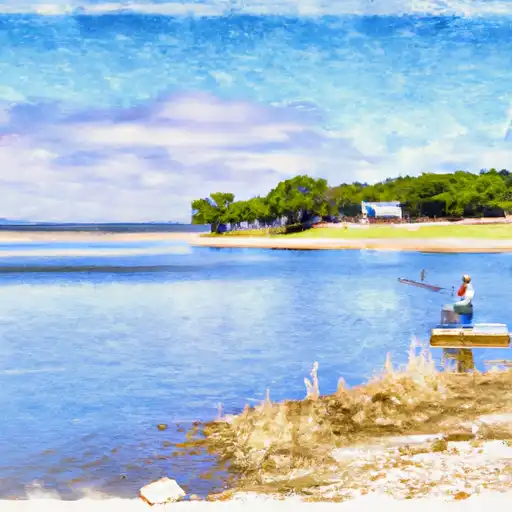
Lake Tawakoni, located near Wills Point, Texas, was created in 1960 by the construction of a dam on the Sabine River. The lake serves as a water source for many surrounding cities and is also popular for recreational activities such as fishing, boating, and camping. The hydrology of the lake is mostly controlled by rainfall, with occasional contributions from snowmelt. The Sabine River Authority manages the lake's water levels, ensuring a consistent water supply for downstream users. The lake provides irrigation water for surrounding agricultural land, mostly devoted to corn, wheat, and soybeans. Additionally, the lake is stocked with a variety of fish species, including bass, catfish, and crappie, making it a popular destination for anglers.
Daily levels at Lk Tawakoni Nr Wills Point
Storage volume, pool elevation, and total release plotted from the operating agency's daily observations.
Reservoir storage, acre-ft
ac-ft · code 00054
Lake or reservoir water surface elevation above NGVD 1929, ft
ft · code 62614
Precipitation, total, in
in · code 00045
Plan around the weather
Same NOAA / yr.no feed Snoflo's iOS app uses. Watch the precipitation column on the meteogram -- rain on the basin upstream typically lifts inflow 24-72 hours later.
Next 5 days, hour by hour
Temperature line with weather symbols on top, snow + rain accumulation as columns, humidity as a dotted line.
5-day forecast table
Every 3 hours, broken out across temperature, snow, rain, humidity, and wind. Each cell is colour-coded relative to the column min/max.
| Time | Condition | Temp (°F) | Snow (in) | Rain (in) | Humidity (%) | Wind (mps) | Wind dir |
|---|---|---|---|---|---|---|---|
| Loading detailed forecast… | |||||||
15-day temperature & precipitation
Daily temperatures, snow, and rain projected over the next two weeks.
Nearby streamflow gauges
USGS streamgauges around Lk Tawakoni Nr Wills Point -- inflows here typically show up in storage 24-72 hours later.
| Streamgauge | Discharge | View |
|---|---|---|
| Sabine Rv Nr Wills Point | 8 cfs | → |
| S Fk Sabine Rv Nr Quinlan | 6 cfs | → |
| Cedar Ck Nr Kemp | 0 cfs | → |
| Cowleech Fk Sabine Rv At Greenville | 0 cfs | → |
| Lake Fork Ck Nr Quitman | 38 cfs | → |
| S Sulphur At Commerce | 0 cfs | → |


About Lk Tawakoni Nr Wills Point
Where does the data for Lk Tawakoni Nr Wills Point come from?
Daily storage, pool elevation, and release rates are sourced from USGS, USBR, and USACE monitoring stations. Weather forecast comes from NOAA / yr.no -- the same feed Snoflo's iOS app uses.
How often is the report updated?
Storage observations are updated daily by the operating agency. The 15-day weather forecast refreshes throughout the day. Snoflo caches and renders the most recent observation -- check the "as of" timestamp on the storage card.
What does the Hazard hazard rating mean?
The Corps of Engineers' hazard potential classification grades probable consequences if the dam fails: High = probable loss of human life; Significant = no probable loss of human life but possible economic loss / environmental damage; Low = no probable loss of human life, only minor economic / environmental losses. See the Dam Data Reference card below for the full definitions.
What's "% of normal"?
The current storage value compared to the historical average storage on this calendar day. 100% = right on average; values above 100% mean above-normal storage (wet year); values below mean below-normal (dry year or drought).
Can I get alerts when storage crosses a threshold?
Yes -- alerts are managed in the Snoflo iOS app. Favorite this reservoir, set a threshold, and you'll get a push the moment conditions cross.