Ray Roberts Lk Nr Pilot Point Reservoir Report
Last Updated: February 9, 2026
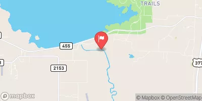
Ray Roberts Lake is a reservoir located in Pilot Point, Texas.
Summary
The lake was created in 1987 as a joint project between the U.S. Army Corps of Engineers and the North Texas Municipal Water District. The lake covers approximately 29,000 acres and has a shoreline of 183 miles. It is fed by two main tributaries, the Elm Fork and the Beaver Creek. The lake is used for both agricultural and recreational purposes. The surrounding land is used for farming and ranching while the lake provides opportunities for fishing, boating, and other water activities. The hydrology of the lake is closely monitored by the U.S. Army Corps of Engineers and the North Texas Municipal Water District to ensure a sustainable water supply for the region. The lake also serves as a source of drinking water for several North Texas communities.
°F
°F
mph
Wind
%
Humidity
15-Day Weather Outlook
Reservoir Details
| Lake Or Reservoir Water Surface Elevation Above Ngvd 1929, Ft 24hr Change | 0.0% |
| Percent of Normal | 100% |
| Minimum |
623.21 ft
2014-07-17 |
| Maximum |
644.4 ft
2015-05-31 |
| Average | 631 ft |
| Dam_Height | 141 |
| Hydraulic_Height | 136 |
| Drainage_Area | 692 |
| Year_Completed | 1986 |
| Nid_Storage | 1931900 |
| Structural_Height | 141 |
| River_Or_Stream | ELM FORK OF THE TRINITY RIVER |
| Foundations | Rock, Soil |
| Surface_Area | 29350 |
| Hazard_Potential | High |
| Outlet_Gates | Uncontrolled - 0 |
| Dam_Length | 14980 |
| Primary_Dam_Type | Earth |
| Nid_Height | 141 |
Seasonal Comparison
Wind Speed, Mph Levels
Wind Direction, Degrees Clockwise From North Levels
Precipitation, Total, In Levels
Lake Or Reservoir Water Surface Elevation Above Ngvd 1929, Ft Levels
Wind Speed, M/S Levels
5-Day Hourly Forecast Detail
Nearby Streamflow Levels
Dam Data Reference
Condition Assessment
SatisfactoryNo existing or potential dam safety deficiencies are recognized. Acceptable performance is expected under all loading conditions (static, hydrologic, seismic) in accordance with the minimum applicable state or federal regulatory criteria or tolerable risk guidelines.
Fair
No existing dam safety deficiencies are recognized for normal operating conditions. Rare or extreme hydrologic and/or seismic events may result in a dam safety deficiency. Risk may be in the range to take further action. Note: Rare or extreme event is defined by the regulatory agency based on their minimum
Poor A dam safety deficiency is recognized for normal operating conditions which may realistically occur. Remedial action is necessary. POOR may also be used when uncertainties exist as to critical analysis parameters which identify a potential dam safety deficiency. Investigations and studies are necessary.
Unsatisfactory
A dam safety deficiency is recognized that requires immediate or emergency remedial action for problem resolution.
Not Rated
The dam has not been inspected, is not under state or federal jurisdiction, or has been inspected but, for whatever reason, has not been rated.
Not Available
Dams for which the condition assessment is restricted to approved government users.
Hazard Potential Classification
HighDams assigned the high hazard potential classification are those where failure or mis-operation will probably cause loss of human life.
Significant
Dams assigned the significant hazard potential classification are those dams where failure or mis-operation results in no probable loss of human life but can cause economic loss, environment damage, disruption of lifeline facilities, or impact other concerns. Significant hazard potential classification dams are often located in predominantly rural or agricultural areas but could be in areas with population and significant infrastructure.
Low
Dams assigned the low hazard potential classification are those where failure or mis-operation results in no probable loss of human life and low economic and/or environmental losses. Losses are principally limited to the owner's property.
Undetermined
Dams for which a downstream hazard potential has not been designated or is not provided.
Not Available
Dams for which the downstream hazard potential is restricted to approved government users.


 Ray Roberts Dam
 Ray Roberts Lk Nr Pilot Point
 Fairview Circle Denton County